Rafting the Grand Canyon — April 2022
In early February, my parents told me about an opportunity to do a Grand Canyon raft trip together in April. I’ve done plenty of hiking in the canyon but never a river trip. While this trip would totally deplete my accumulated vacation days, I decided to go for it.
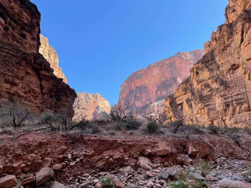
This was a trip organized by the Grand Canyon Field Institute and conducted by Grand Canyon Explorations/Expeditions (CanX). April provides some of the best weather for taking side hikes from the river. The trip would be eighteen days, which is on the long side for a full river trip, affording plenty of time for hiking along the way.
Gear
CanX sent a detailed gear list, which I supplemented with some of the gear I usually carry backpacking. While I have plenty of experience hiking and living outdoors, this was a new ballgame in some ways. My backpacking trips are generally much shorter than eighteen days, so I didn’t have a sense of how many consumables I needed, like soap, chargers for my phone, and spare camera batteries.
On the other hand, because I wouldn’t be carrying all my gear the whole time, weight was not nearly as important. However, volume was a factor since everything would have to fit into a pair of dry bags. One big blue bag would carry all of my stuff needed in camp and overnight (spare clothes, etc.). A smaller purple dry bag would be with us in the raft and had to fit everything we’d need during the day.
One of the more difficult decisions was what sort of camera gear I wanted to bring. On recent backpacks, I’d been getting by with just my iPhone. However, in addition to its limited zoom capabilities, I was also concerned about bringing enough external USB battery packs to keep it charged the whole trip. I considered buying a waterproof point-and-shoot camera, but in the end, I opted against it. Instead, I brought the Canon EOS M200 mirrorless I’d bought the year before for my video conferencing setup.
I bought a pair of extra batteries for the Canon. I brought two external batteries to keep my iPhone charged: one 26800 mAh and the other 6000 mAh. I hoped that with the combination of airplane mode, low power mode, and turning the phone off at night, I’d be able to make it through the trip.
Before the river
My flight to Las Vegas was scheduled to leave at 8:35 PM. When I got to the airport, I found it had been delayed about 30 minutes. We were all boarded, pushed back from the gate, and were taxiing to the runway before we taxied right back to the gate. A couple of police officers came onto the plane and escorted a passenger off. This, plus topping off the fuel tanks, left us more than an hour behind schedule.
Upon arriving in Las Vegas, we had to sit on the tarmac for another fifteen minutes waiting for a gate to open up. I grabbed my checked luggage and hopped in a taxi to my hotel. I got to my room at 11:45 PM Las Vegas time, 1:45 AM Central. Before bed, I texted my parents, asking them to pick me up an hour later than we’d planned the next morning.
Despite the extra hour, I only managed about six hours of sound sleep before my jet-lagged brain woke me up. After an hour of tossing and turning, I just went ahead and got up.
My parents picked me up and we headed to Flagstaff. Despite the later start, we still had a little time to visit with my uncle in Flag before heading over to the hotel for an orientation meeting that evening. The orientation covered a lot of logistics for getting everyone on the bus the next morning and a bit about gear. More detailed info about life on the river would wait until we got to the put-in at Lee’s Ferry the next day. They handed out the blue and purple dry bags, and we headed off to our rooms to try to cram everything in.
I did have to make some choices about what to take, but I still packed more and a greater variety of stuff than I’d take backpacking.
Day 1
I got a decent night’s sleep, but the alarm came pretty early. We made short work of finishing packing. My Dad went to McDonald’s to pick us up some breakfast while Mom and I carried our bags down to wait for the bus.
We boarded at about 6:30 AM and started the drive to Lee’s Ferry. There was a stop at Cameron Trading Post for a bathroom break and (for some folks) souvenir shopping.
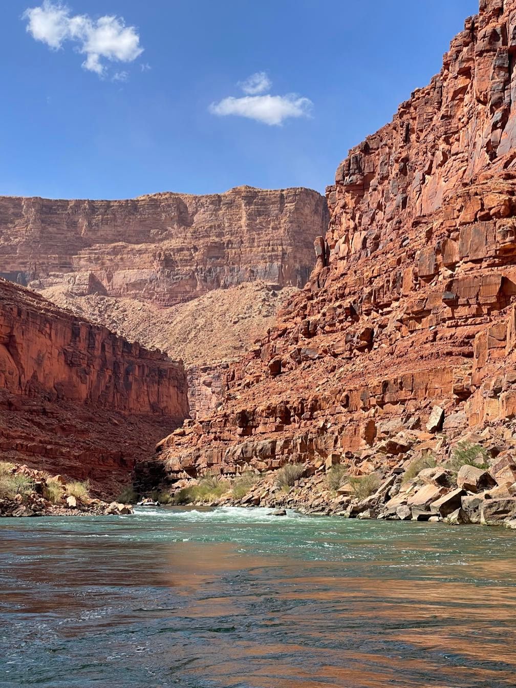
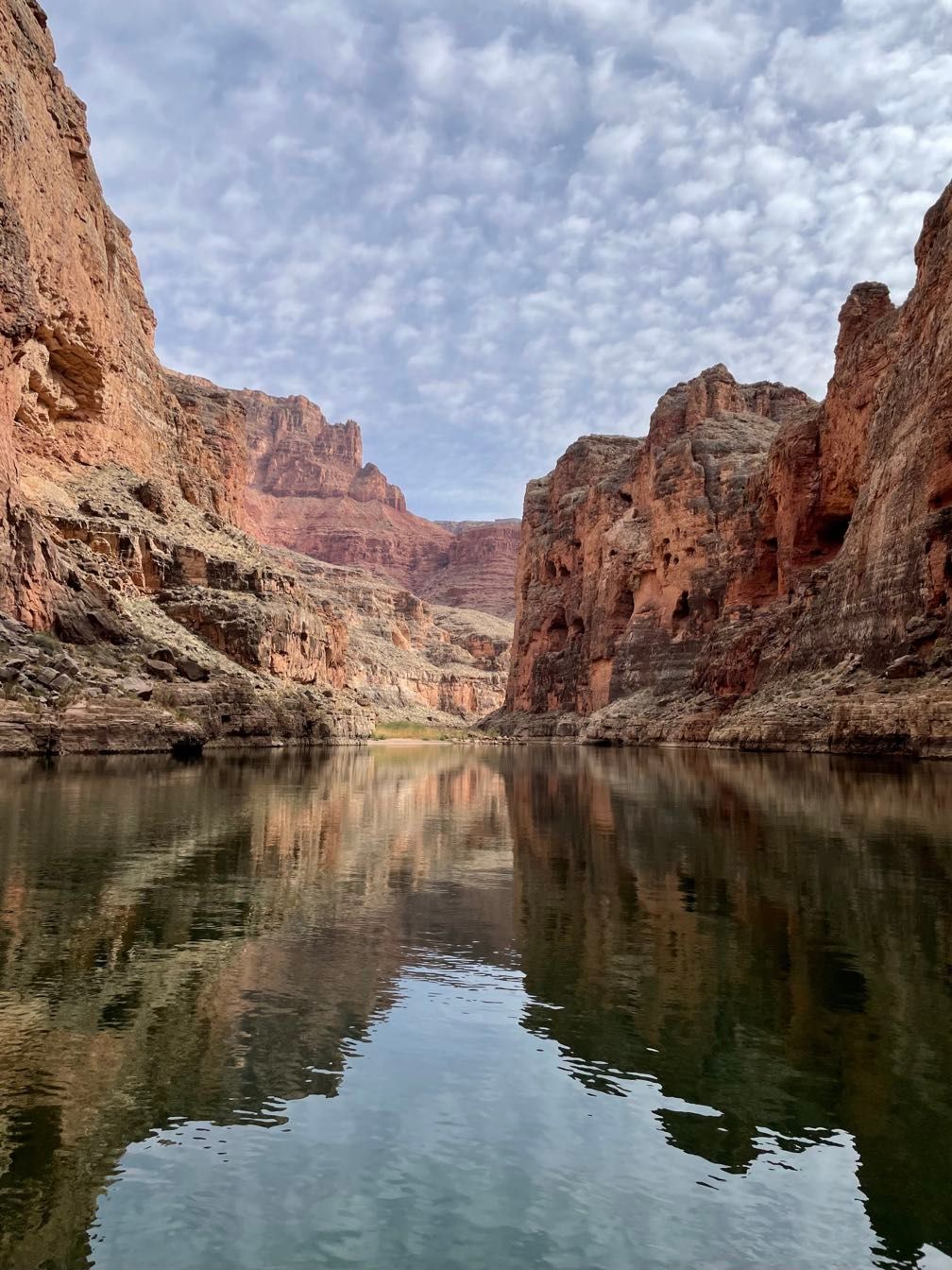
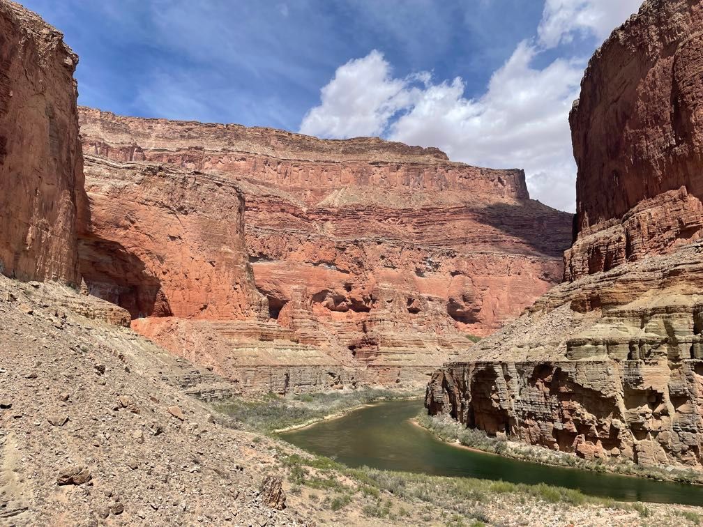
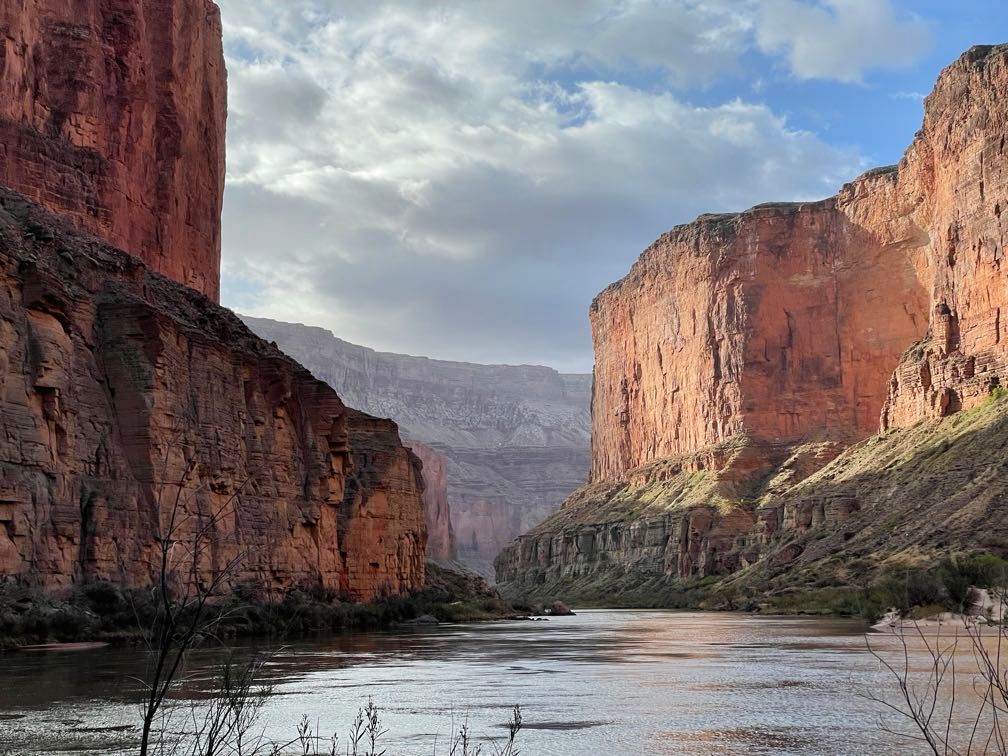
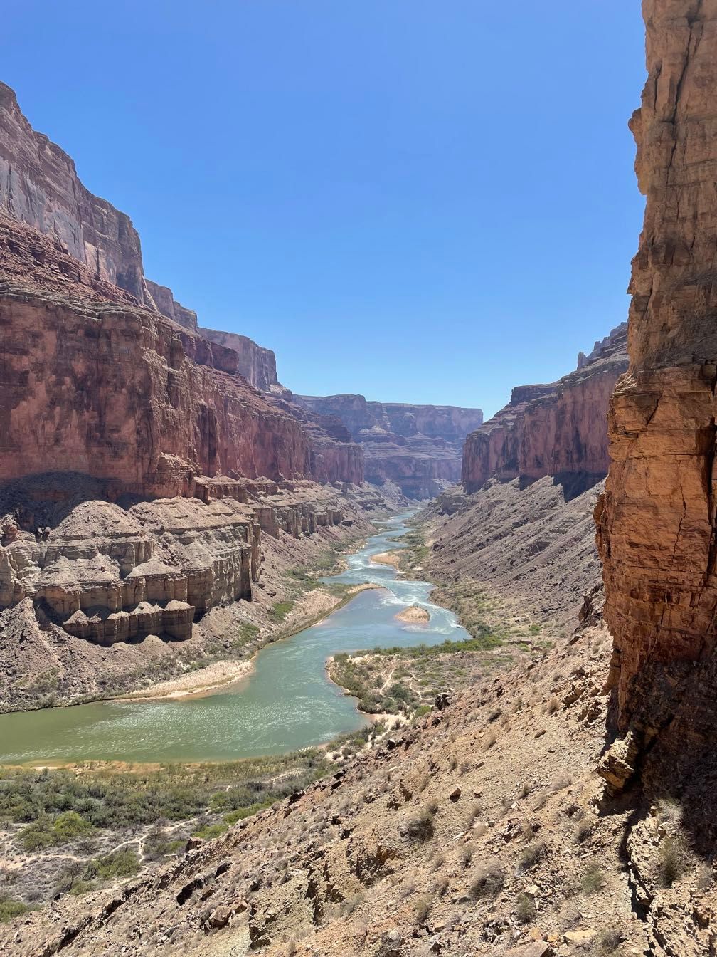
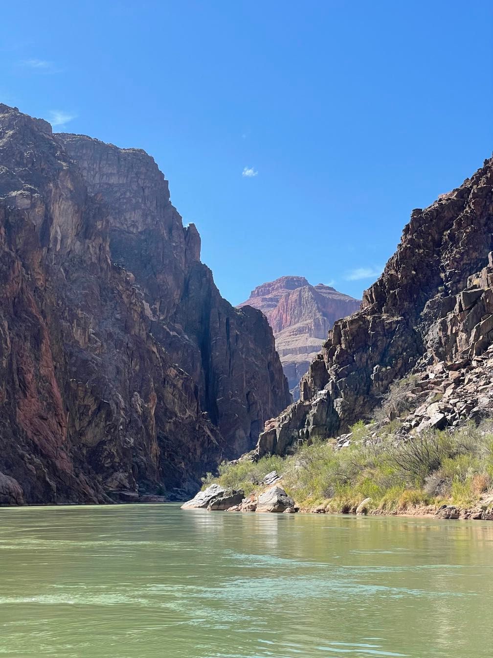
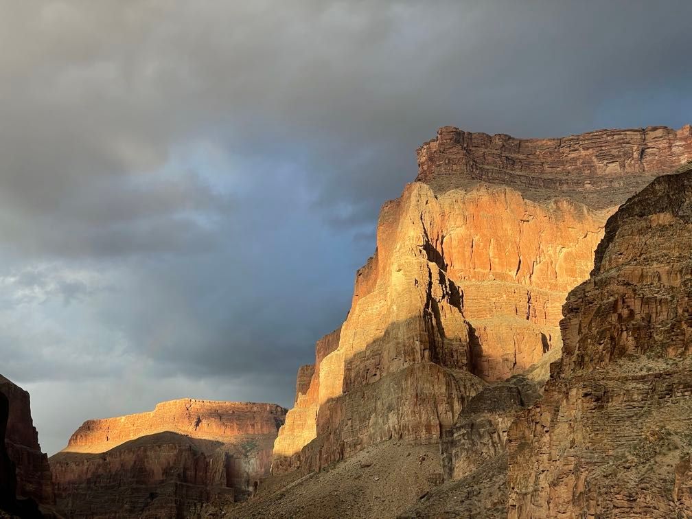
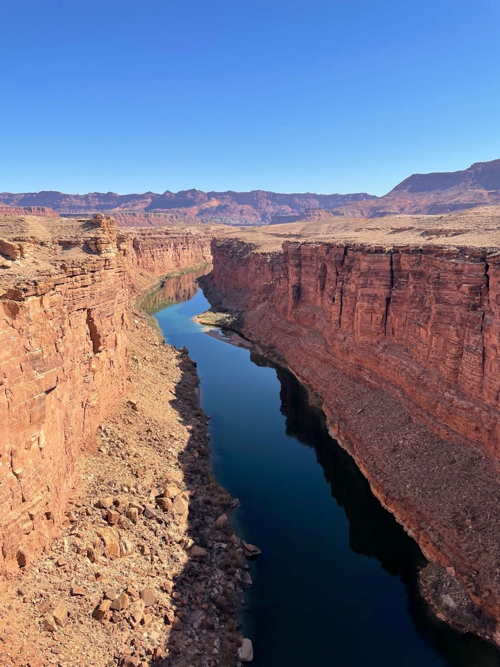 The Colorado River from Navajo Bridge
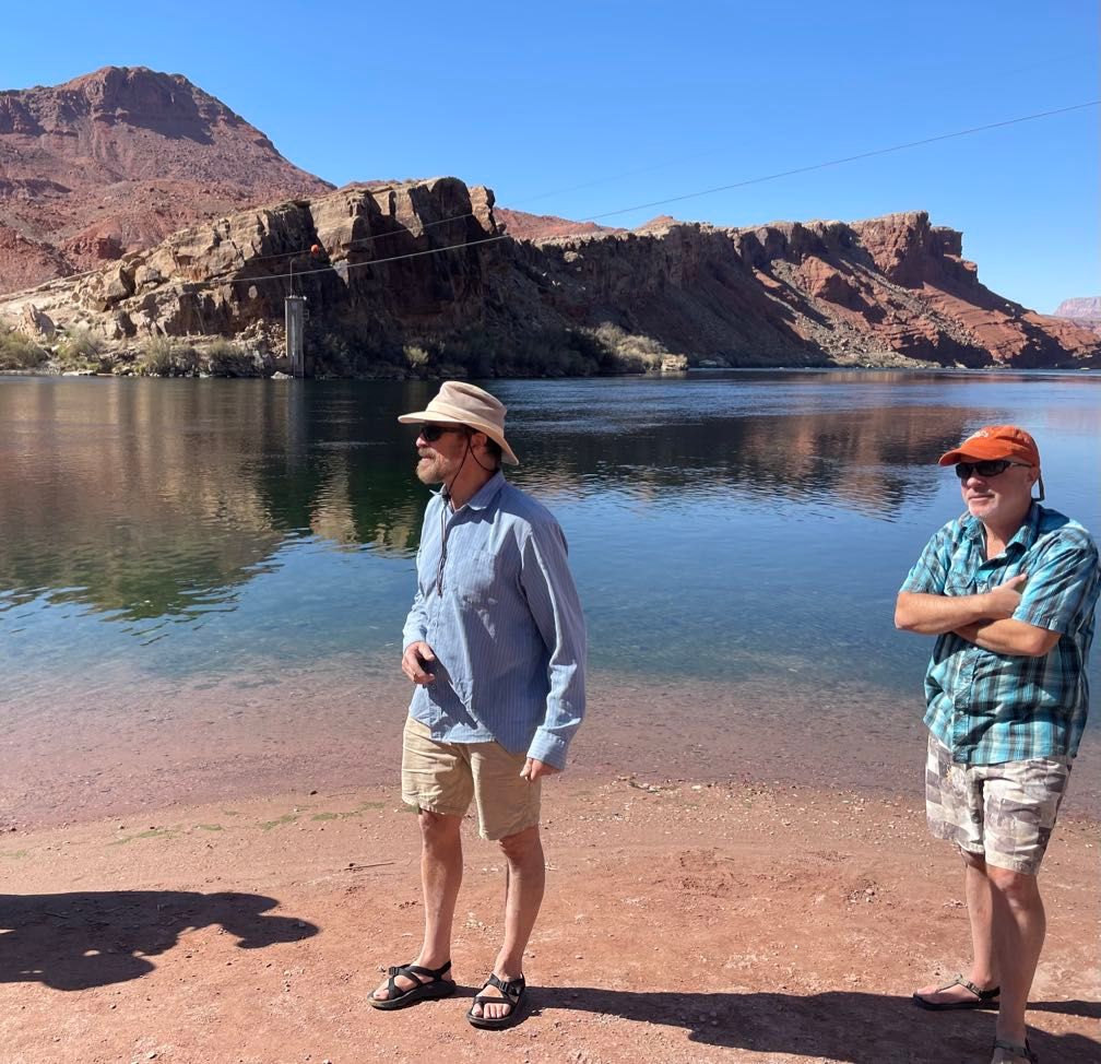
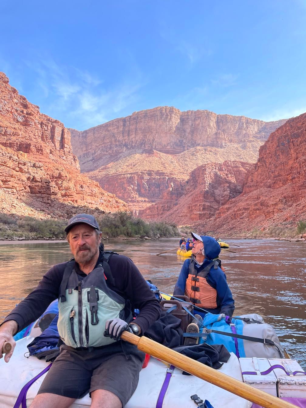
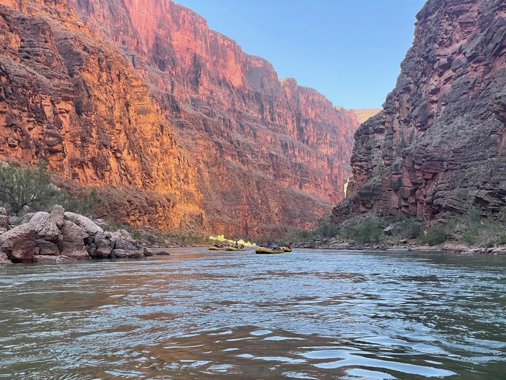
After another stop at the Navajo Bridge over the Colorado River, we arrived at Lee’s Ferry around 9:30 and met our guides.
Our trip leader was Gary, who’s been guiding in the canyon since the ’70s. The other guides were Dave, Amy, and Leo. Sequoyah was rowing our baggage boat. She’d been down the canyon several times before, but this was the first one where she’d be rowing her own boat. In addition to the river guides, we had two other people along. Sherri works for the Grand Canyon Field Institute and will be lending the trip her expertise on the Native American inhabitants of the canyon. Gary’s wife, Elise, was also along as an assistant. She’s a professor at a university in Australia.
 Gary and Dave at Lee’s Ferry
We did a brief orientation and fitted our life preservers before rowing across the river. There, we took a short walk up on the bluff above Lee’s Ferry, where we saw a very long petrified wood log. The guides did a bit of orientation on how our hiking trips would go, and Gary talked about the geology of the Lee’s Ferry area.
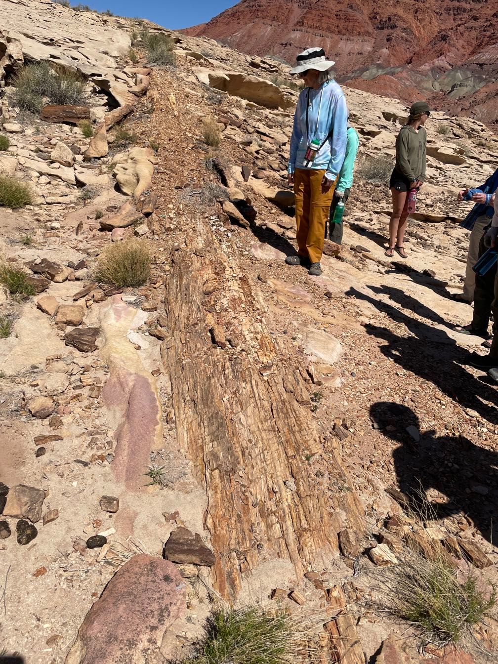 Massive petrified wood log
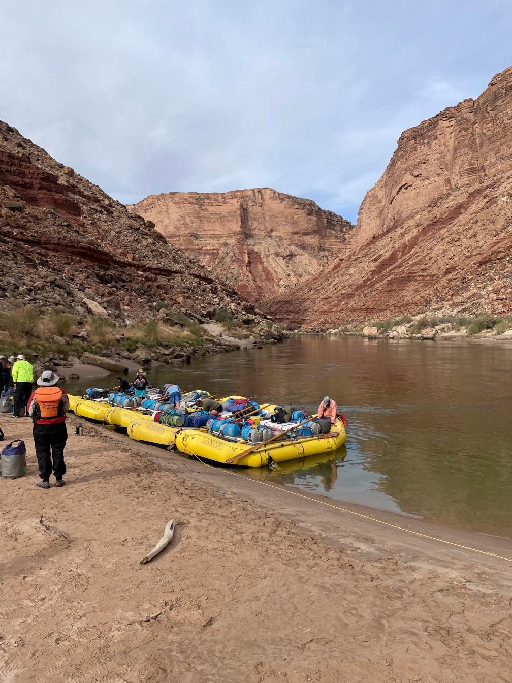
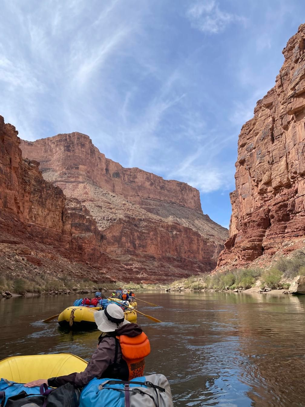
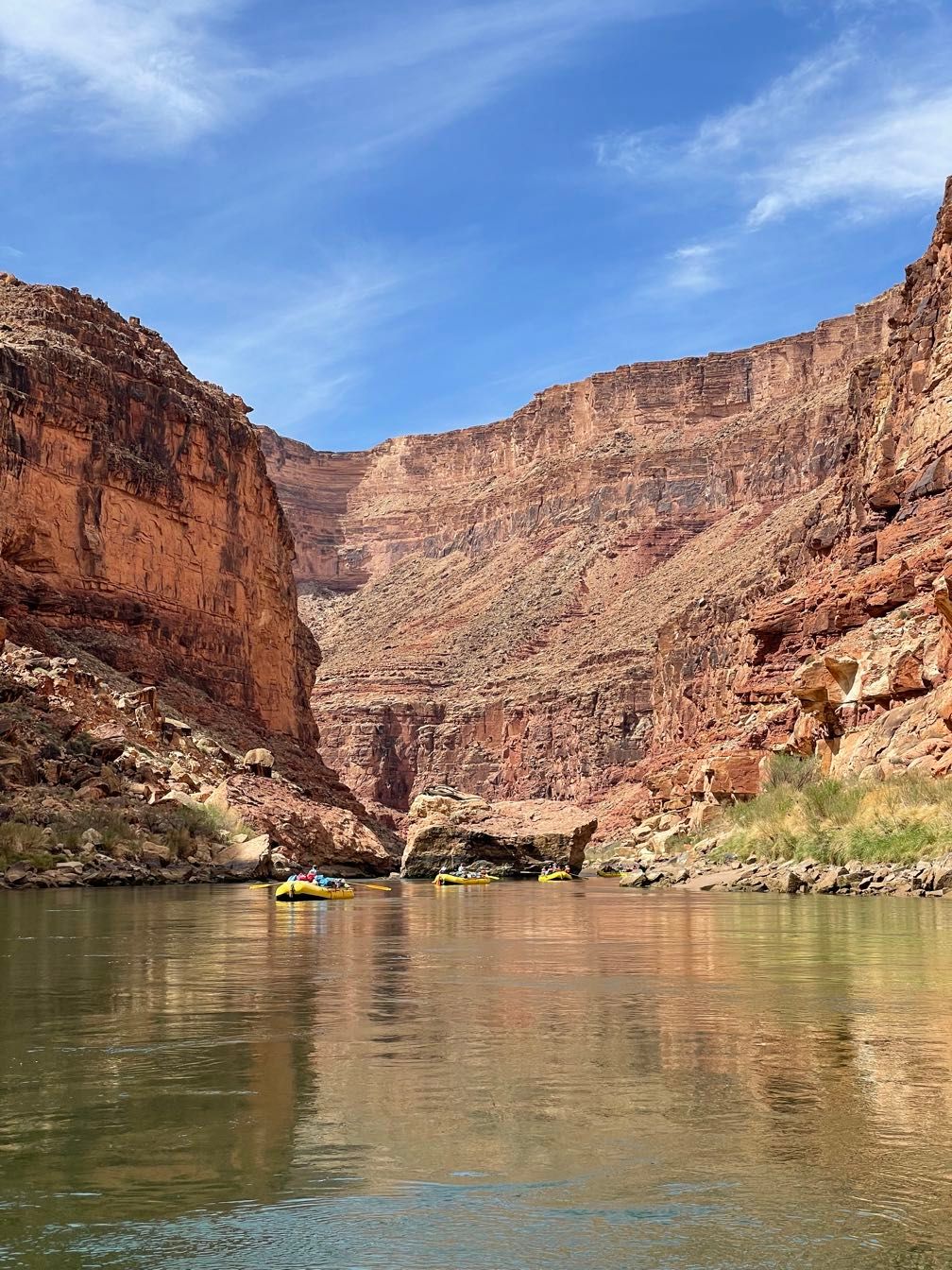
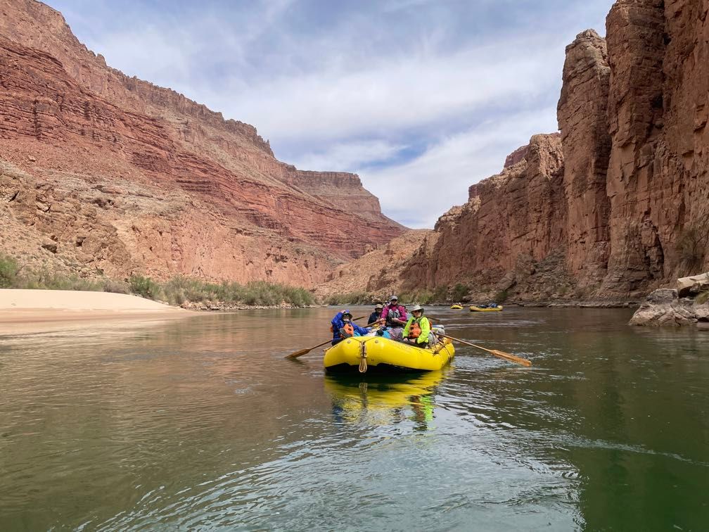
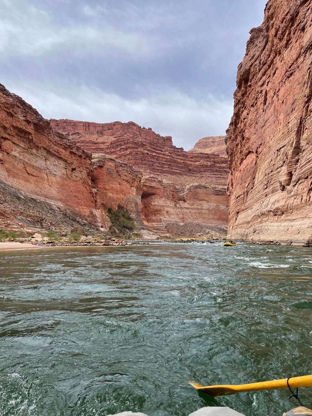
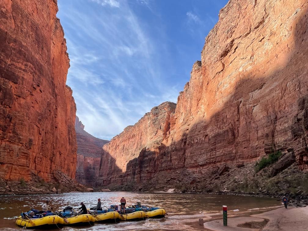
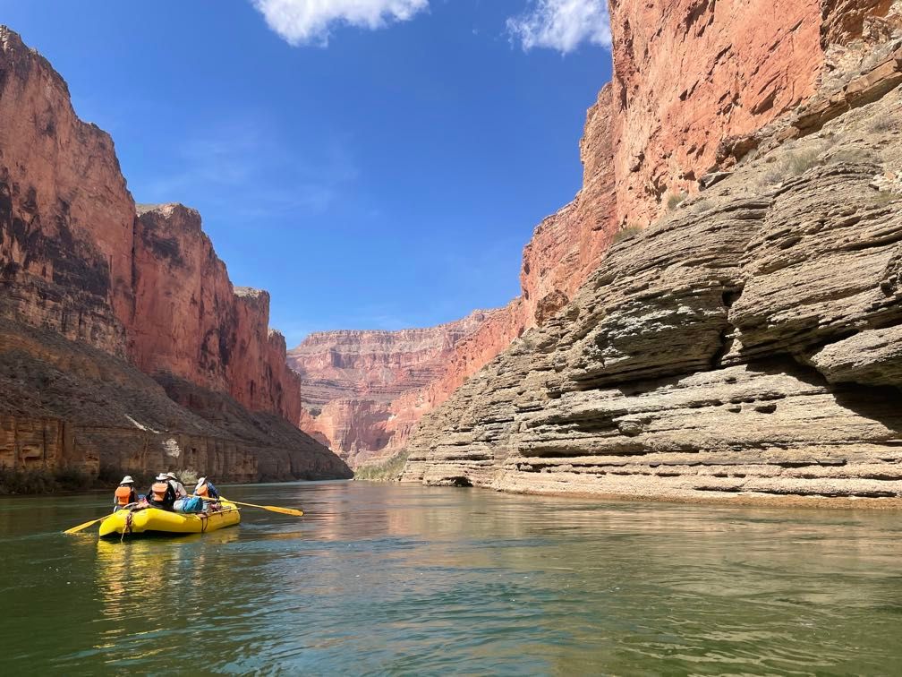
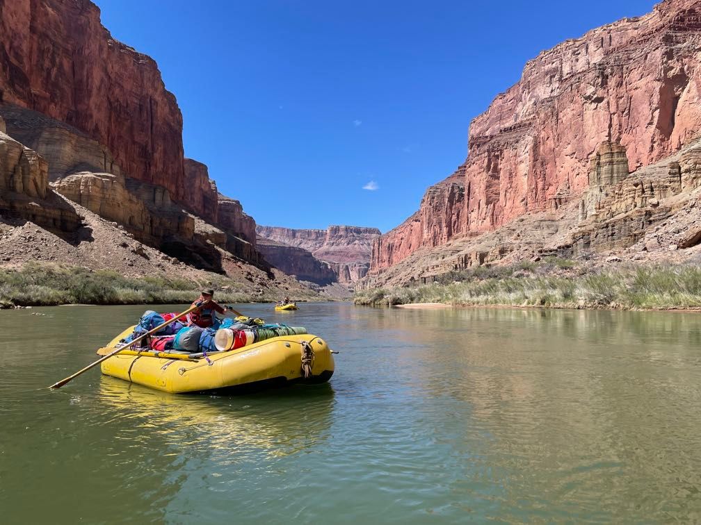
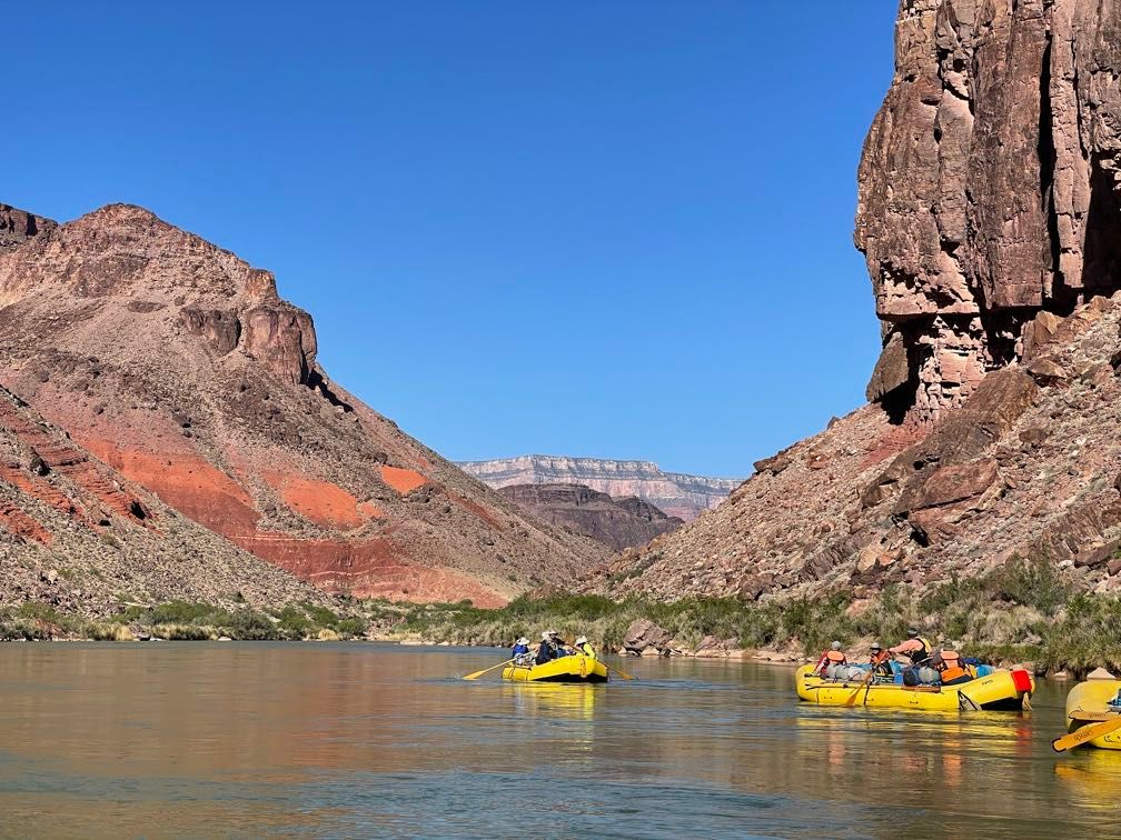
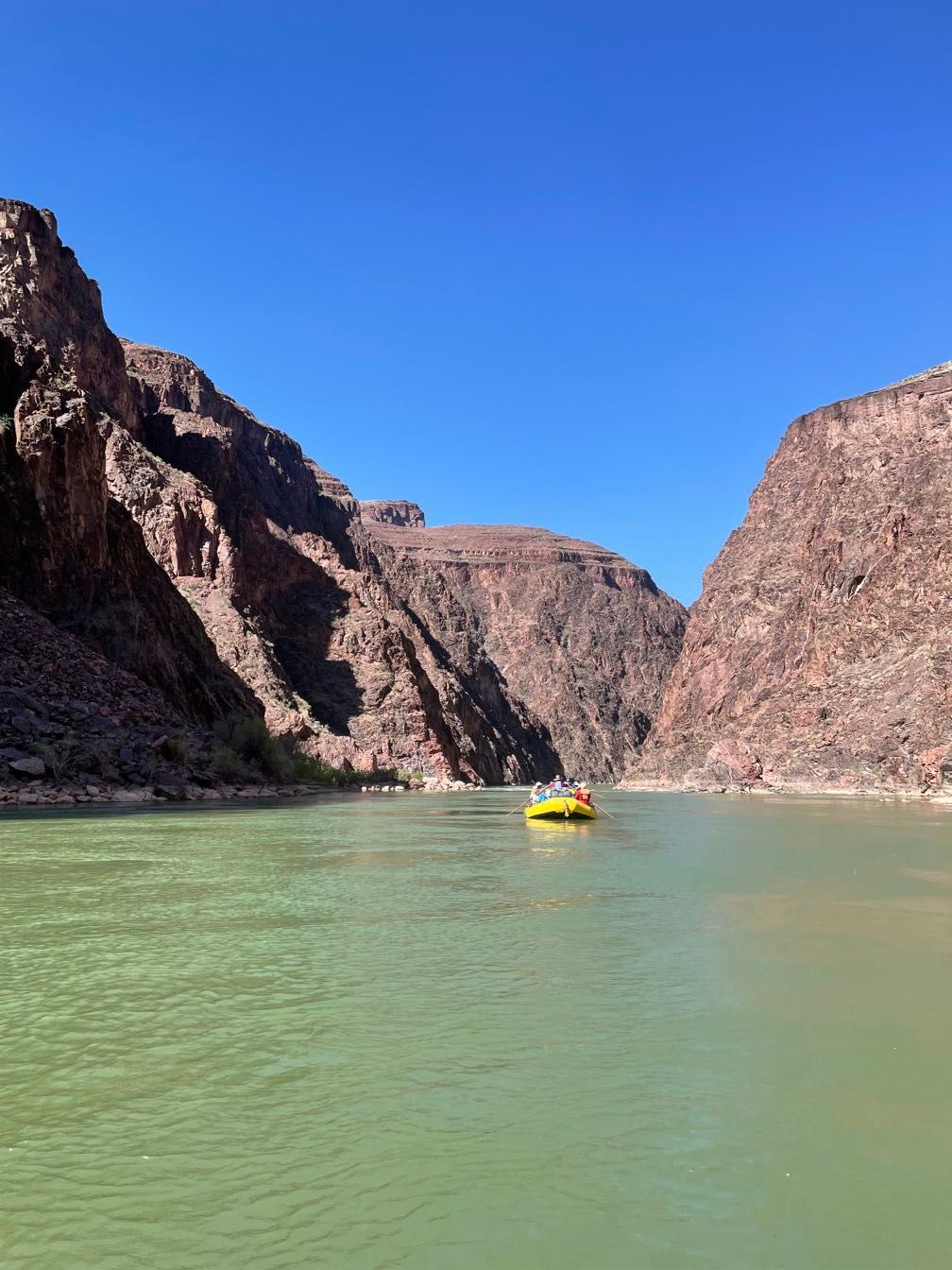
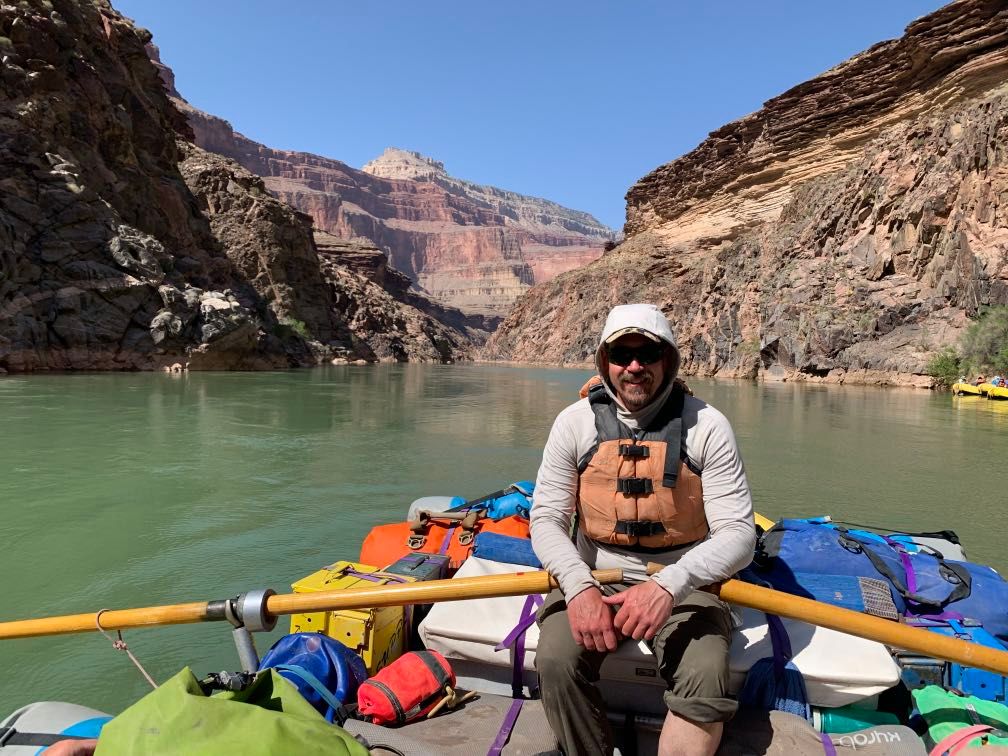
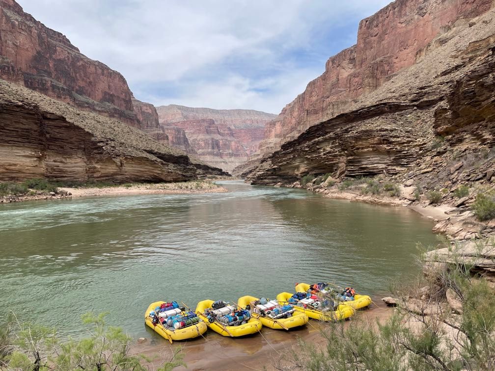
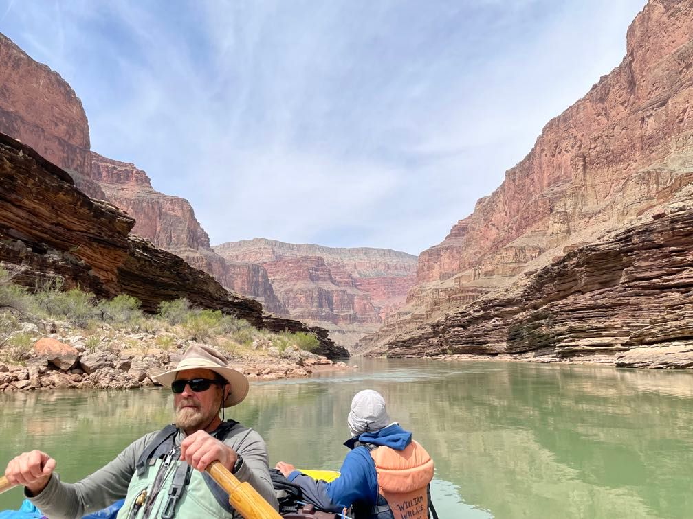
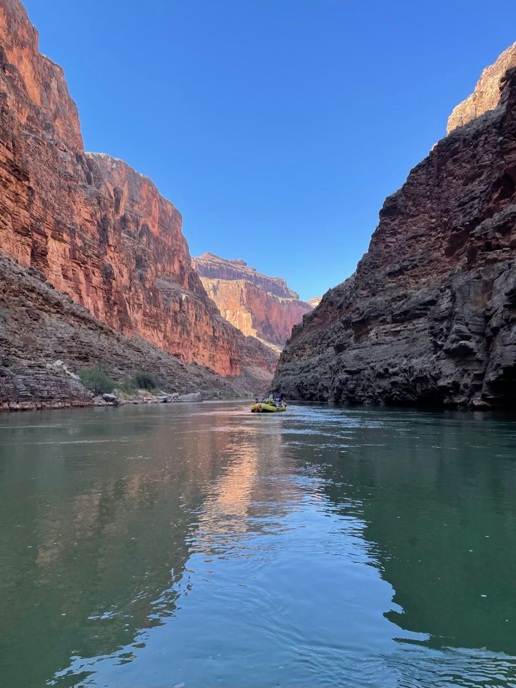
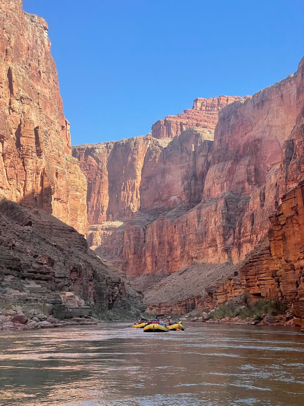
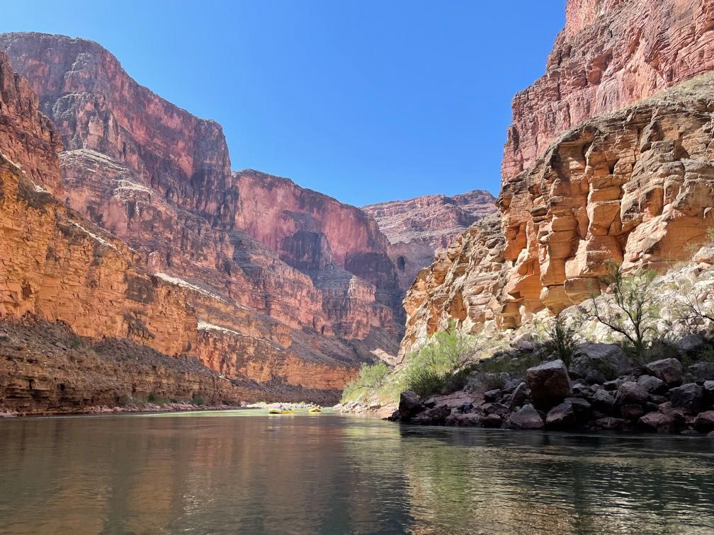
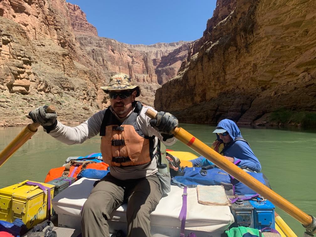
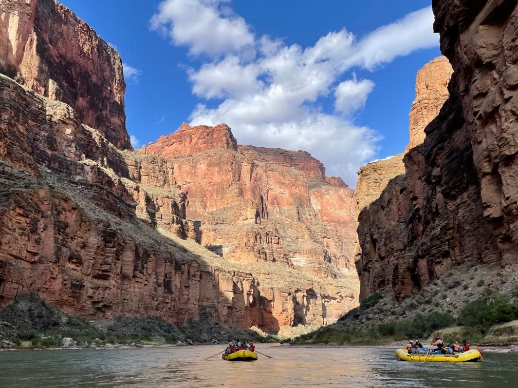
With that, we got on the river. My parents and I started the trip riding with Dave, but we’d rotate among the guides’ boats each day. There were a few minor riffles just downstream, placed there as if to accommodate river trips by providing some low-impact whitewater right at the start.
Just after noon, we stopped for lunch. After getting back on the river, we tied the five rafts together, and Dave gave the water safety lecture. We drifted under the Navajo Bridges, giving me a look at them from the underside for the first time.
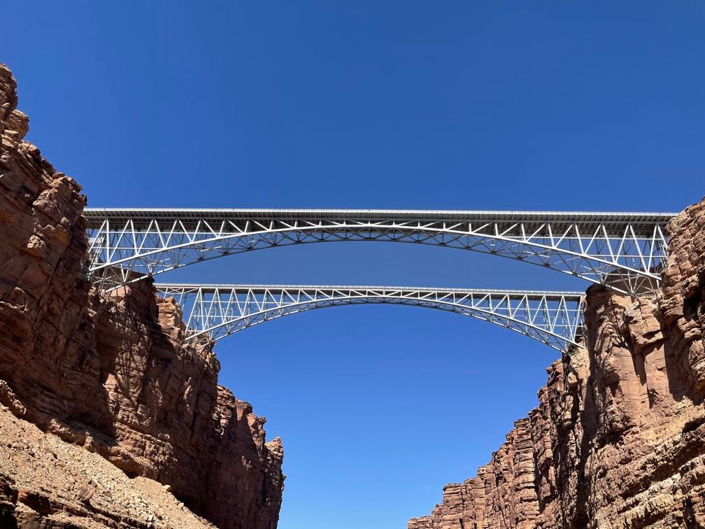 The two Navajo bridges from the river
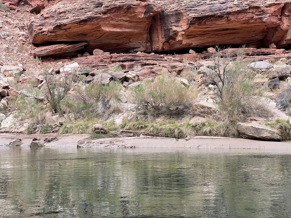
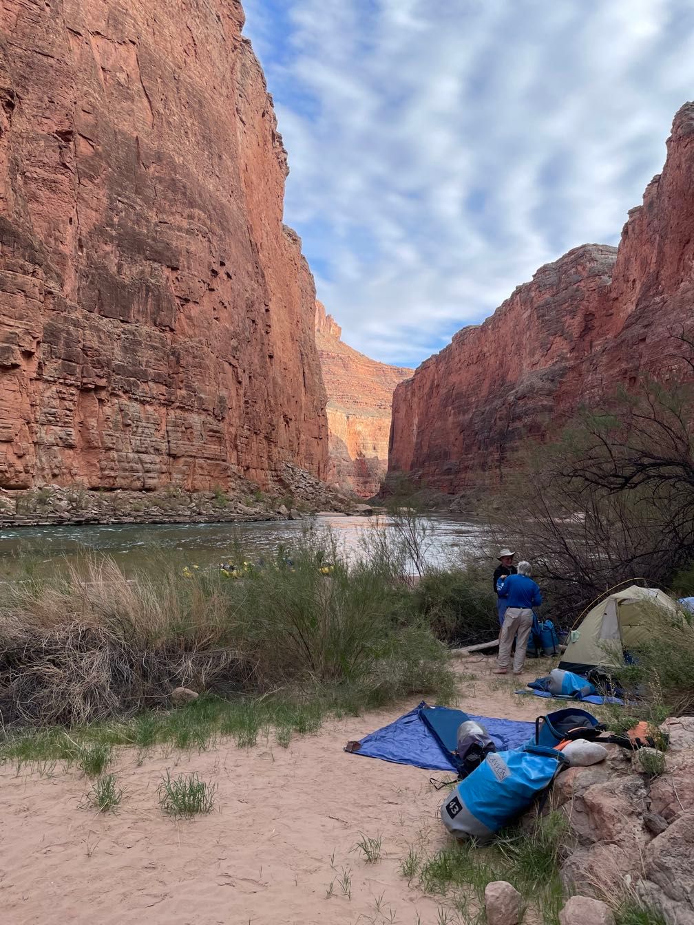
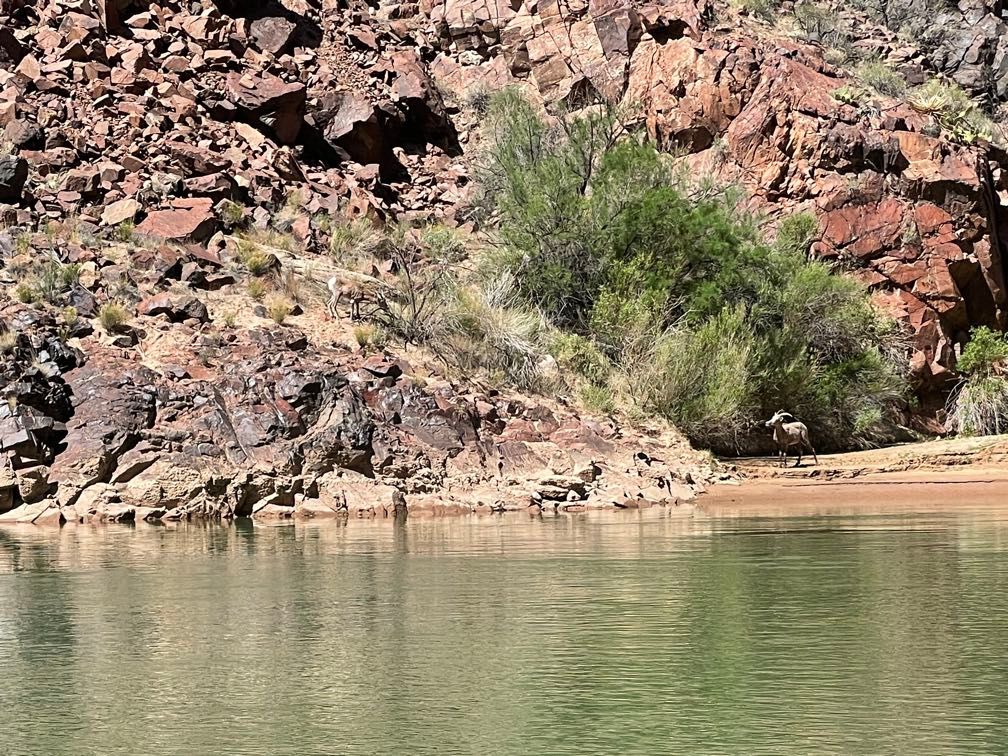
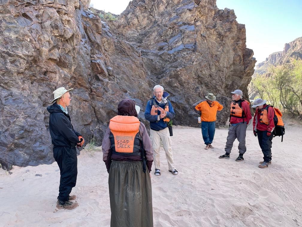
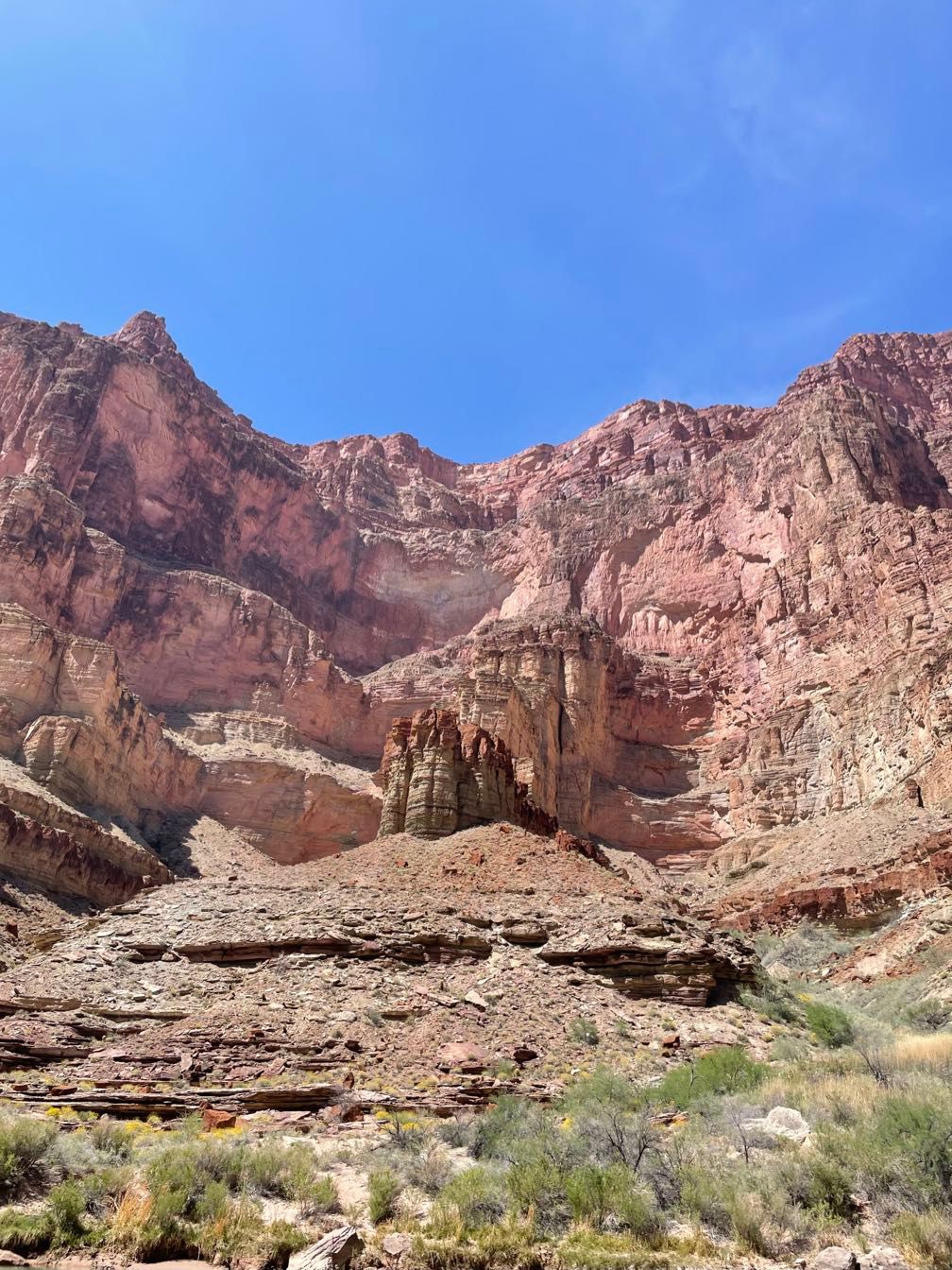
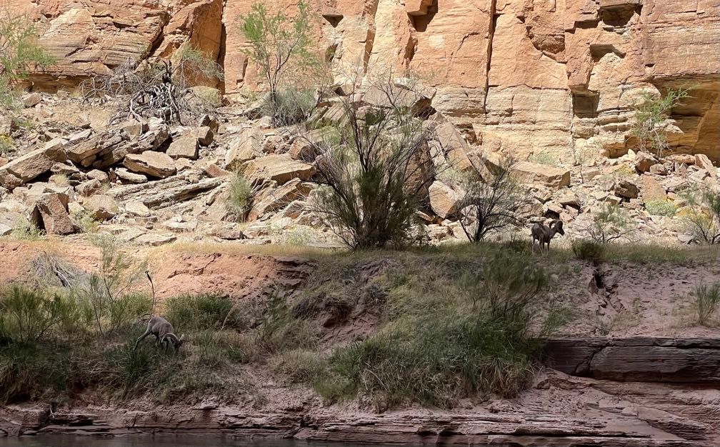
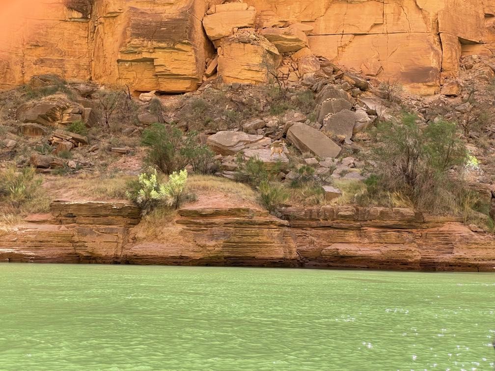
Shortly after that, we ran our first rapids — Badger Creek and Soap Creek. We also saw the first of many bighorn sheep. We pulled off to camp shortly downstream of an inscription commemorating Frank Brown, a railroad executive who drowned during an expedition surveying the Grand Canyon for a potential rail route.
The first order of business in camp is to get the rafts unloaded. This is very much under the principle of “many hands make light work,” with everyone pitching in to get all the necessary items (tables, food, tents, everyone’s bags, etc.) off the boats and on the beach.
After we got the tents set up, we had an orientation to the toilet setup, known as the “Groover.” Rafting trips are required to carry out all of their solid waste, so we have to do all of our pooping in a big metal box (actually an ammo can) with a toilet seat on it. Before the addition of the toilet seat, river rafters had to sit directly on the box, which tended to produce grooves in their posteriors, hence “groover.” Liquid waste, on the other hand, can go straight into the river.
We had a hearty ravioli dinner. Afterward, around the campfire, Gary talked about the Brown-Stanton expedition (on which Brown drowned). The expedition took pictures facing upstream and downstream at every bend in the river to see if it would be possible to locate a rail line along it. Gary was involved in some research trips where they recreated these photos over a century later to see how the river had changed over that time.
Day 2
Life on the river starts nice and early, about 5:30 AM. I spent some time reorganizing my gear since it was clear that the amount of stuff I had crammed into my purple day bag wasn’t doing me any favors.
After breakfast, Sherri led us in some “chair yoga,” doing stretches to help us loosen up after sleeping on the ground all night and sitting on the rafts all day. For me, at least, this was very welcome. We did it almost every morning during the trip.
 Rafts at our first camp
We got camp packed up and everything loaded on the boats by about 8:30, which would turn out to be pretty typical. My parents and I were riding with Leo. We saw a bighorn ewe with three cute little lambs.
 Bighorn sheep
Very breifly we stopped at an inscription made by the 1923 Birdseye Expedition, which was surveying the canyon for potential dam sites.
 Inscription from the 1923 Birdseye Expidition
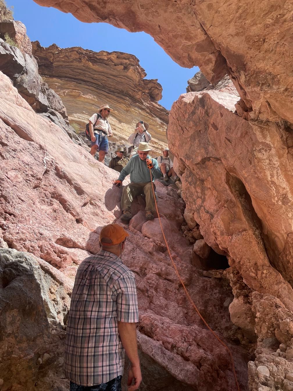
We ran a couple of minor rapids before coming to House Rock Rapid. This was the first rapid we stopped for the guides to scout it ahead of time, rather than just rafting right in. It definitely provided the most exciting ride so far (and the wettest) when we ran it.
 Scouting House Rock Rapid
There was one more minor rapid; from there, it was flat for a pretty good stretch. Leo even let me row the boat for a bit.
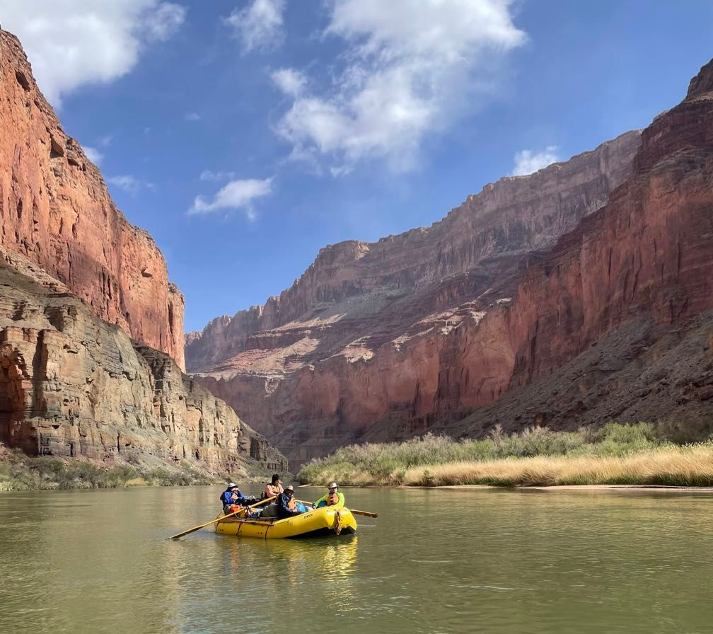
 Rafting downriver
 Boulder Narrows
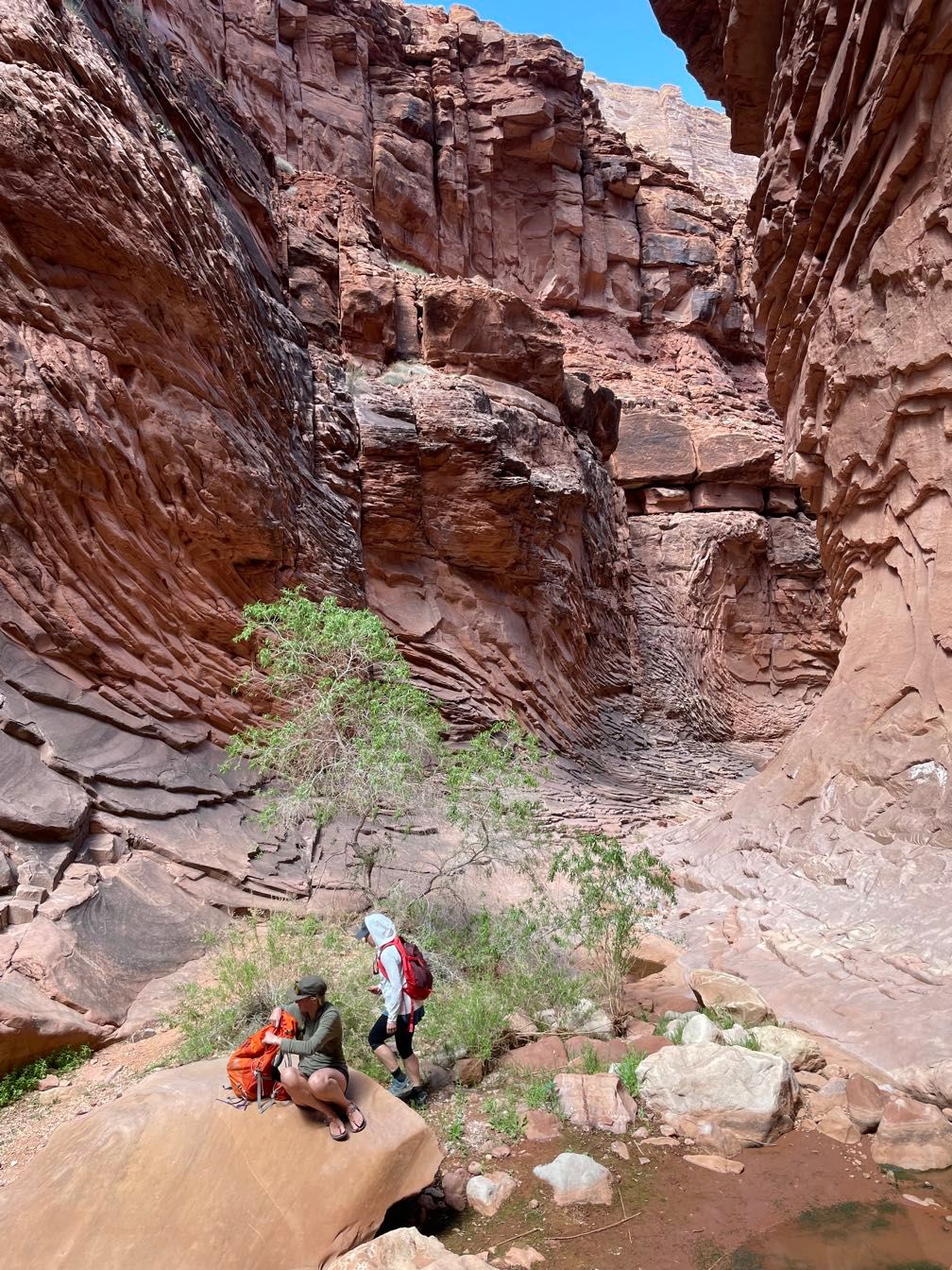
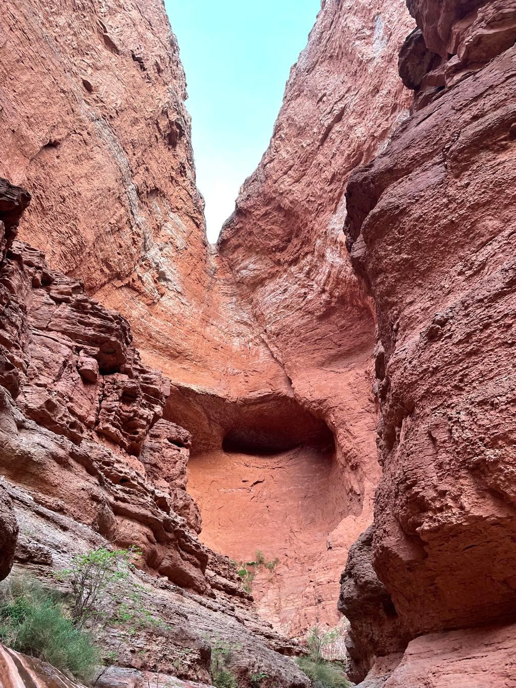
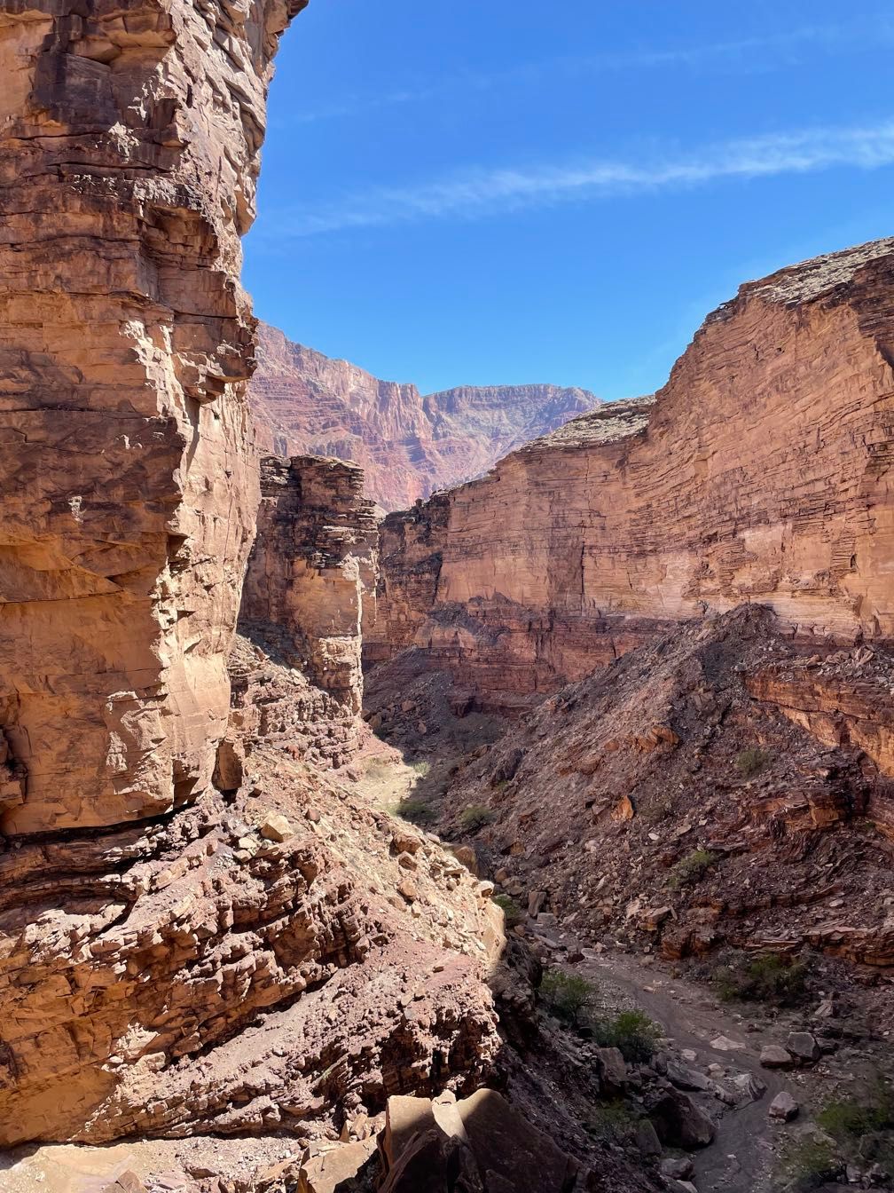
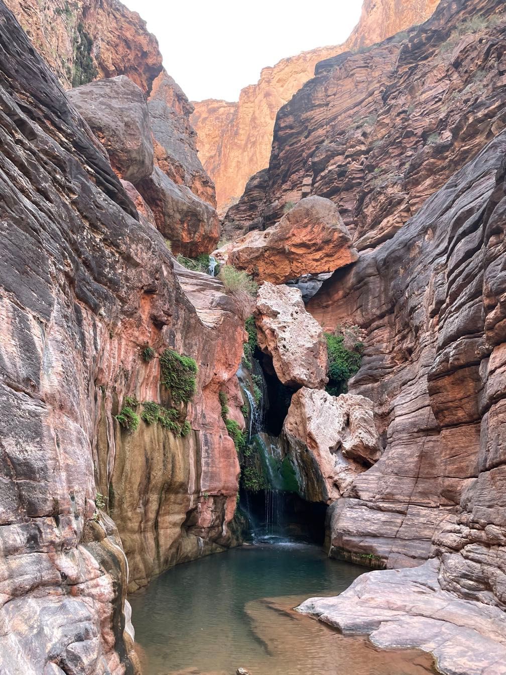
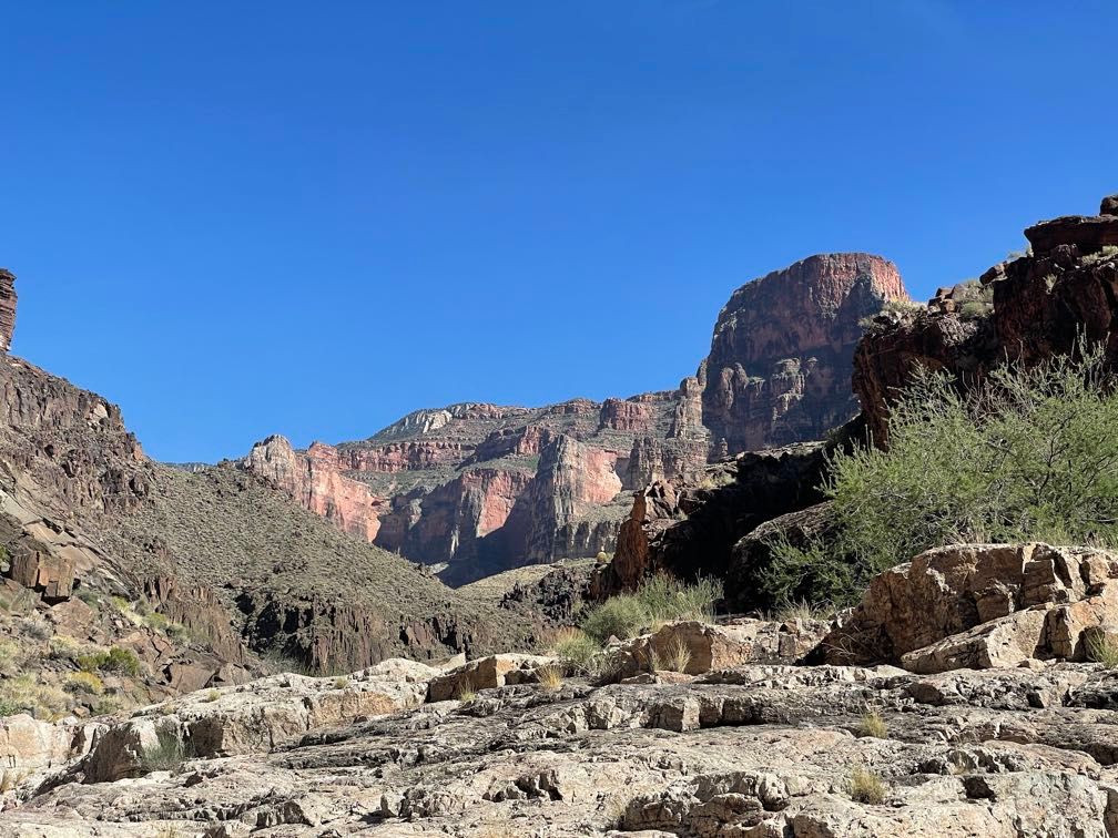
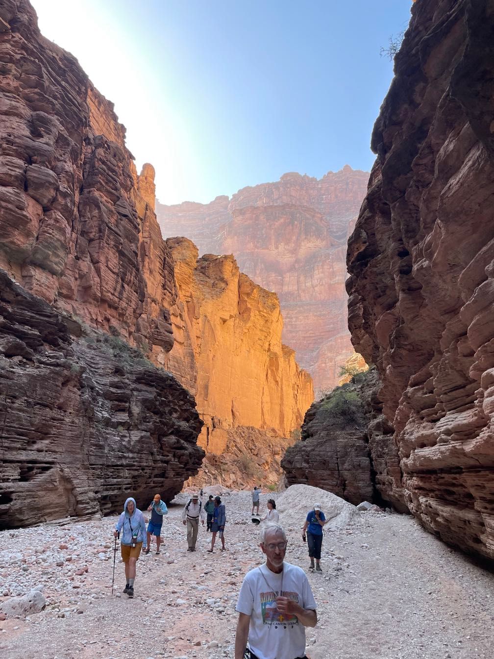
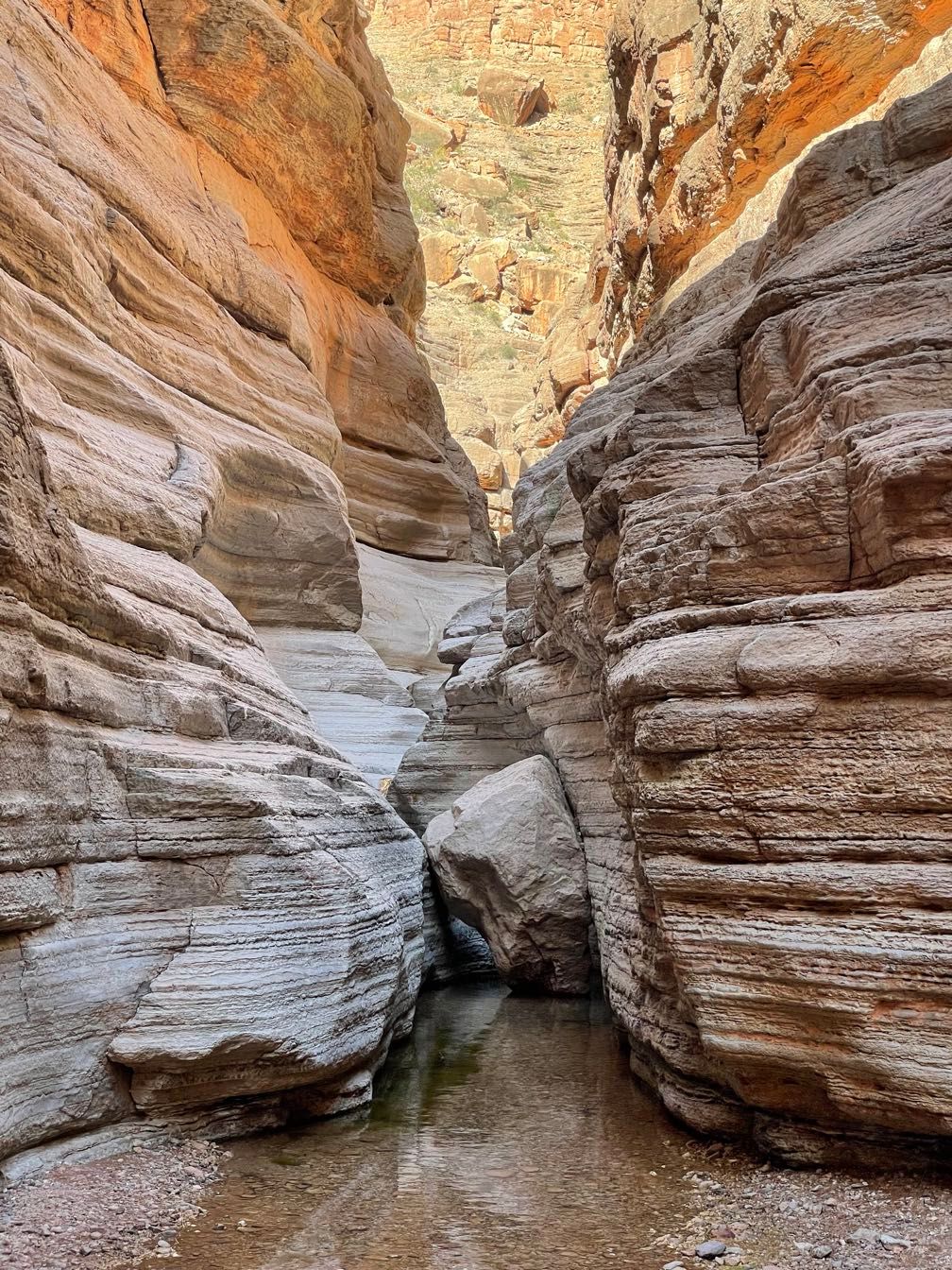
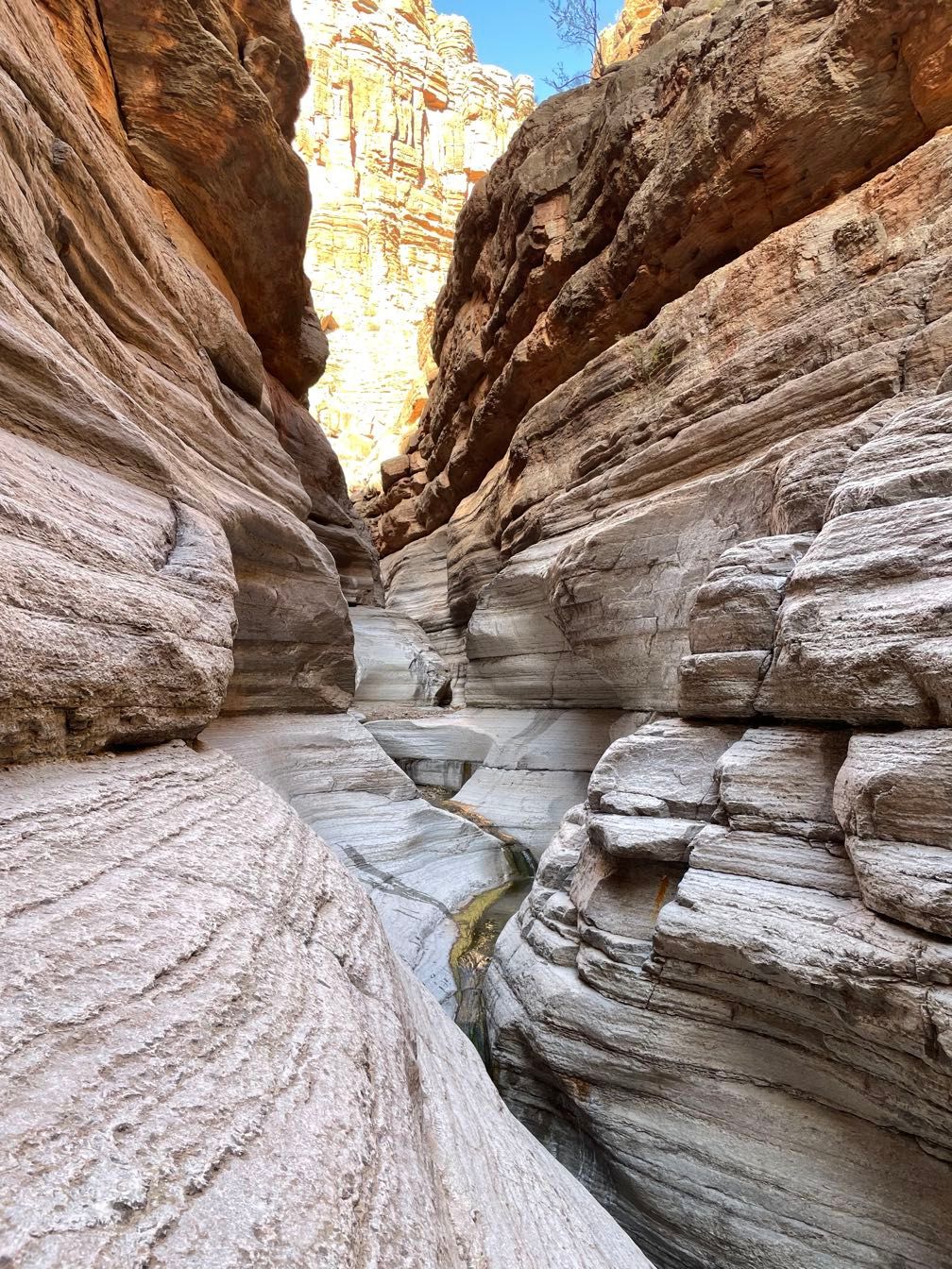
At North Canyon, we had lunch and took a short hike up through the Supai Formation. It ended at a nice pool, just before a short pour-off.
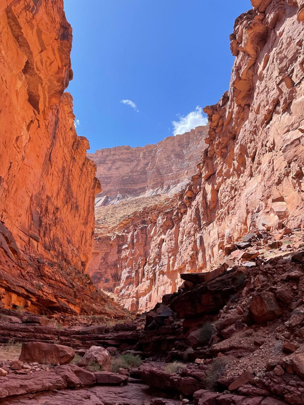 Looking up North Canyon
 North Canyon
 Pool in North Canyon
After the hike, we got back on the river and ran the first two rapids of what’s known as the Roaring Twenties (North Canyon Rapid and 21 Mile Rapid). These are a series of 11 rapids between Mile 20 and Mile 29, some at intervals as short as half a mile. We only did those first two today; the rest would have to wait until tomorrow.
 A motor rig approaching 21 Mile Rapid
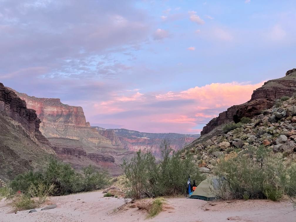
We pulled off to camp on a narrow beach with a big dune behind. After getting camp set up, we were sitting around when a massive wind blew up, scouring us with sand. Little did we know this would be only the first of many.
Dinner was a delightful combination of salmon, potatoes, and bok choi. Afterward, Sherri talked to us about the native peoples of the canyon.
Day 3
 Taking pictures on the beach
This morning, I was a bit more efficient, getting my gear packed up before breakfast. Today, my parents and I rode with our trip leader, Gary. We ran through the rest of the Roaring Twenties in one go before lunchtime.
 Gary rowing the boat
 Amy’s boat behind us
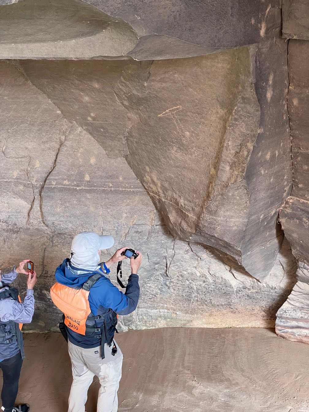
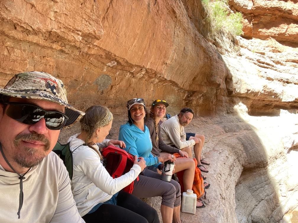
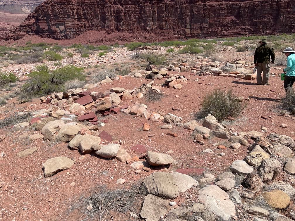
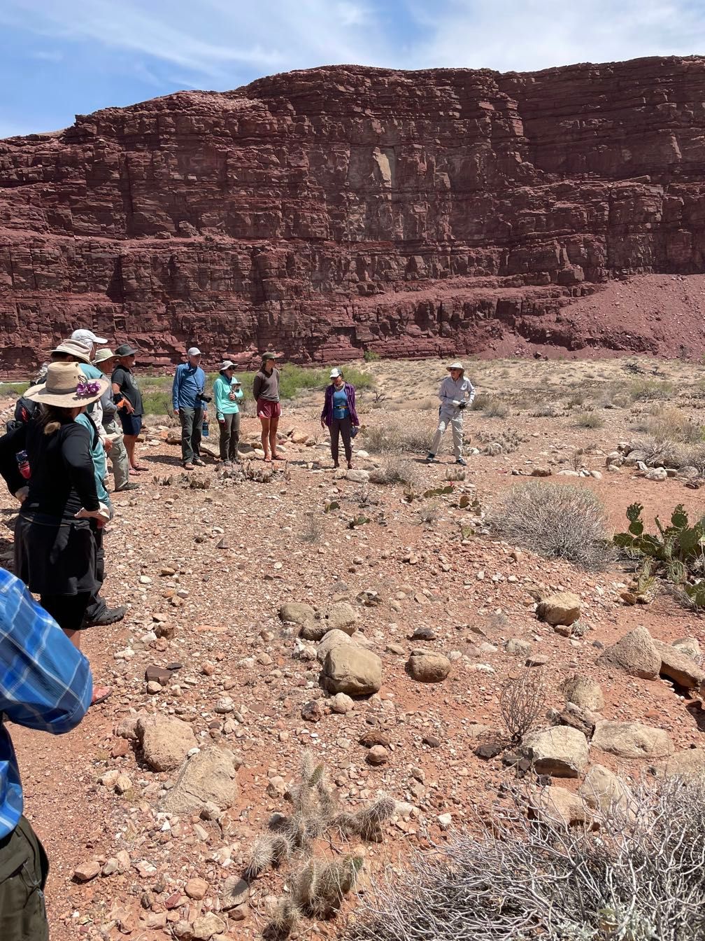
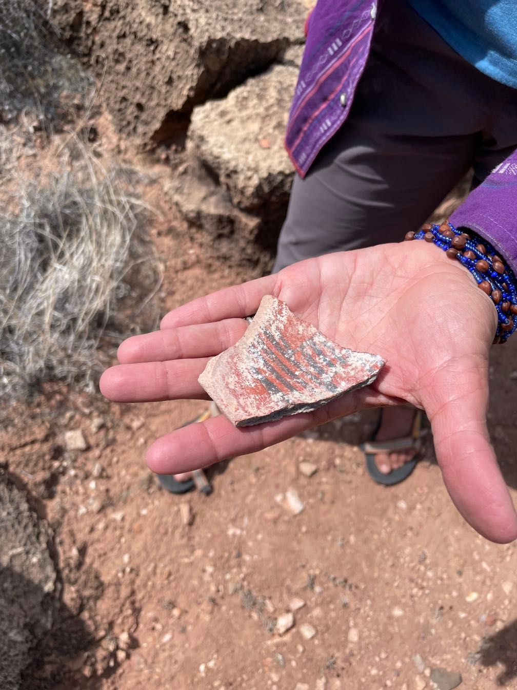
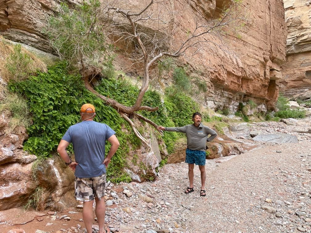
Around noon we stopped at a beach below some Ancestral Puebloan Ruins and took a walk up to the archeological site. We saw a couple of dwellings (walls about thigh high) and lots of pot shards. Sherri did a great job talking about the site for us, including showing us some chert that had been used to flake stone tools.
 Petroglyphs
 Potshards
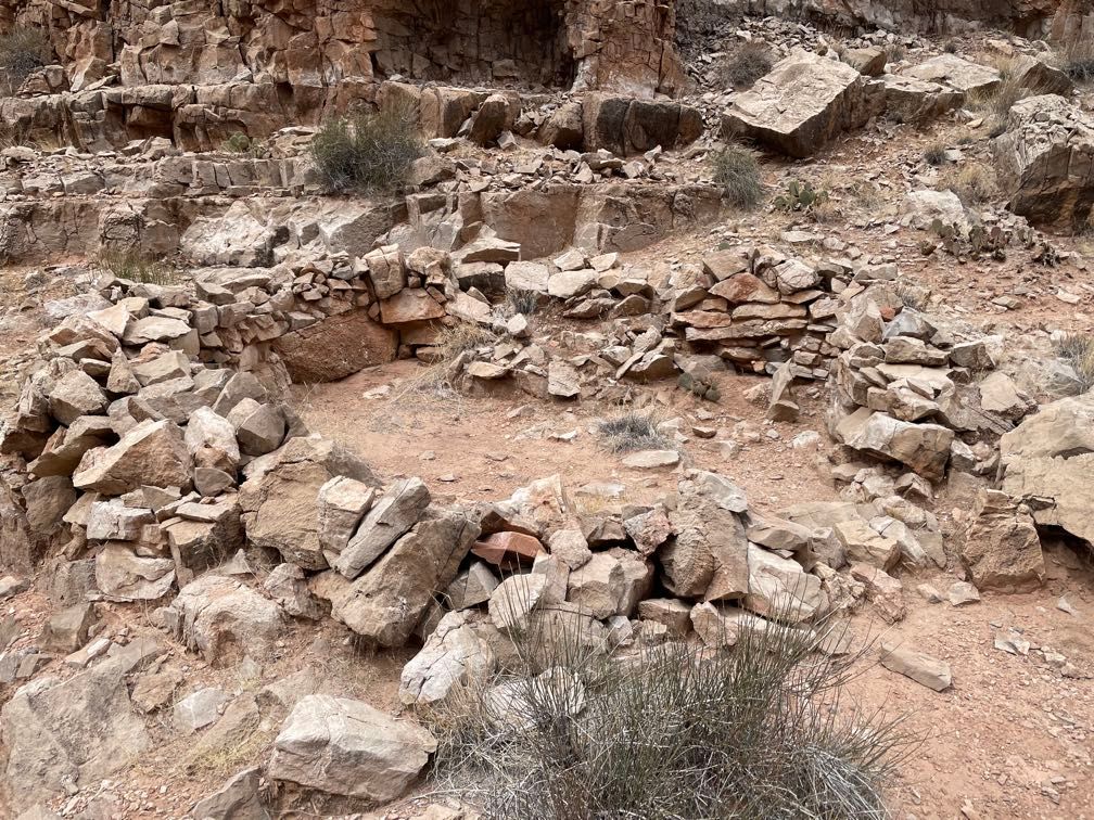 Dwelling
We ate lunch down on the beach. Heading downstream, we floated by Stanton’s Cave, where researchers found many split twig figurines dating back thousands of years.
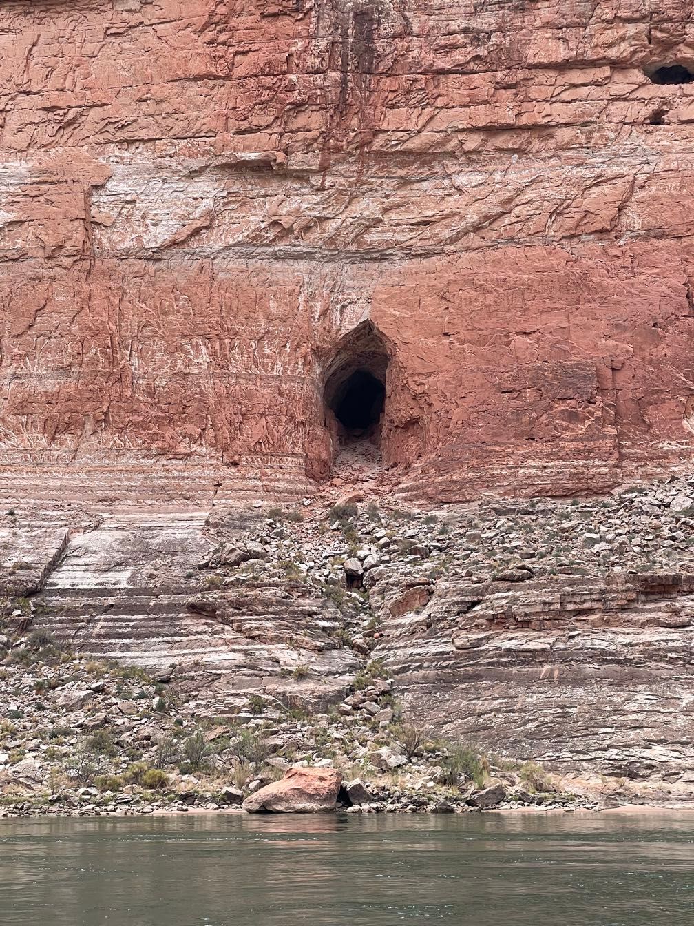 Stanton’s Cave
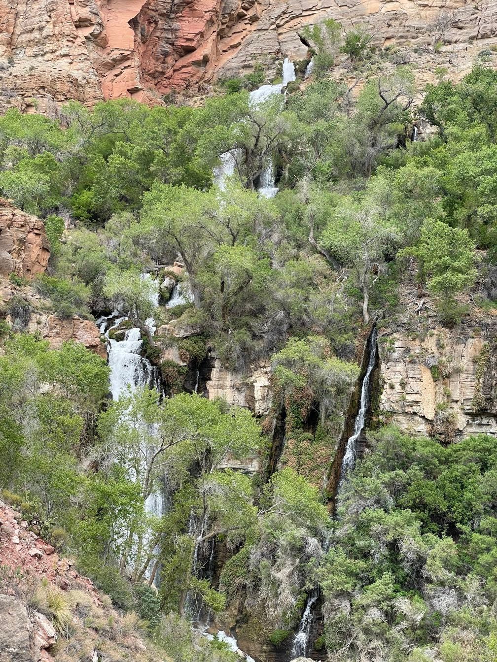
Shortly after came Vasey’s Paradise, a spring flowing out of the canyon wall, giving rise to a spectacular array of greenery growing right out of the rock. Right now, the water was just trickling out, but Gary said when it’s wetter, it spurts out a couple of holes.
 The big patch of greenery on the canyon wall is Vasey’s Paradise
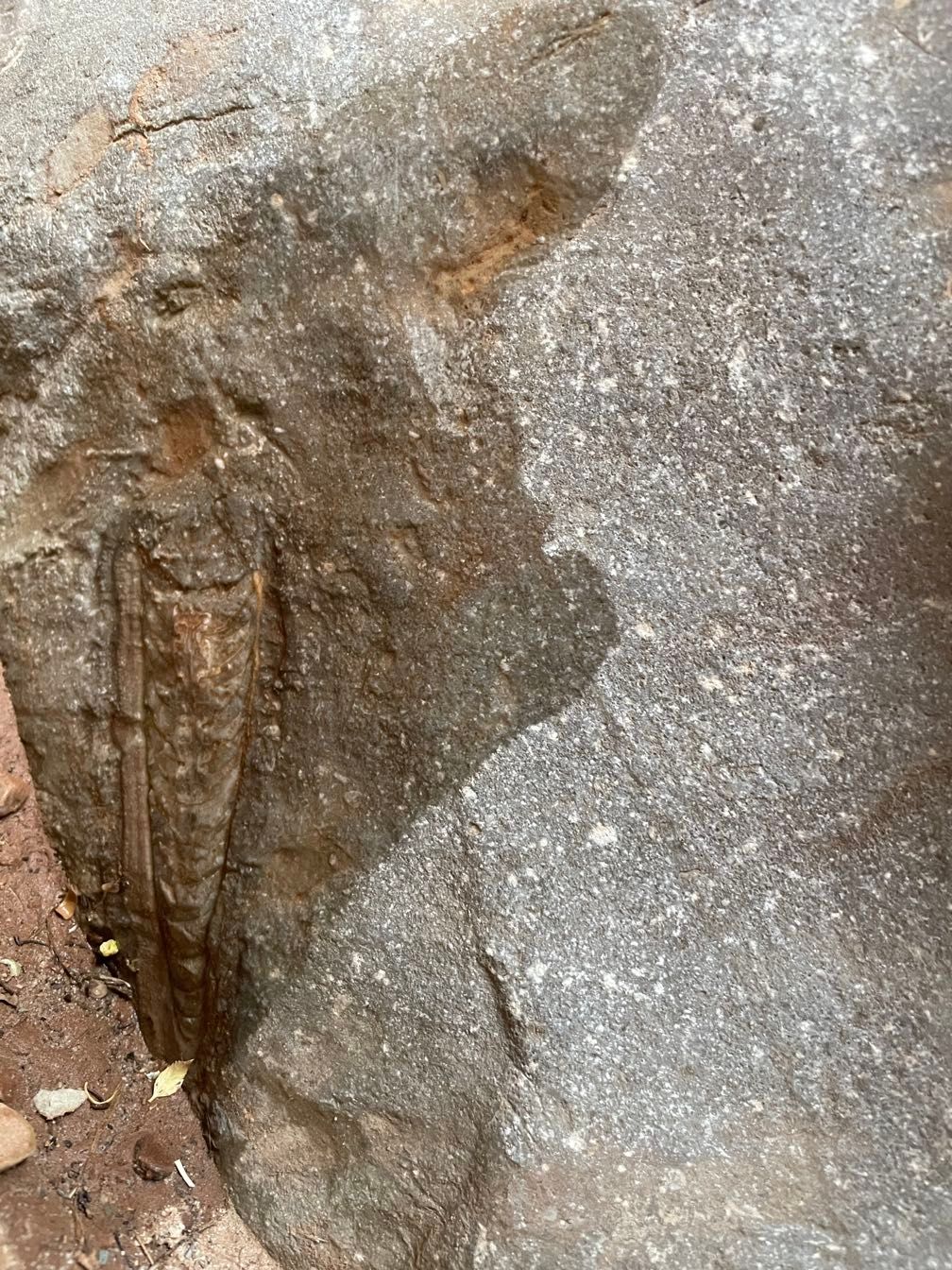
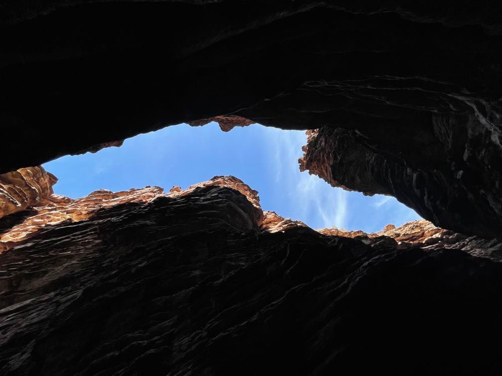
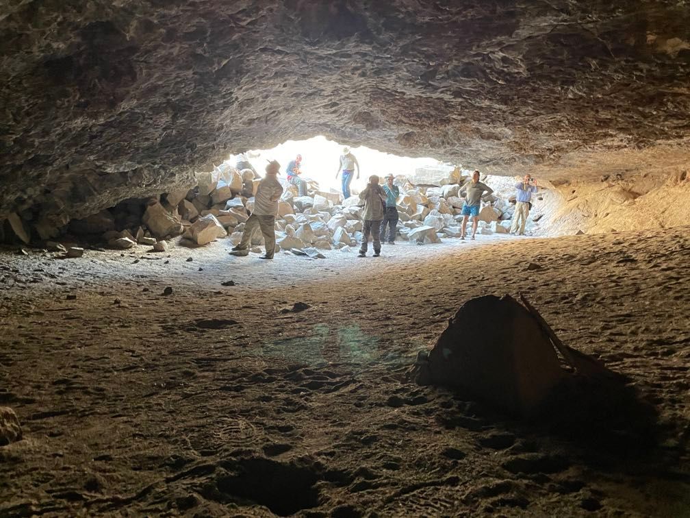
Redwall Cavern is a huge alcove cut into the base of the cliff face next to the river. In addition to the impressive cave itself, we also saw some neat fossils there.
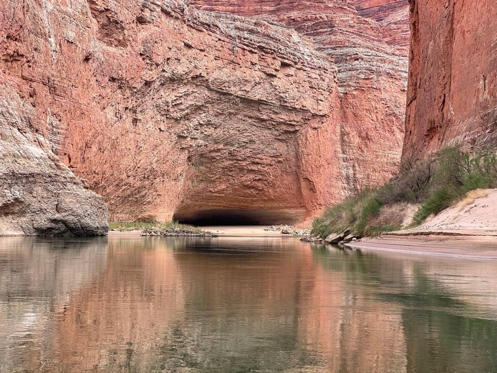 Redwall Cavern
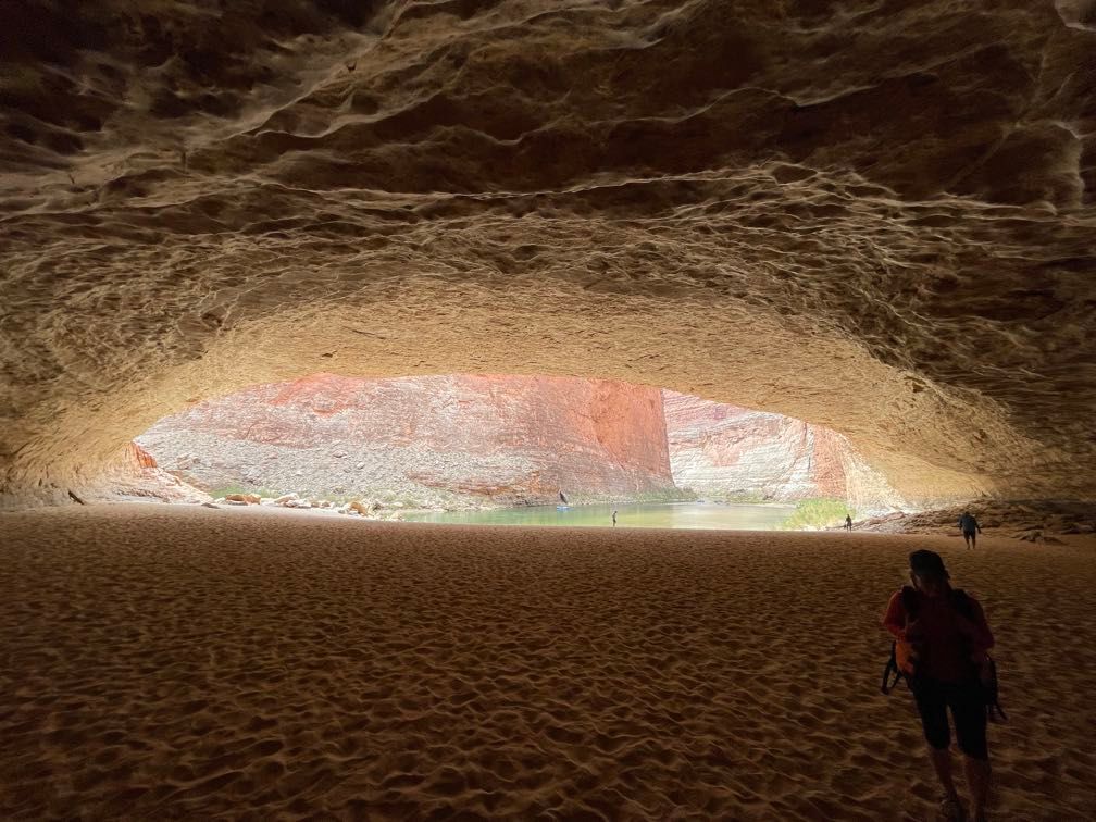 Inside Redwall Cavern
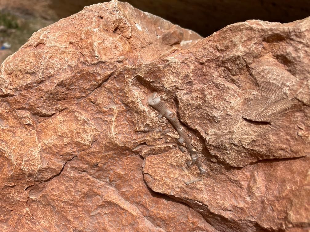 Fossils at Redwall Cavern
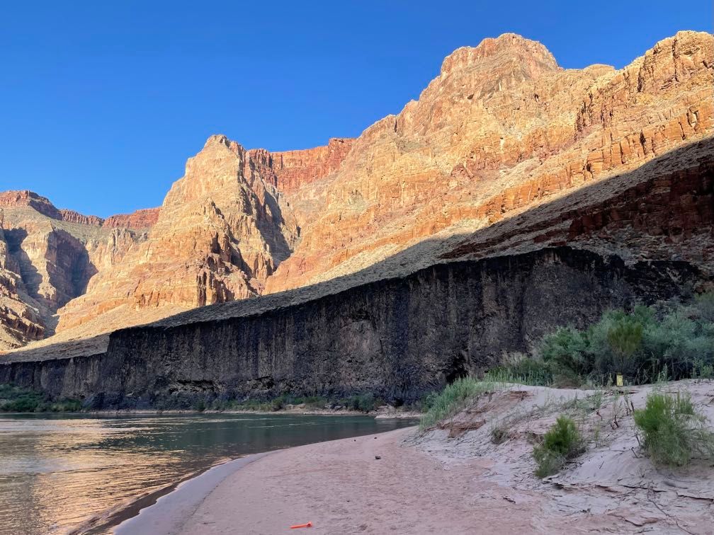
Heading downriver, we passed a place where an enormous monsoon runoff event last year had killed one member of a rafting party and injured several others. Gary knew the guides involved.
 Travertine buildup beneath a spring
 Calcite crystals in limestone
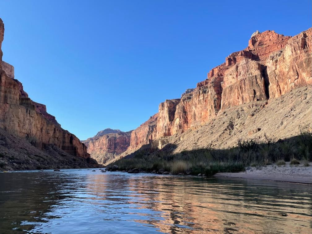
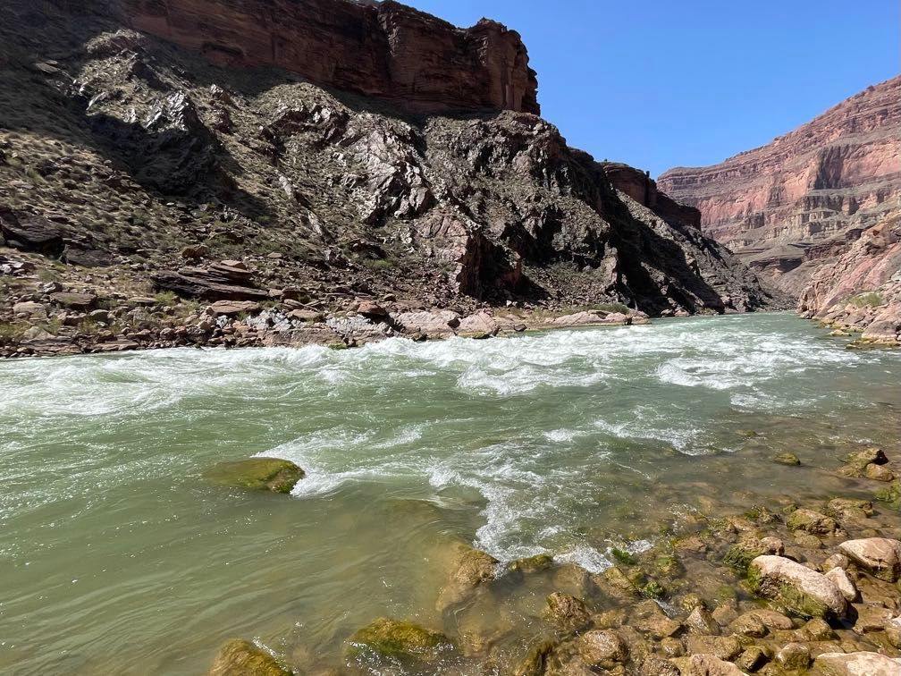
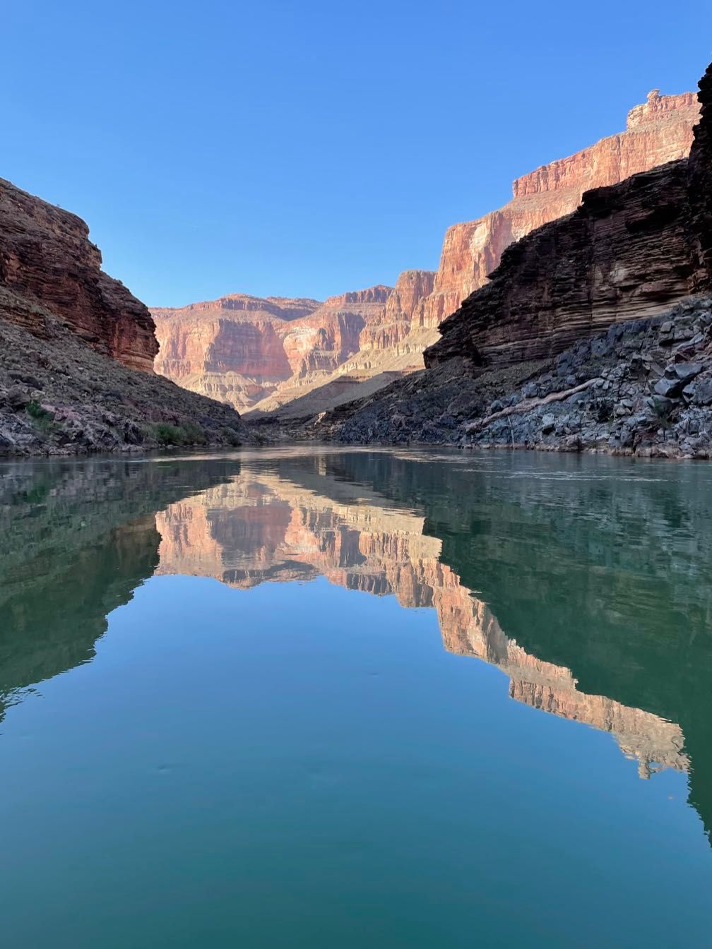
 Still water on the river
We stopped for the night at Redbud Camp and enjoyed some excellent fajitas for dinner.
 Redbud Camp
 Red rocks at Redbud
Day 4
After breakfast, we walked up to Redbud Alcove; a beautiful semi-circular alcove incised deeply into the canyon wall. Gary pointed out the redbud trees that give the alcove its name. He had to explain why the flowers were, in fact, purple.
 Redbud Alcove
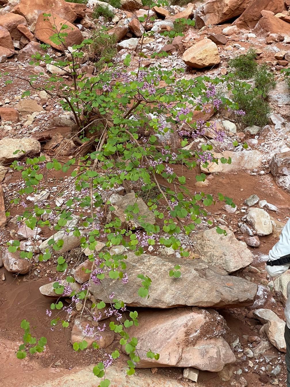 Redbud tree at Redbud Alcove
 The boats at Redbud Camp
We broke camp and loaded the boats. Today, we were riding with Amy. Heading downriver, we had a long stretch of calm water. After the Roaring Twenties, these were the “Rowing Thirties.” Just past Mile 39, we passed the proposed Marble Canyon Dam site. Had it been built, it would have flooded all the beautiful canyon we’d been rafting through. Gary talked a bit about the fights over dams on the Colorado River, and Sequoyah read a poem on the subject by Vaughn Short.
Gary talking about damming Marble Canyon, with one of the test excavations visible in the background
We passed the Anasazi Bridge, the remains of a wooden bridge built by the Ancestral Puebloans to cross a crack high up on the cliff as part of a cross canyon route.
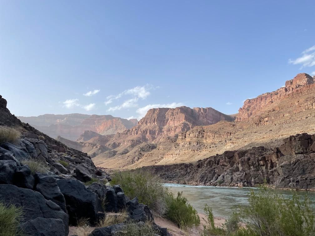
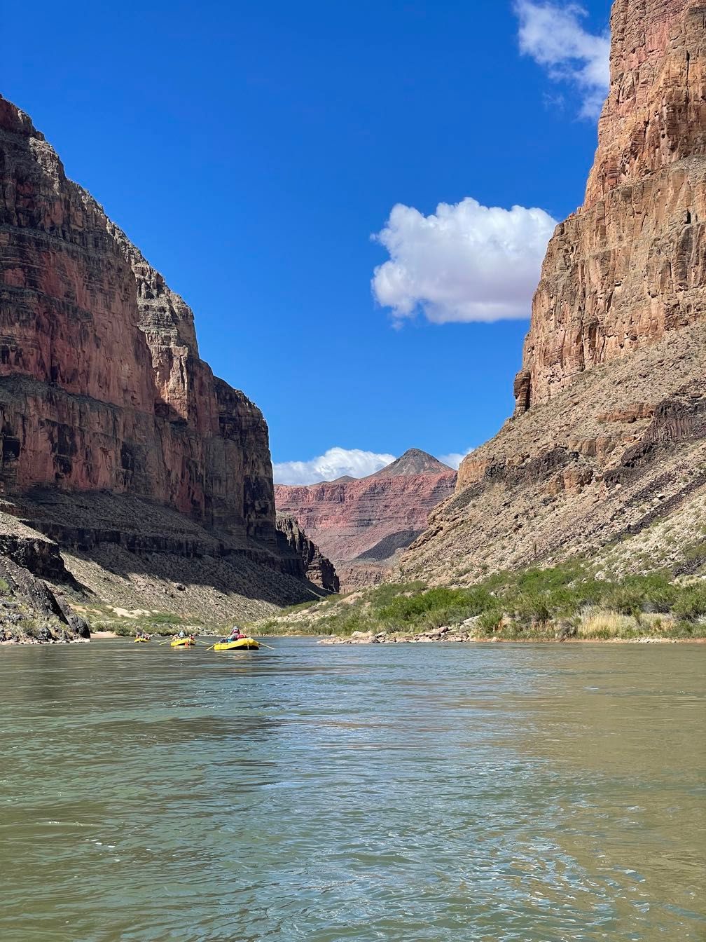
Eventually, we reached President Harding Rapid, our first significant bit of water in quite a while. Shortly after that, we came to a long straight stretch of canyon and faced a stiff headwind. Amy got quite a workout. This was our first real taste of many windy river miles to come.
 Rafting down the canyon
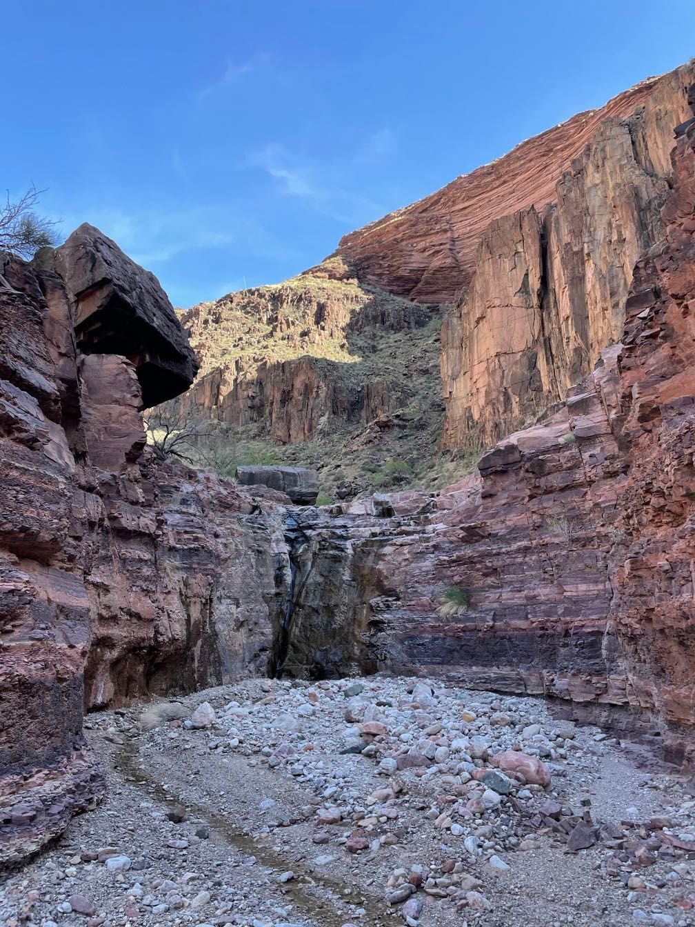
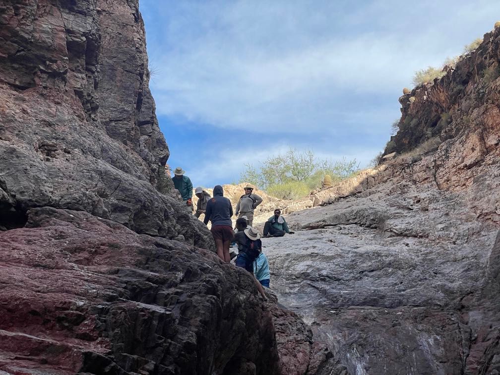
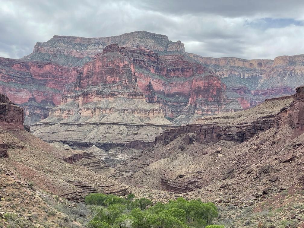
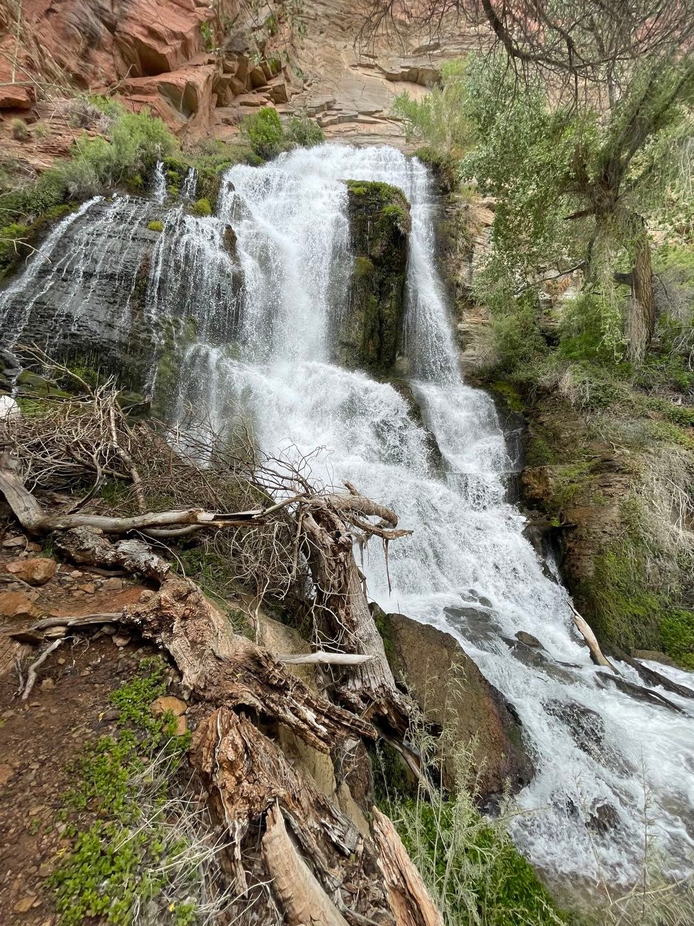
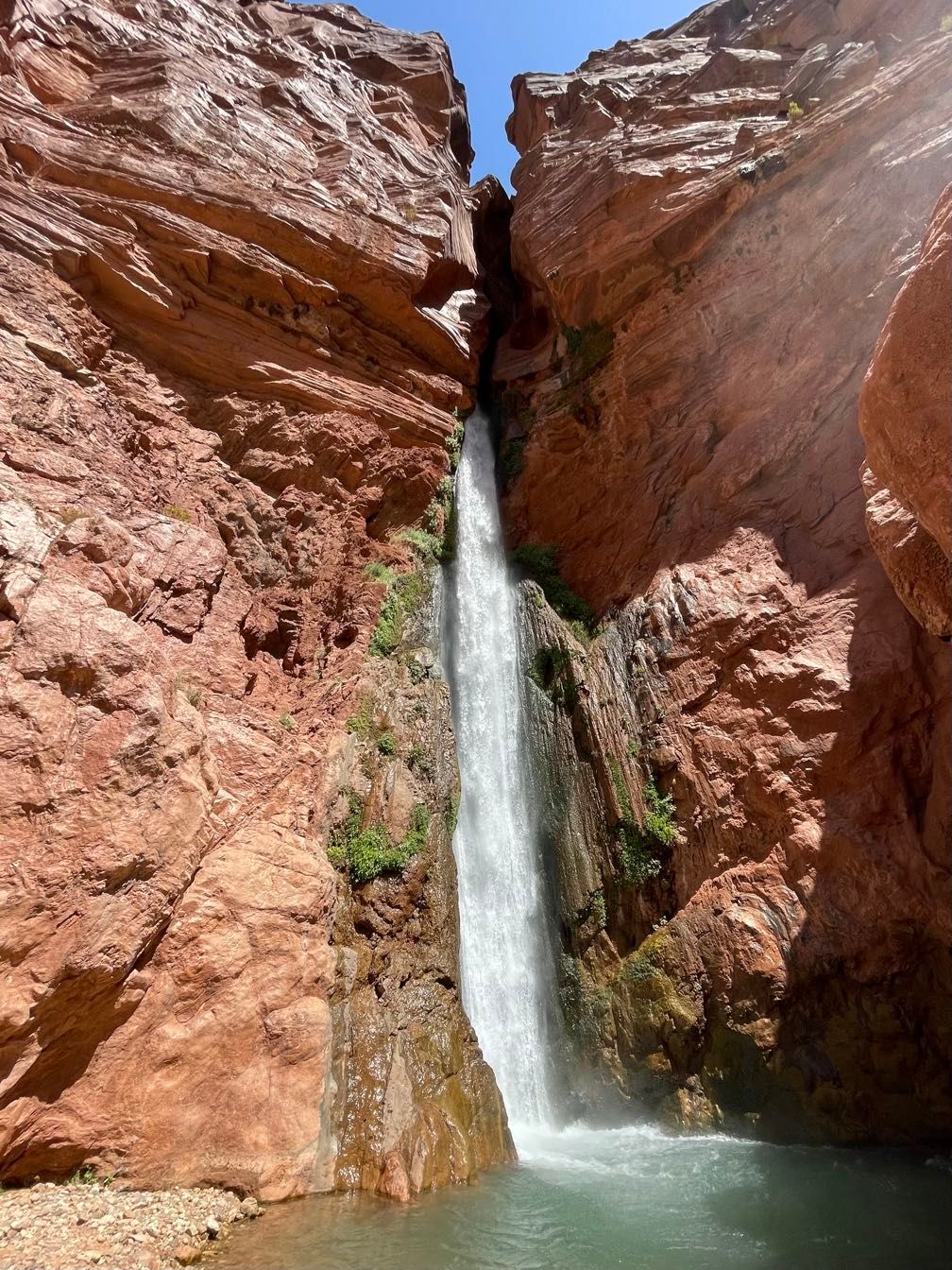
Shortly before noon, we pulled into Saddle Canyon. A group was already eating lunch there, so we delayed lunch and headed up the trail with a big helping of snacks. After a steep climb, a walk along a dry creek bed, and a short bit of wading, we reached a lovely little waterfall. We rested there for a while. Lying curled up against the cool rock was pretty relaxing.
 View from the Saddle Canyon trail
 Walking up Saddle Canyon
 Waterfall in Saddle Canyon
 Relaxing in Saddle Canyon
We headed back down to the beach to be met by a tremendous wind. It was even kicking up whitecaps out on the river. We had lunch while trying to shelter from the blowing sand. The guides talked it over and decided that there was no way to make progress against such a gale (far stronger than what they’d rowed against this morning).
We lined the boats around to a more sheltered location, then set up a bucket brigade to wet down the sand in an attempt to keep the blowing sand to a minimum. It took a lot of buckets. Once that was done, we shifted to a bag line and got the boats unloaded and all of our gear up a steep slope.
After that, it was off to find the most sheltered campsites we could. In the wind and blowing sand, we scarfed down a well-earned chicken teriyaki dinner.
Day 5
The wind continued to blow heavily overnight, making sleep difficult and snapping a pole in my parents’ tent. Around 4:45 am, it started spattering a light rain. Upon waking, there looked to be a light dusting of snow up on the Hermit Shale and Coconino Sandstone layers downriver.
 Dusting of snow up on the canyon wall
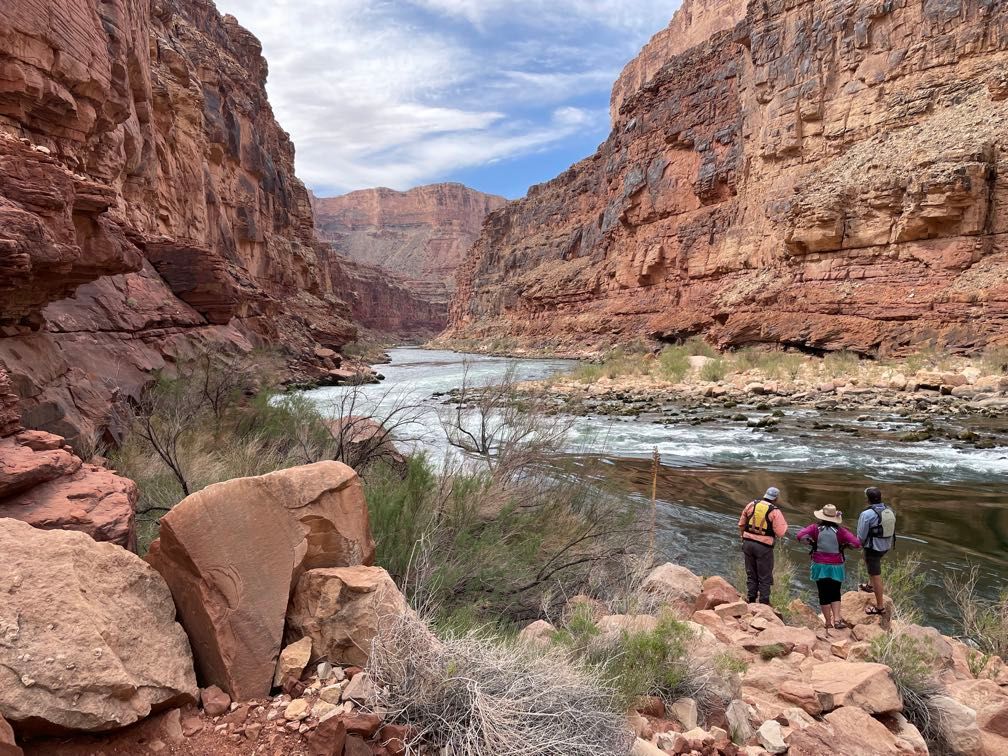
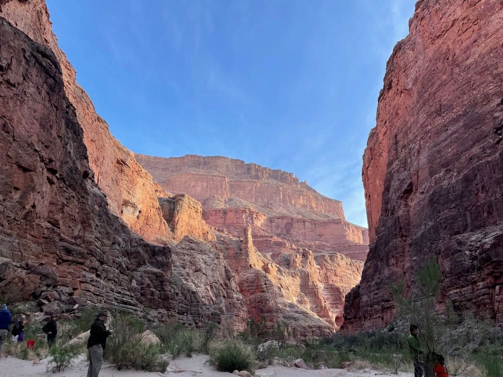
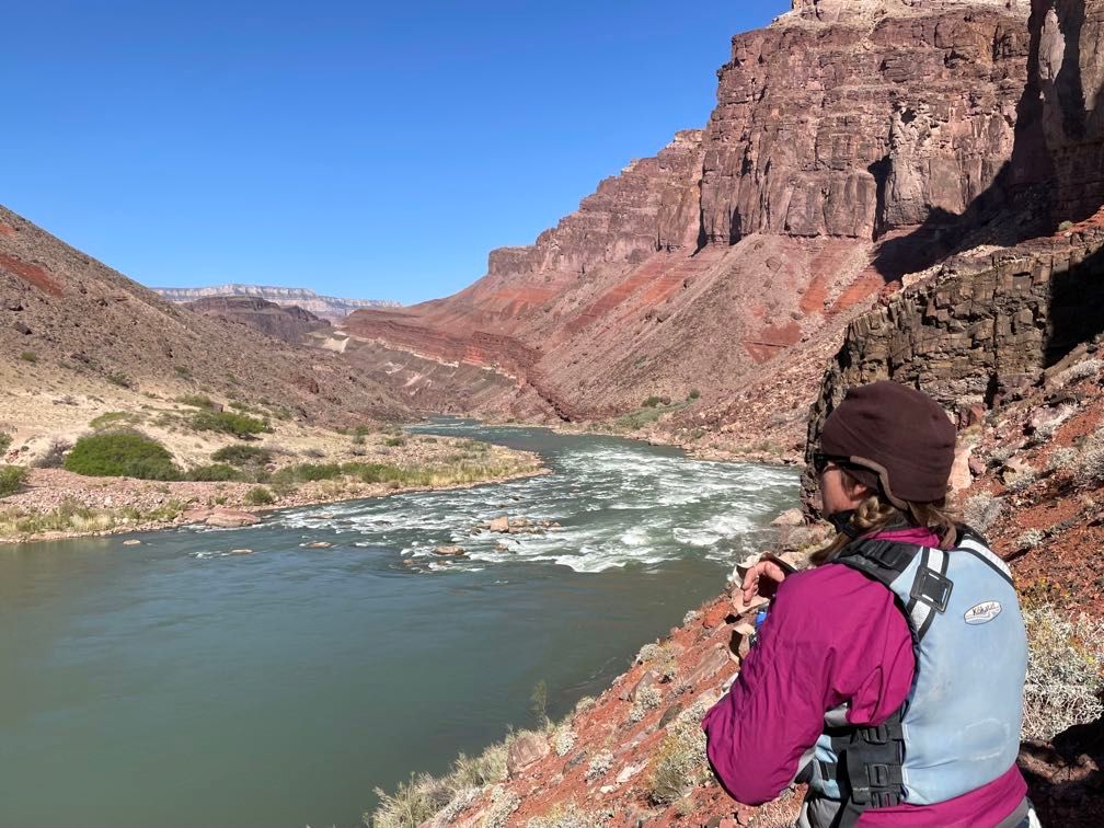
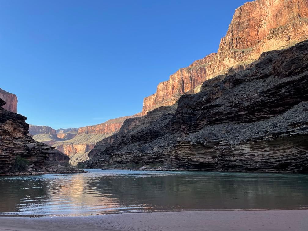
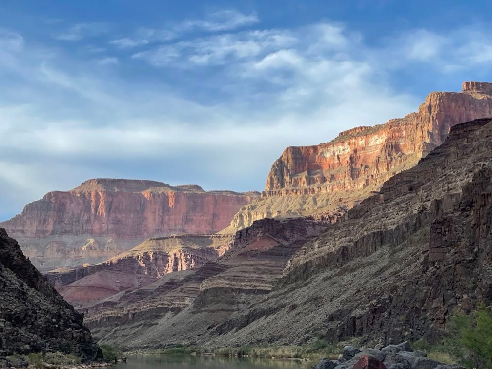
We had breakfast and got on the river, riding with Dave today. I was wearing my rain gear as much for the additional warmth as for staying dry. We saw quite a bit of waterfowl on the river this morning, even more than earlier in the trip. There was some really spectacular scenery as well. After a long, flat cruise, we go to Nankoweap Rapid. It wasn’t rough, but it’s very long, about a mile.
 Light on the canyon walls
 Rafting downriver
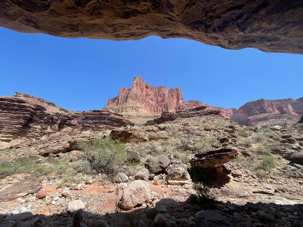
Downstream of the rapid, we pulled in and started the steep hike up to the Nankoweap granaries. It’s about 7-800 vertical feet. The granaries are an Ancestral Puebloan site where the people who farmed the Nankoweap delta below stored their crops. They’re fantastically well preserved, and the view is excellent. Sherri talked a bit about the granaries and the people who lived there.
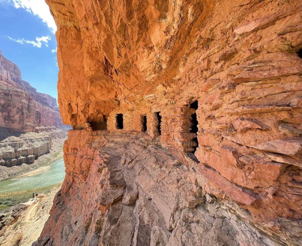 The Nankoweap granaries
 View downriver from the granaries
 Looking back upriver
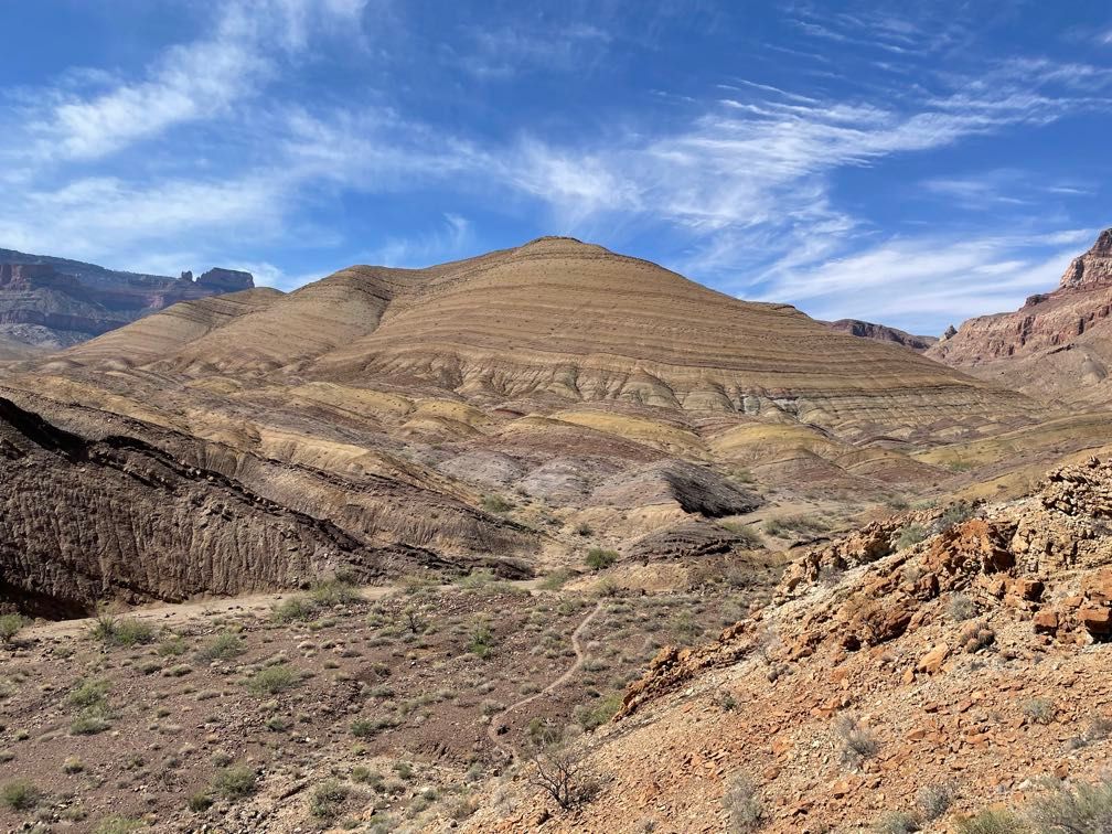
We had lunch before getting back on the river. We floated down to Kwagunt. There we unloaded the boats and set up camp. We hiked up Kwagunt Creek to some neat geology associated with the Butte Fault. After hiking a couple of miles up a side canyon, it opens up into a broad valley formed by the heavily faulted layers. This may have been a bit ambitious a hike to start at 3 PM. Everyone was pretty pooped by the time we made it back.
 Kwagunt Creek
 Geology
 Evening light on red rock
We had a late steak dinner. Afterward, we sat around the fire for a bit, and Sherri talked about the Hopi. Everyone hit the sleeping bag fairly early that night.
Day 6
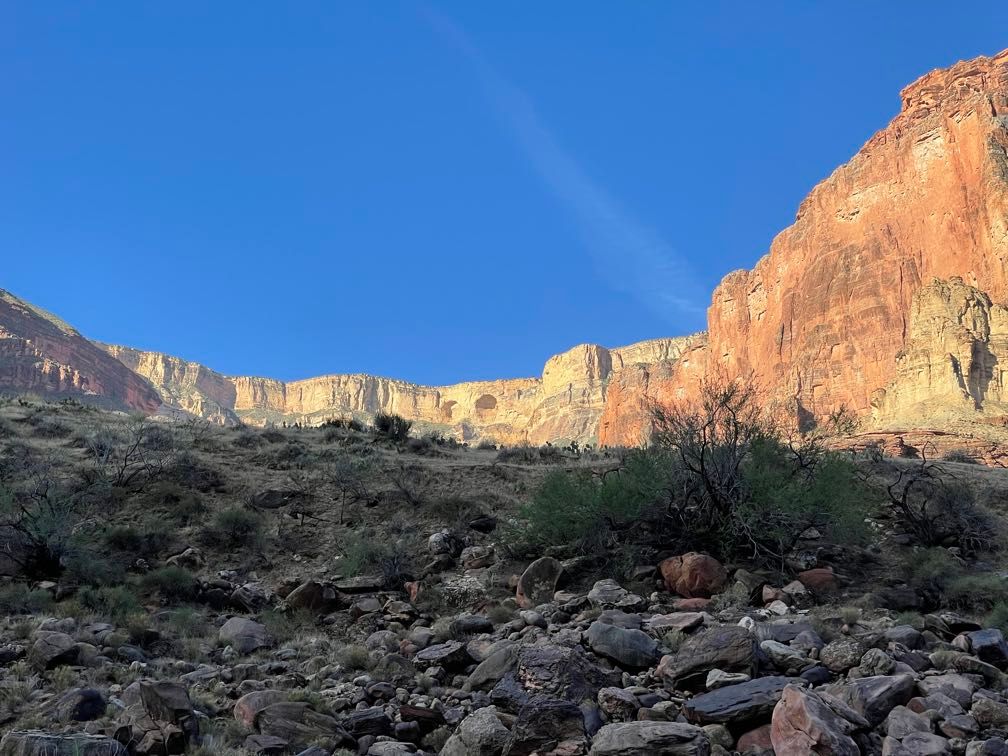
The day dawned chilly and windy. It had been cold overnight, but I’d managed to stay pretty warm with long underwear, socks, and a hat. We had chorizo sausage breakfast burritos, one of the best breakfasts yet. My zip-off long underwear bottoms came in handy while changing into my rain pants before pushing off. Today we were riding with Leo.
 Morning light on the canyon wall
We ran some moderate rapids on our way to the confluence of the Little Colorado River. There we walked a short way upstream and saw Beamer Cabin (built on the remains of an Ancestral Puebloan structure). The Little Colorado was flowing, but not enough to turn the Colorado completely brown, just a milky green.
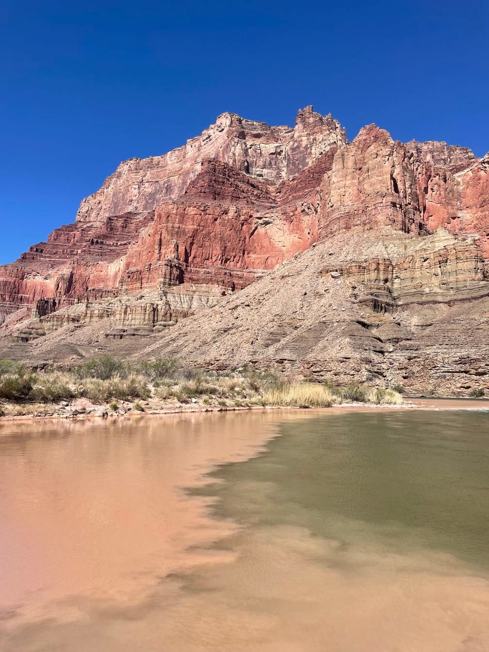 Muddy water of the Little Colorado flowing into the Colorado
 Salt deposits along the river
 Downstream of the LCR
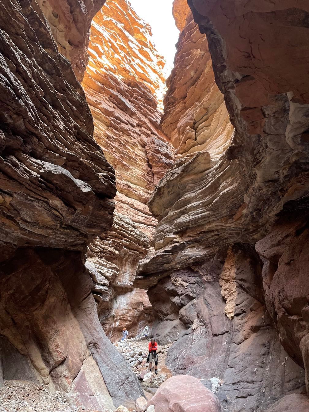
We floated down the river to Carbon Canyon, where we started a loop hike. We would walk about three miles overland and meet the boats downstream. Because Gary and Amy did the hike with us, Dave and Sequoyah walked the loop backward to pick up Gary and Amy’s boats and move them down to the end of the loop.
 Hiking up Carbon Canyon
 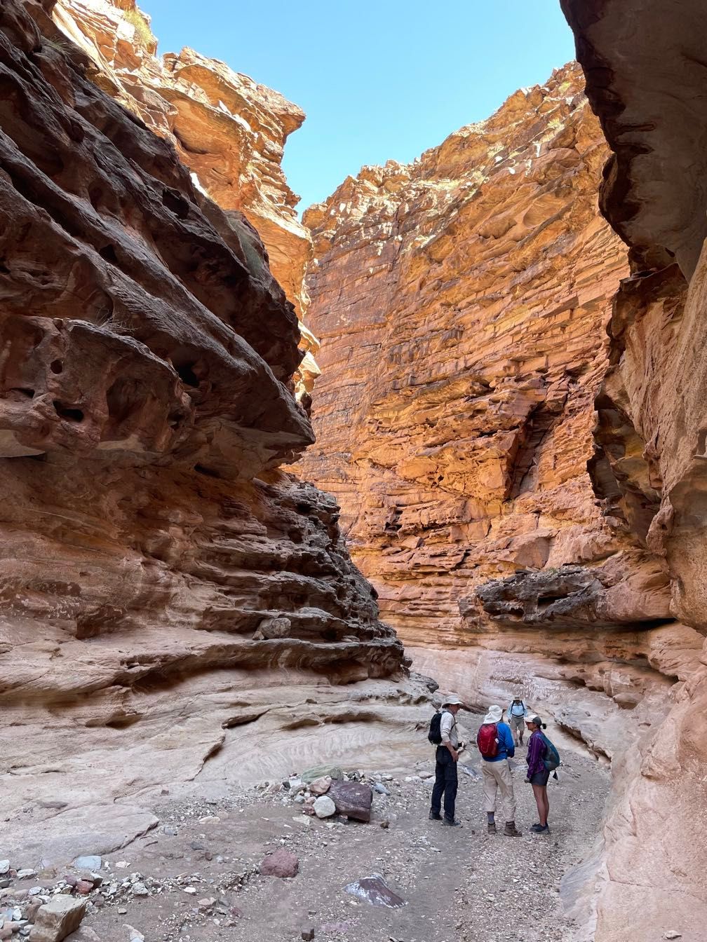 Carbon Canyon narrows
The hike up Carbon Canyon involved one very steep section to bypass a big pour-off. Up at the saddle between Carbon Canyon and Lava Canyon, Gary talked about the area’s geology and how the Butte Fault exposed the Grand Canyon Supergroup rocks. We descended from the saddle and followed Chuar Creek down Lava Canyon to the boats.
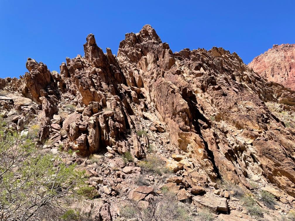 Heavily folded rock along the Butte Fault
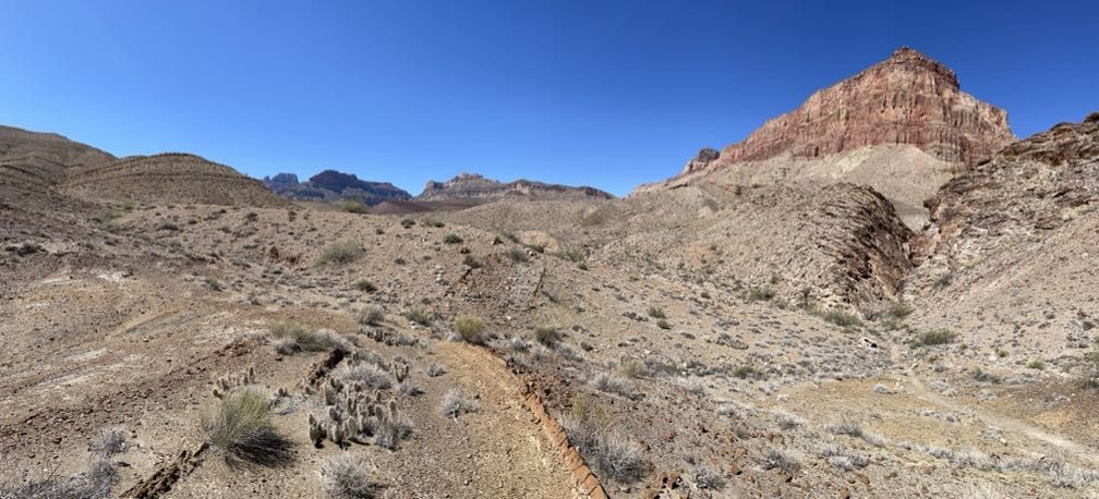 An open valley above Carbon Canyon
 Rocks of the Grand Canyon Supergroup
We rafted a short distance to our camp for the night. I did a river bath in the cold water before setting up my tent. After dinner, Sherri told us the story of Bessie Hyde around the campfire.
 Evening light on distant cliffs
Day 7
It was another cool morning, but it didn’t feel as cold as yesterday. After breakfast, Gary unrolled a couple of big maps for a geology lecture about the whole Grand Canyon region.
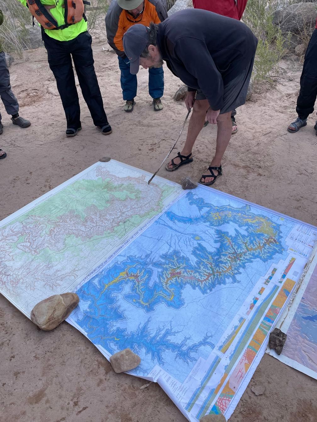 Gary giving a geology lecture
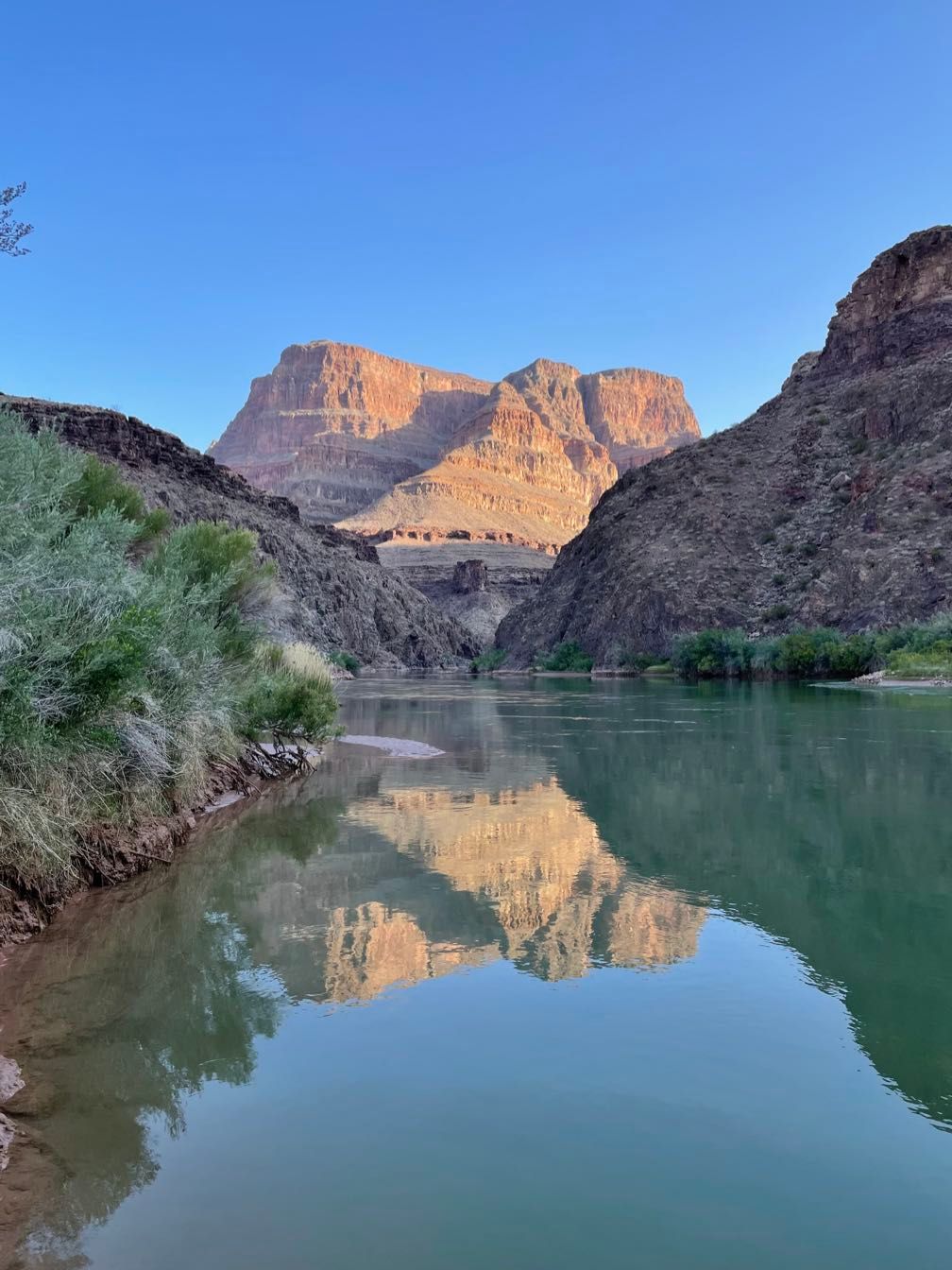
Riding with Gary, we pushed off and ran a few rapids. I was able to see a few landmarks like Solomon Butte, which helped me orient myself in relation to parts of the canyon I’ve often seen from the rim.
 Some familiar landmarks
We stopped at the Unkar Delta archeology site. For about an hour walked around the loop trail while Sherri talked about the Ancestral Puebloans who lived at the site. We saw the remains of some dwellings and some really nice potshards. Sherri also demonstrated a “ticklish” cactus blossom. When you touch the tiny pollen-covered hairs inside the flower, they wave around to try to stick more pollen to the insect it thinks just landed.
 Dwellings at Unkar Delta
 Sherri talking about the Ancestral Puebloans
 Beautifully painted potshard
Rafting downstream, we passed through Unkar Rapid, which was a bit of a ride. Soon after, we came to a newer rapid caused by debris flows from adjacent streams.
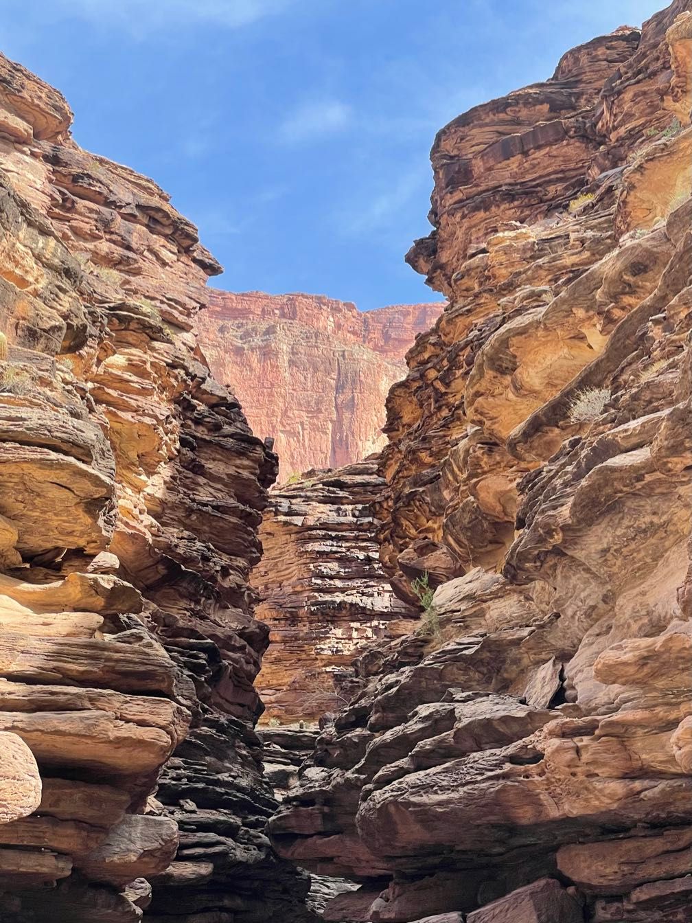
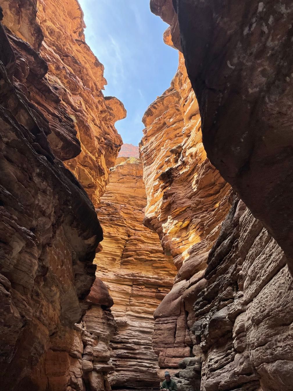
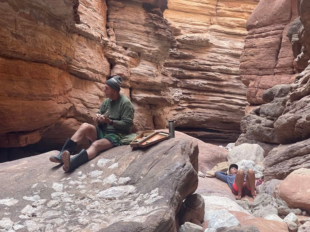
We stopped for a late lunch, then hiked up the narrow 75 Mile canyon in the Shinumo Quartzite. There, Leo serenaded us with some songs on his Ukulele.
A bit further downriver, we camped at Below Nevils. It was windy again, so my parents and I held off putting up our tents until later. We had burgers and brats for dinner.
Around the campfire, my Dad talked about the Black Bridge, a pedestrian suspension bridge across the Colorado at Phantom Ranch. He described how it was built back in the 1920s and its designation as a National Historic Civil Engineering Landmark. Then we adjourned to another windy, sandy night.
Day 8
It proved to be another windy night with little sleep. During breakfast, my parents’ tent rolled over and broke another pole.
 Amy scouting Hance Rapid
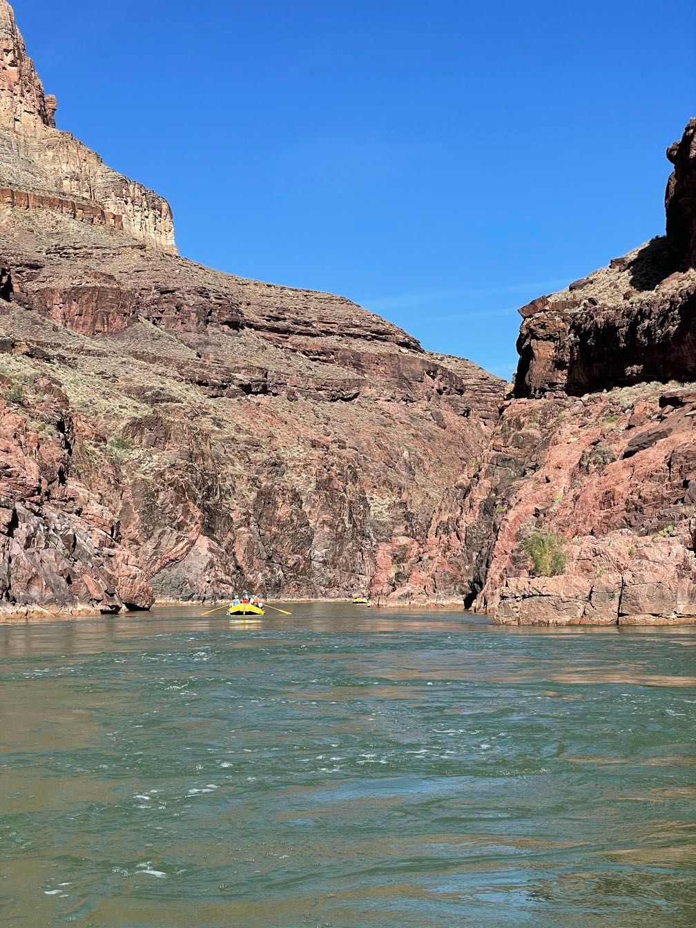
We ran a couple of rapids on the river in Dave’s boat before stopping to scout Hance Rapid. This one requires some maneuvering in the rapid. Rather than just finding the right line on entry, you have to pull to the left. It was a bit of a rough entry, followed by lots of splashing.
 Into the granite gorge
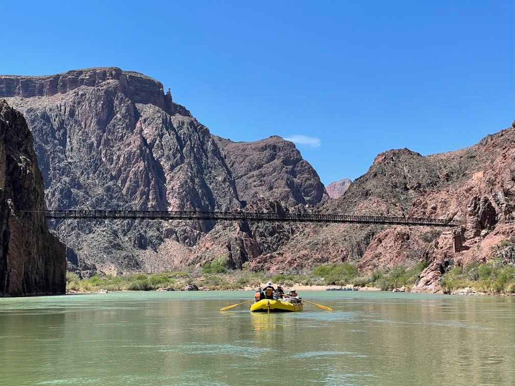 Under the Black Bridge
Several more rapids, including Sockdolager and Grapevine, brought us to Phantom Ranch. After lunch, some folks headed up to mail postcards and buy t-shirts. My parents and I walked up to the black bridge to look at the National Historic Civil Engineering Landmark plaque. On the way, we passed a deer munching at some vegetation that didn’t seem to be afraid of people at all.
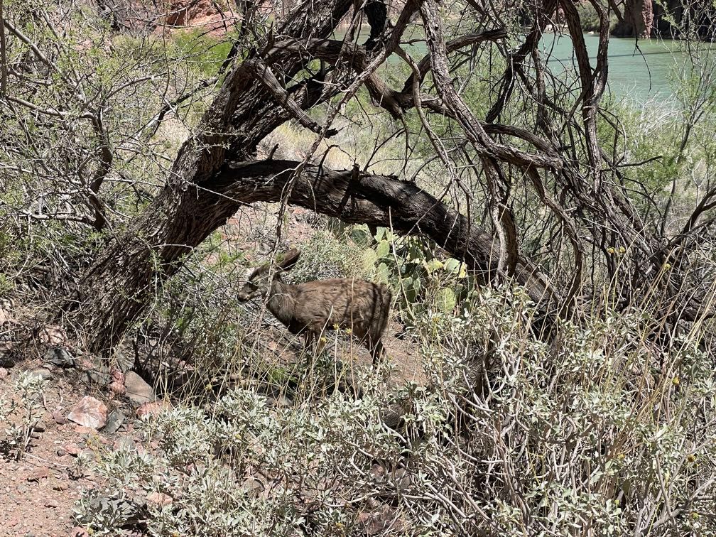 Deer at Phantom Ranch
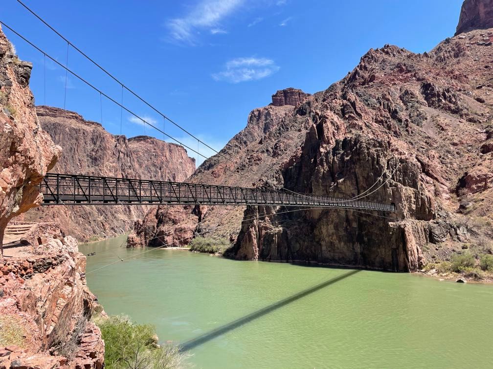 The Black Bridge
Waiting for the rest of our group to make it back, we talked a bit with some hikers down on the boat beach.
 Downriver from Phantom Ranch
We got back on river about 2 pm, rafting down to Horn Creek Rapid. The guides spent some time scouting the rapid. We ran between the horns, which involved a 10-foot drop with a sudden stop at the end, followed by a couple of big waves.
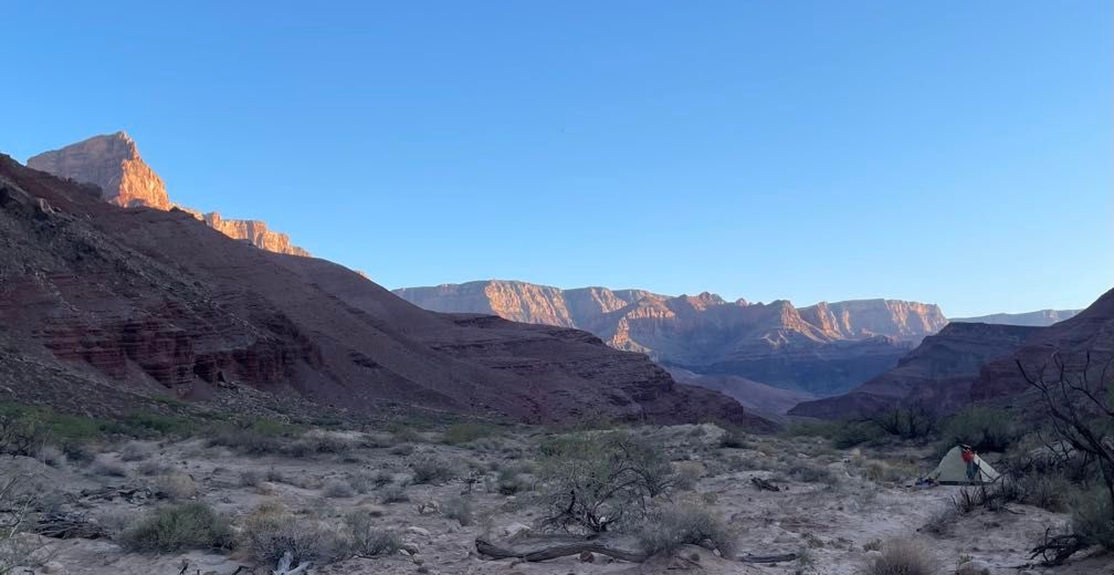
Soon after, we landed at Trinity Creek. There we set up camp. My parents and I picked a site in a side canyon, hoping for less wind and sand. Trinity Creek has carved a very narrow side canyon through the schist. I walked a ways up before dinner.
 Trinity Creek
We enjoyed a nice chicken vegetable curry, and at that point, everyone was about ready to turn in.
Day 9
 The view downcanyon
With little wind or blowing sand, this was a much better night’s sleep than the last few. We had a leisurely pack-up. Gary gave us his capsule summary of Grand Canyon geology.
There are three kinds of rocks: flat layer cake, tilted layer cake, and chocolate swirl.
Back on the river in Amy’s boat, the rapids came thick and fast today. Our first big one was Granite. This is actually one I’ve seen from the shore. When hiking the Tonto Trail about 25 years ago, we camped and Monument Creek and walked down to the river here.
 Rowing downriver
 Bighorn Sheep
Granite was the first of many wet rapids today, with water coming at the boat from lots of directions. Shortly after came Hermit Rapid. It was one big wave train with lots of water coming into the boat. Towards the bottom, some of the waves got pretty rough too.
The next big rapid was Crystal. In addition to being wet and particularly rough, this one is tricky. We stopped for the guides to scout, and they spent a good bit of time talking about its characteristics before running it. Amy threaded between the two big holes at the top and took us down with a wet but safe ride.
 Crystal Rapid
In less than a mile came Tuna, Lower Tuna, and Nixon Rock rapids in quick succession. Next up were the gems: Agate, Sapphire, Turquoise, Emerald, Ruby, and Serpentine (ASTER). The first three were splashy but not a bad ride. Emerald got kind of rough. Ruby and Serpentine had some hard hits. I could feel the boat bending between the rubber part where I was sitting and the front of the frame.
This brought us to Ross Wheeler camp, named for a metal river running boat abandoned here in 1915 and dragged up above the high water mark. The guides talked a bit about the boat and its history. The wind picked up again. After observing a huge sand cloud get blown up at Inscription Camp, the next campsite downstream, we made an early camp here.
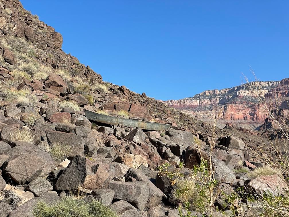 The Ross Wheeler
 View from camp
It was windy at times during the evening, but we had a fine dinner of Greek chicken.
Day 10
Thankfully, the wind died down quite a bit overnight. It was barely cool in the morning and felt like it would probably be a hot day.
 Morning light
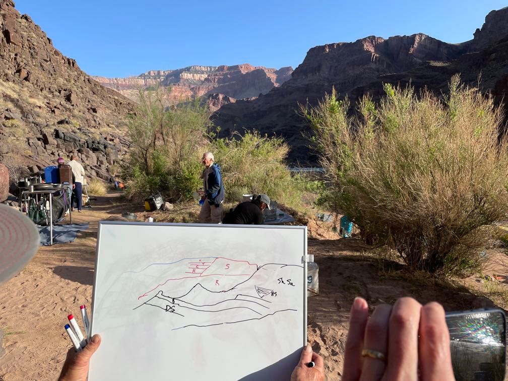
In addition to the usual fare, we had chocolate eggs for breakfast, as it was Easter. After breakfast, Gary did his best Bob Ross impression, drawing the rock layers in the scene before us on a whiteboard as part of his geology lecture.
 View from camp
We loaded up the boats (riding with Leo today) and headed downriver a short way through Bass Rapid to Inscription Camp. There, a well-carved inscription reads Geo. W. Parkins Washington D.C. 1903. For many years, no one had known who Parkins was, but my Dad had done the painstaking research and identified him. He also figured out that in 1903 Parkins had been in the canyon as part of the surveying work on the Matthes-Evans Map (the first topographic map of Grand Canyon).
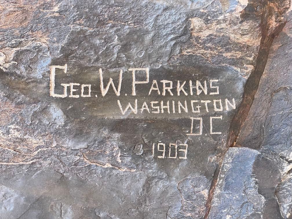 The Parkins inscription
 Dad talking about the inscription
Leo gave us a very smooth run through Hakatai Rapid. Further downriver, Waltenberg Rapid was much more of a ride, with a significant drop and a series of big waves.
 Waltenberg Rapid
This took us to a pull-off just below Garnet Canyon. We scrambled up about 20 feet through an arch in the schist (my Mom decided not to attempt this). From there, it was a mile or so of walking in the heat along a trail back upstream to Garnet Canyon proper. Up canyon a bit, we rested in a shady alcove while Gary talked about the geology of what we were seeing.
 Scrambling up the arch
 The arch from above
 Looking out from the alcove
 Schist and granite
 Scrambling down
We walked back, scrambled down with the help of a rope, and got back to the boats for a late lunch. We pushed off downstream, and Leo let me row through a couple of riffles to Elves Chasm. I did take us on a detour through one eddy, but other than that, I think I did OK for a newbie. I did wear a nice blister on my hand through. I guess I don’t have the proper calluses.
 On the oars
Elves Chasm is a short, scrambly hike ending at a beautiful waterfall. You can swim across the pool below and make a slippery climb up a cave behind the waterfall to reach a spot where you can jump through the fall into the pool. With a bit of trepidation, I emptied my pockets, swam the pool, climbed up the cave, and made the leap.
 Elves Chasm
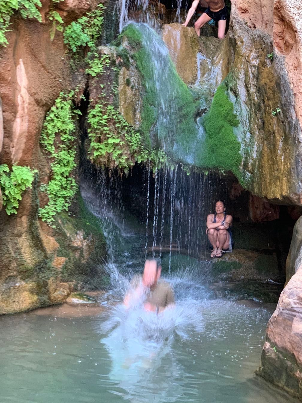 Made the leap
 Reflections on the river
I was pretty wet after that, but the day was hot enough that it felt pretty good. We made the short walk back to the boats, then a short float down to Big Dune camp. We enjoyed a jambalaya dinner, and Leo told some great stories around the campfire.
Day 11
 Morning at Big Dune
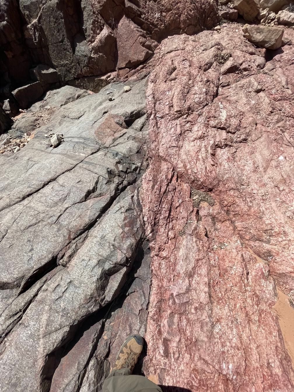
Starting on Gary’s boat, we rafted a short way downstream to Blacktail Creek and hiked up. Gary talked for a bit about the deposition of Tapeats Sandstone, Bright Angel Shale, and Muav Limestone, including how the order of deposition relates to the changing shoreline of an ancient sea.
 Blacktail Canyon
 Gary talking about geology
 A fossil
He suggested that we continue our hike upstream to a small waterfall in silence. Hiking quietly up the narrow slot canyon in the Tapeats was a pretty neat experience. The waterfall was lovely.
 Waterfall in Blacktail Canyon
 Looking up
 Walking down Blacktail Canyon
Partway back downcanyon Leo serenaded us again with his Ukulele. Sherri spent a bit of time talking about the Ancestral Puebloan archeological site near the mouth of the canyon. Amy got in on the action by talking about a science project she’d been involved with on how varying water releases from Glen Canyon Dam affected the population of certain insect species that breed at the water’s edge.
 Looking up from Blacktail Canyon
 Leo with his Ukulele
 Amy talking about insect life
 Boats at the mouth of Blacktail Canyon
After walking back to the boats, we rafted downstream. We spotted a tall cairn up on top of the Muav Limestone that was used during the making of the Matthes-Evans topographic map of the canyon.
 Rowing downriver
I caught a big wave in the face at 125 Mile Rapid and several more in Fossil Rapid. After stopping for lunch below Fossil, we got some more big water at Specter Rapid.
 Red rocks
 Black rocks
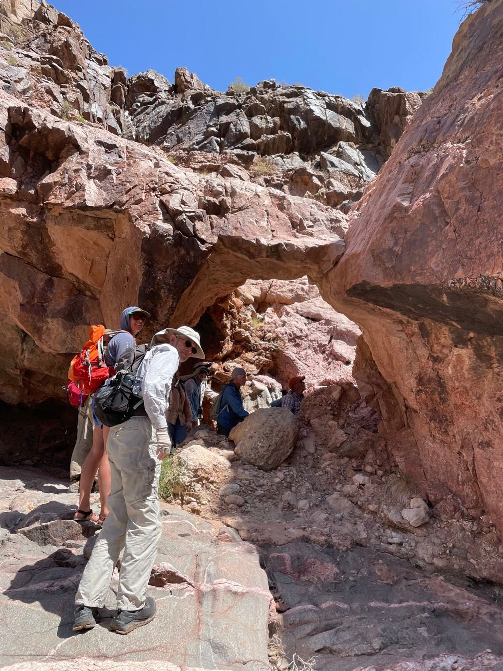
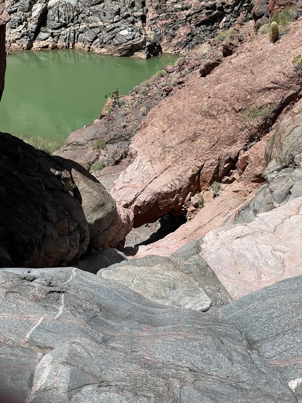
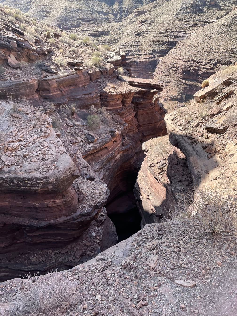
We stopped at Bedrock Canyon and hiked upstream. Mostly an easy walk, but one section required some hand and foot scampering up an exposed ledge about 20 feet off the ground. My Mom opted out of that very quickly. Above the scramble, we walked a bit further to a trickling 18-foot waterfall.
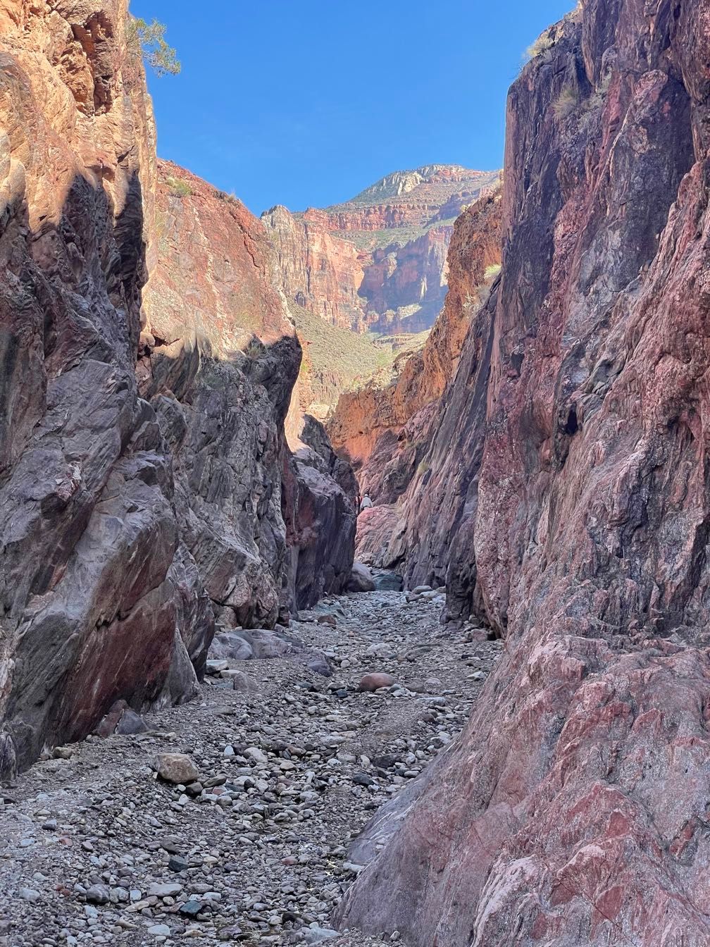 Bedrock Canyon
 Looking up at the rim
 Waterfall in Bedrock Canyon
 Coming down the scrambly bit
Back at the boats, we pushed off and ran Bedrock Rapid. This rapid has a big island in the middle, and while the current wants to push you left, you really want to get to the right of it. Sequoyah got swept down the left channel. This took her into an eddy where a boat can get smacked against vertical rock walls. As she told us later, she broke one oar and an impact jammed the oarlock of her remaining oar. She was able to free up the jammed oarlock with a hammer, replace the broken oar with a spare, row herself out of the eddy and get past the island without getting flipped (which happens to many boats that take the left channel). Truly an impressive performance.
 Evening light at Diabase Camp
After that excitement, we rafted down to Diabase Camp, a short way downstream. We had a great dinner of pork tenderloin. We also had a guest for dinner: a fat little mouse going after our crumbs. Despite river rafters’ best efforts to ensure everything gets packed out or goes in the river, these camps get enough use that they can be a steady food supply for things like mice and ants.
Day 12
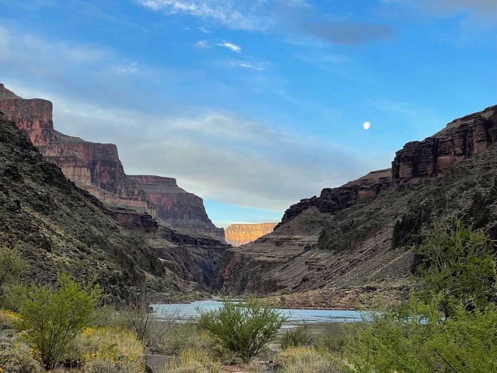 Moon over the canyon
Following breakfast, we rafted a short distance downstream to scout Deubendorff Rapid. Amy ran it very neatly.
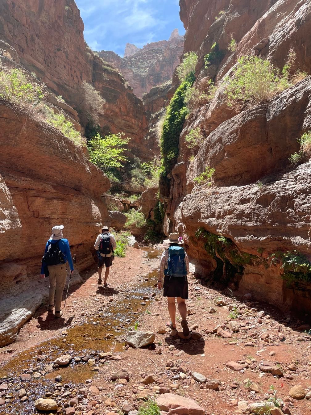
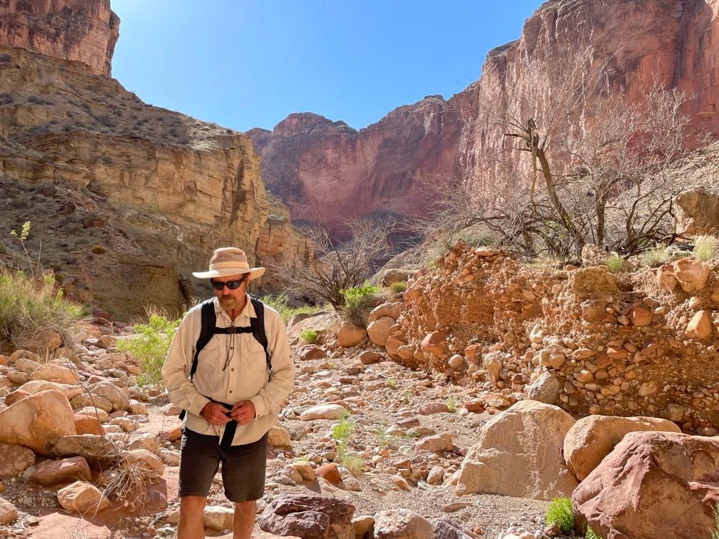
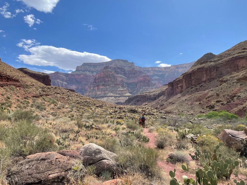
After another minor rapid, we came to Tapeats Creek, where we would start our longest hike of the trip up to Thunder River and back. This was a long enough hike that some guests opted for a shorter walk, only partway up Tapeats canyon.
One of the key features of this hike was repeated creek crossings: three on the way up and three on the way back. The first one came immediately, crossing Tapeats Creek right at its mouth. We climbed a steep trail covered in loose pebbles and rock several hundred feet up to the top of a flat rock layer. We followed this rock layer as it angled slightly down until it met the rapidly rising creek for our next water crossing. I was wearing my boots, so every crossing meant changing to my water shoes (I also removed the long pant legs of my convertible pants), all of which was kind of a pain.
 Steep climb
 Boats down at the mouth of Tapeats Creek
 Tapeats Creek far below the trail
 Tapeats Creek
 Red rocks on a cloudy day
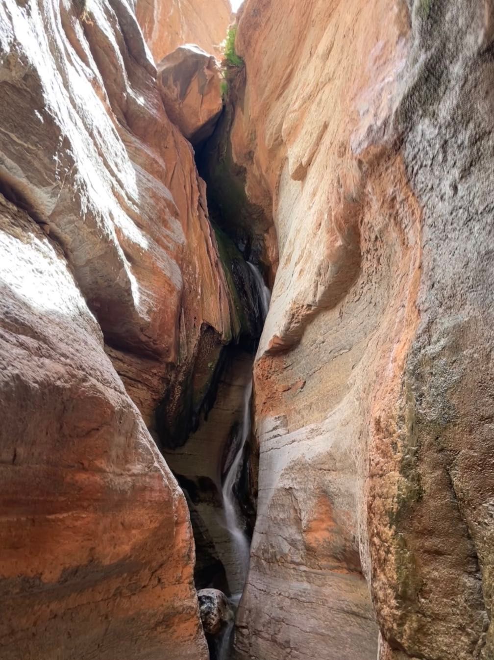
On the other side, we generally paralleled the creek. We had a nice trail in many places, but in a few, it got kind of scrambly. Eventually, we recrossed the creek and passed through the campground for folks hiking into Thunder River. It was another steep climb up a trail through heavily crumbled rock to Thunder River.
 Thunder River cascading down
Thunder River was worth the walk, though. It’s a massive spring where water shoots out of the Muav Limestone and cascades spectacularly down the cliff in a series of waterfalls.
 Thunder River waterfall
There we met an NPS science crew taking water samples. We’d seen their motor rig earlier in the trip. We spent a bit of time talking with them and enjoyed our packed lunch before starting the hike back down.
If anything, coming down these steep, crumbly trails was worse than going up. During the morning walk up the creek, some light clouds had helped keep the temperature tolerable, but coming back, they cleared out, leaving us exposed to the sun’s full force on the hottest day of our trip. I took about 4.5 liters of water with me and used almost out of it. Several people used all their water, and the guides had to pump some more using a backpacking water filter.
 Blue skies
Back at the beach, we pushed off and ran Tapeats Rapid and Mile 135 rapid. Hot as it was, I opted against any waterproof gear and got thoroughly soaked. It felt pretty good though perhaps a tad excessive.
 Pink clouds at sunset
We stopped at Owl Eyes Camp, named for a pair of alcoves up in the Kaibab Limestone just below the rim. There we enjoyed an excellent dinner of pozole (a chili-like Mexican stew made with lamb) and a well-deserved rest.
Day 13
 The Owl Eyes alcoves
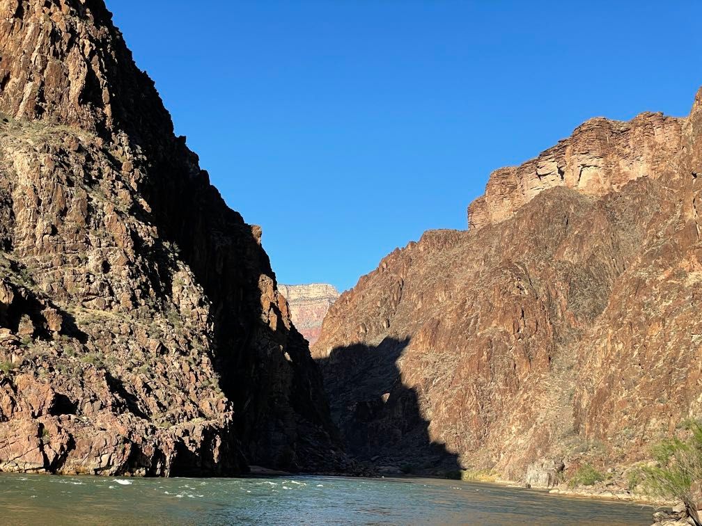
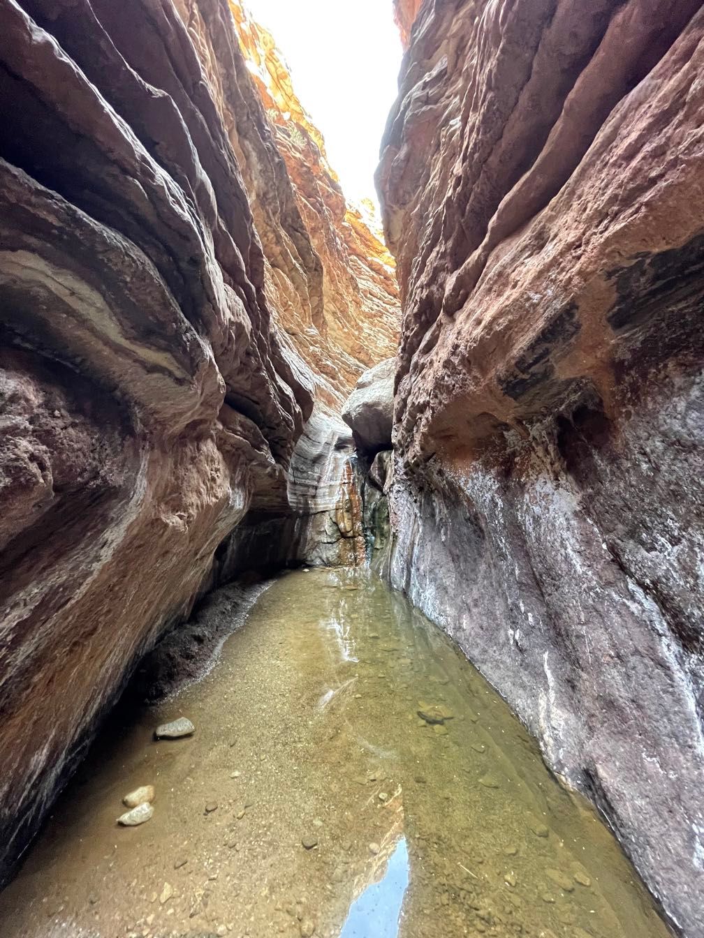
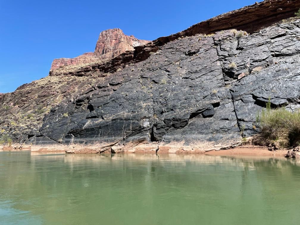
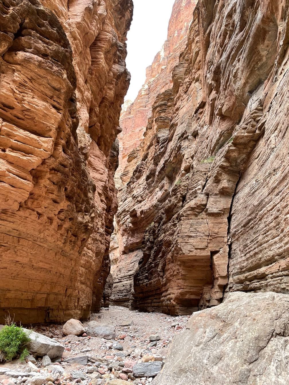
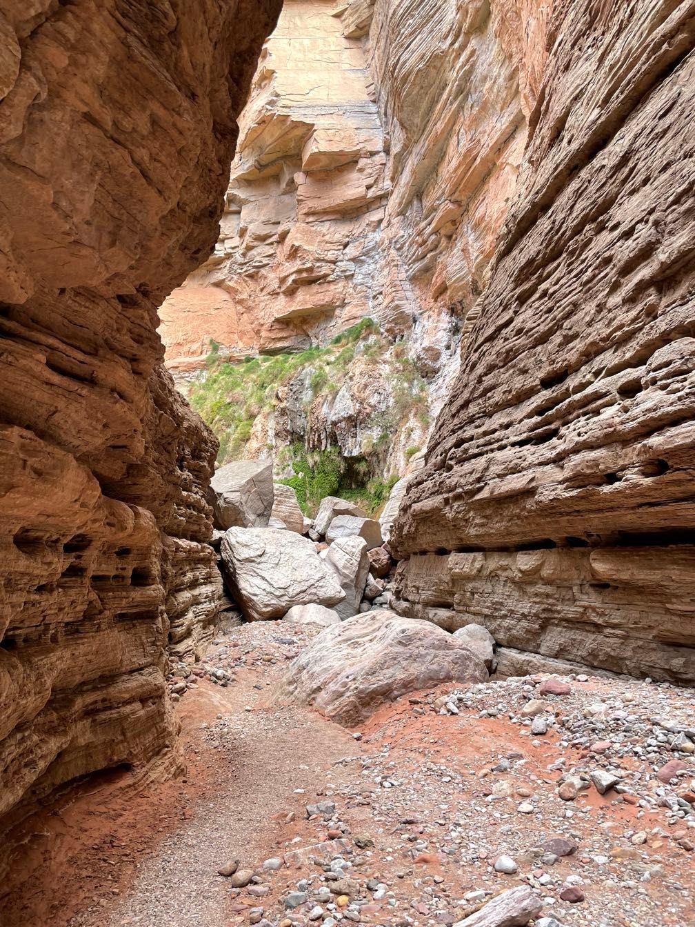
In Dave’s boat, we rafted down through the narrowest part of the Colorado River in the Grand Canyon. Relatively recently (geologically speaking), a big slumping of land on the right side of the river cut off the original channel. Since then, the river has eroded a very narrow channel down through the schist.
 Through the narrowest part
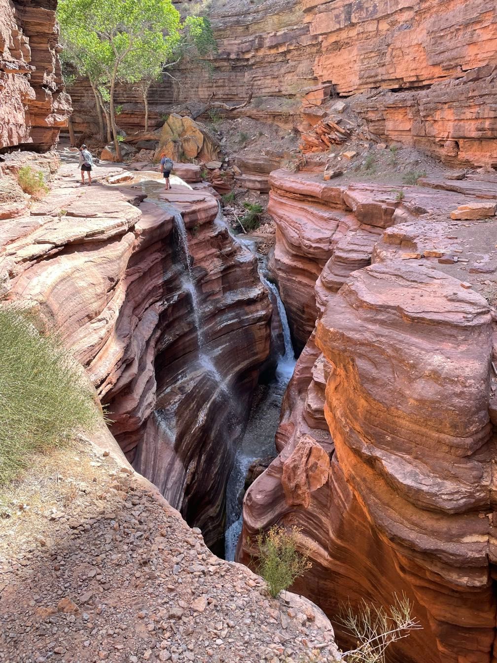
We stopped at Deer Creek, a short way downstream. A waterfall tumbles hundreds of feet out of a narrow side canyon.
We climbed up a steep trail up to a ledge above the slot canyon. As we walked upstream, there were some exceedingly narrow spots. We passed some handprints placed there by the Paiute people, who continue to use the Deer Creek Canyon as a ceremonial site today.
 The Deer Creek slot canyon from above
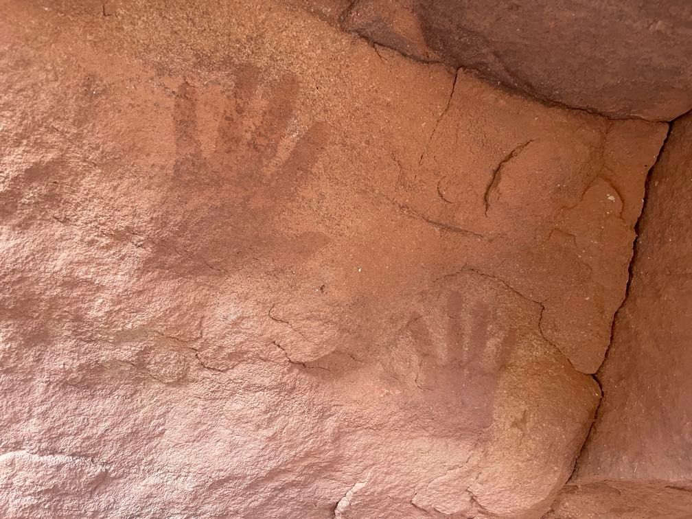 Paiute handprints
This brought us to “the patio,” a flat area where the canyon broadens out at the boundary between the Tapeats and the Bright Angel Shale.
 Approaching the Patio
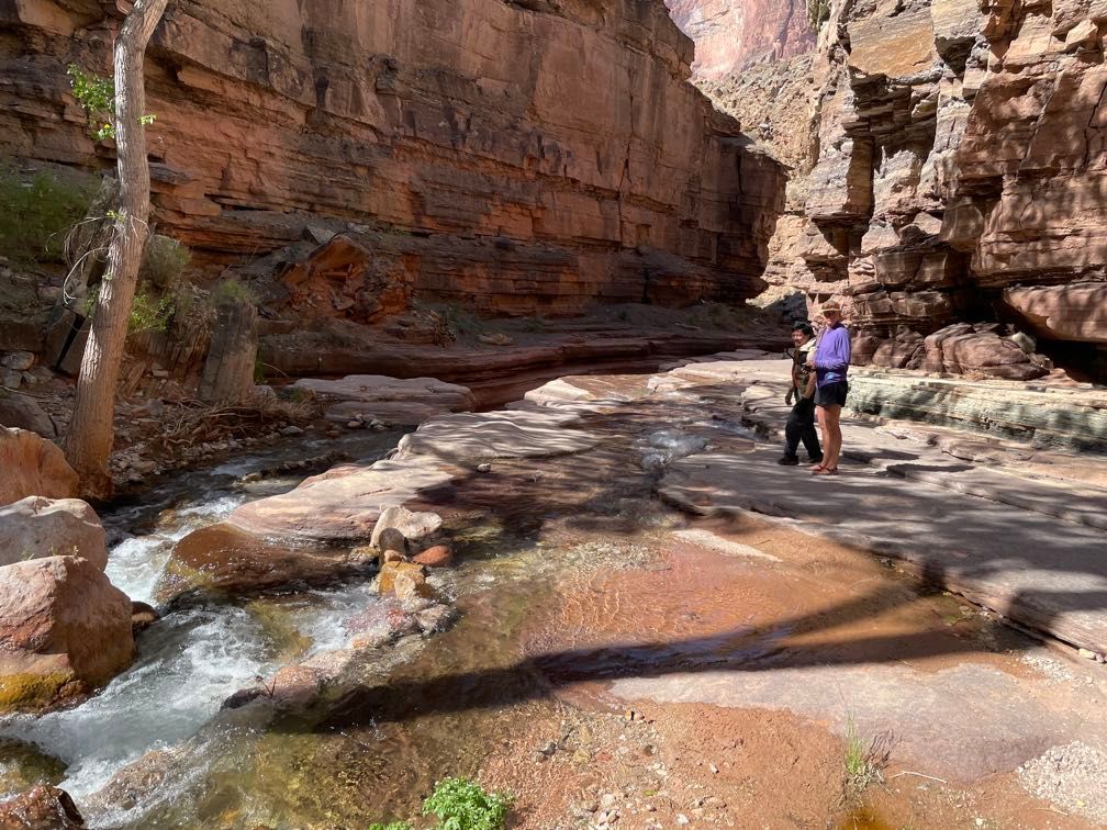 The Patio
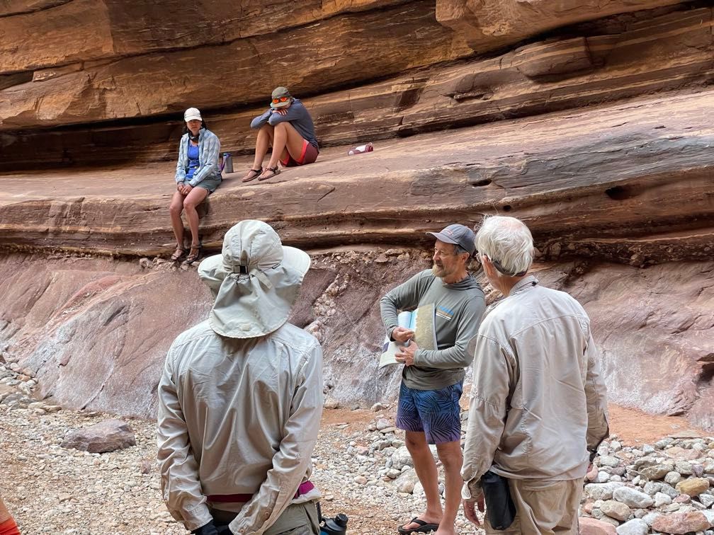
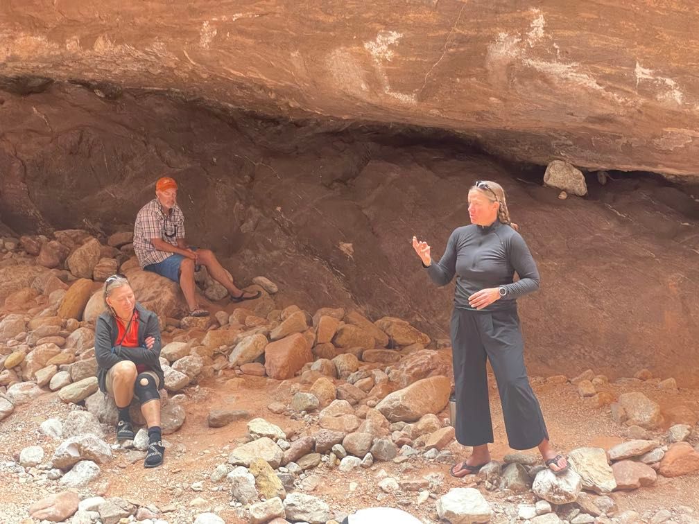
We enjoyed a nice rest. Sherri gave a talk on the Paiute people and their use of the site. As we were getting ready for the hike back, Gary pointed out some fossil worm burrows and places where trilobites had rested.
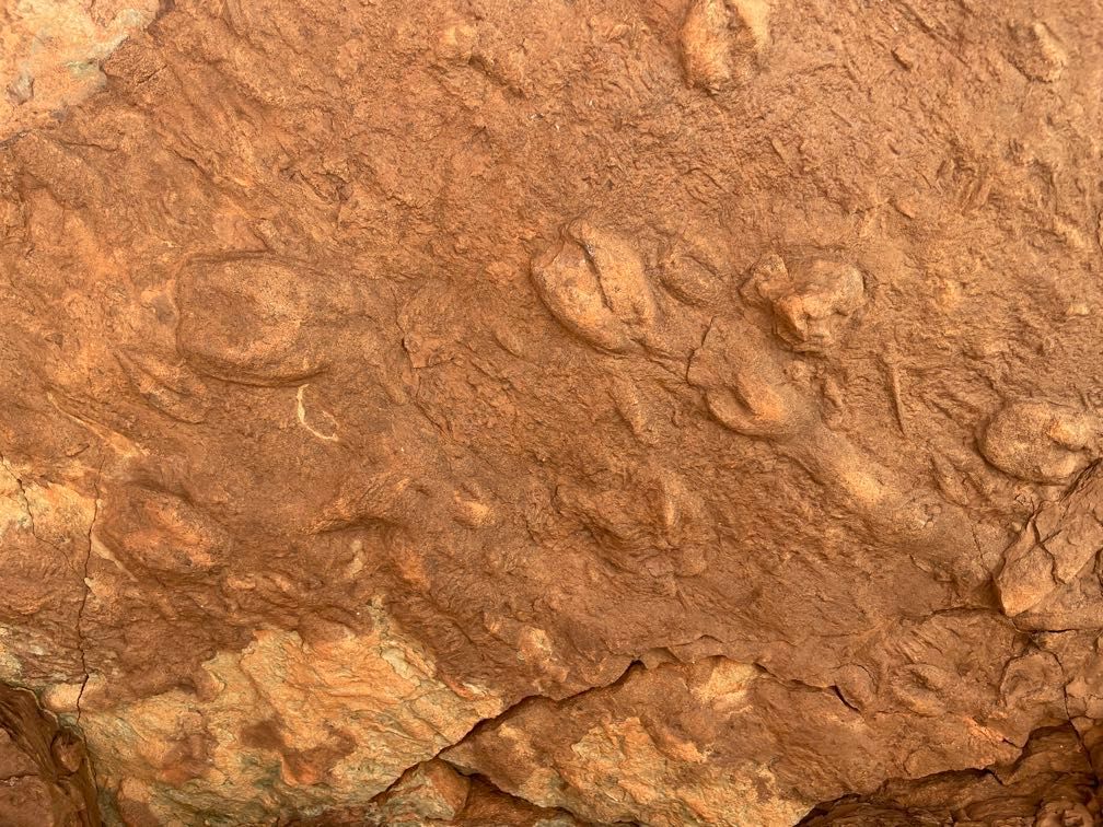 Trilobite resting spots
We made the hike back down to the boats, stopping near the end for a closer look at the waterfall. Some folks jumped into the pool there for a swim. I limited myself to enjoying the cool spray and taking some pictures.
 The waterfall
We pushed off for a short trip down through Deer Creek Rapid to a camp known as the Football Field for lunch. Given the hot day, I eschewed my waterproof gear in favor of some cooling splashes.
After lunch, we ran Doris Rapid and Cranberry Rapid. At that point, Dave let me row a bit, including through the (minor) rapids Fishtail and One Hundred Forty-One Mile. After about four miles of rowing, Dave took over and landed us at Kanab Creek. We enjoyed a stroll up the canyon.
 Kanab Creek canyon
Kanab Creek
This is one of the biggest drainages into the canyon, and we saw lots of aquatic life: frog eggs, tadpoles, and a ton of flannel mouth suckers swimming upstream spawning.
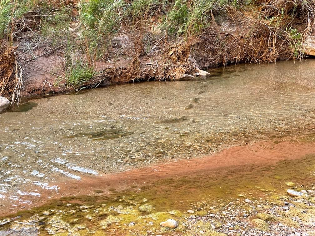 Flannel mouth suckers
After this leisurely stroll, we pushed off and ran Kanab Rapid on our way to the campsite Below Kanab for the night. Tonight’s dinner was pasta with andouille sausage.
Day 14
Riding with Leo today, we pushed off and went through Upset Rapid, which was pretty wet.
 Rafting through red rock
 On the river
 Red walls
Shortly after Upset, we saw a USGS science trip doing river channel mapping. They had two big motor rigs and at least four other boats. Tripods with surveying equipment dotted the riverbank. They were on a 24-day trip and mentioned that the greatest depth they’d surveyed was 29 meters at mile 127.8 in the Middle Granite Gorge.
 An alcove
 Light on red rocks
I volunteered to row for Leo. I kept it up for about four miles, including Havasu Rapid. It was really enjoyable, and I think I’m getting a bit better at it.
 On the oars again
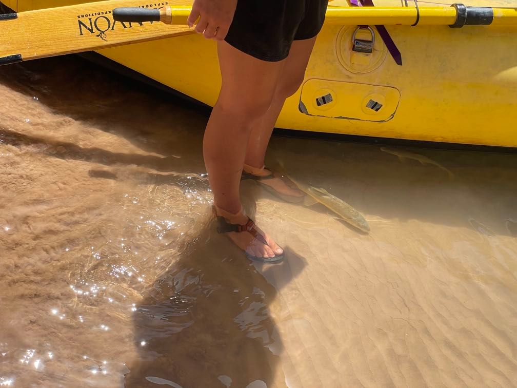
We stopped for lunch at sort of a natural amphitheater along the riverbank with tiers of stone layers about sitting bench height. A bunch of flannel mouth suckers congregated around Sequoyah’s boat. We fed them bits of cheese, which they sucked right up.
 Kanab Creek
During the day, we saw several bighorn sheep. There was a ewe with three little lambs and several rams, including some with impressively curled horns.
 Bighorn rams
 Another ram
At that point, it was a very windy afternoon run down to National Creek for a hike. Leo asked Sherri (who he shanghaied from Amy’s boat) and me to sit up front and paddle to help him progress against the wind. We pulled into National about 3 pm.
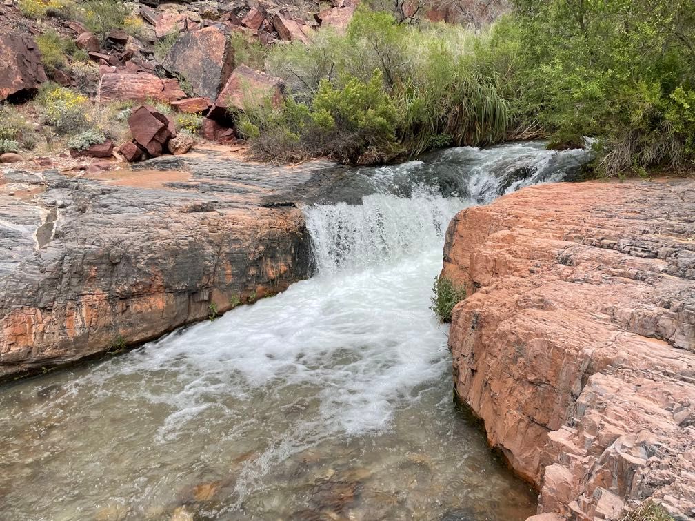
We decided to camp there rather than just doing the hike, so we unloaded the boats and set up camp. About an hour later, we started wandering up National Creek’s steep-walled canyon. We came across some rather noisy frogs (though we couldn’t actually lay eyes on them). Further up, there was a smooth pour-off with a lovely little waterfall. Then it was back to camp for some chicken fajitas.
 Hiking up National Creek
 The pour off
 The waterfall
After dinner, Sherri talked to us about the Havasupai and Hualapai tribes.
Rather than set up my tent, I decided to sleep out under the stars.
Day 15
It was definitely less stuffy than in the tent, but there was some wind about midnight, and a few spots of rain around 5 am.
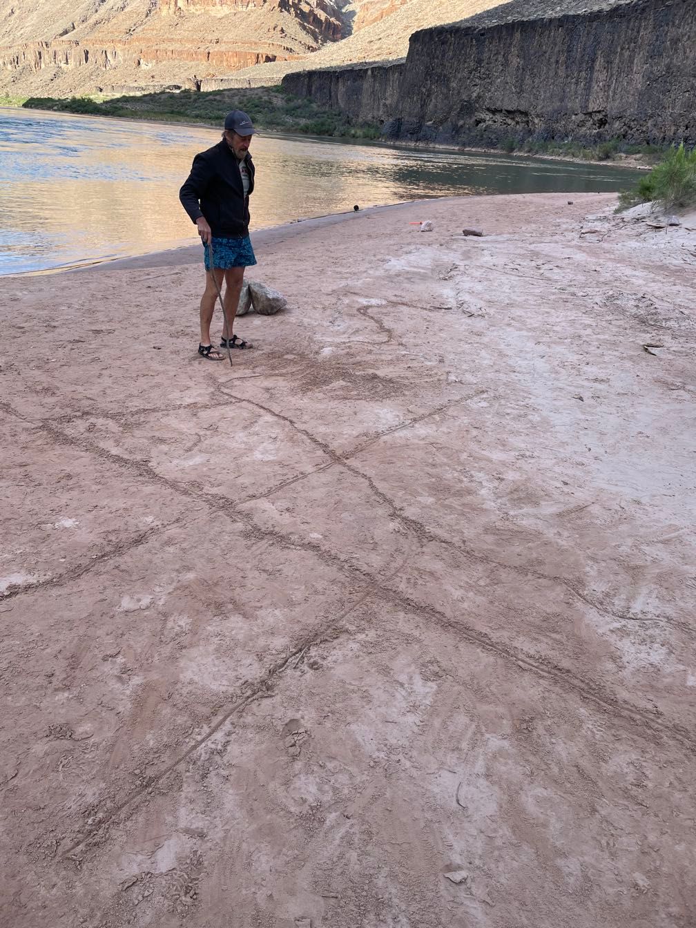
We would be doing Lava Falls Rapid later in the day. Dave drew out the rapid in the sand and talked through how to run it with Sequoyah.
We got a fairly early start today, which turned out to be a good thing. We rafted a short way downriver to Fern Glen, pushing against some wind on the way. Fern Glen was a nice side canyon with a walk up to an enormous jam of chockstones and some nice greenery.
 Rafting downriver
 Ferns at Fern Glen
 Slot canyon portion of Fern Glen
 This jam of chockstones was as far as we got
We floated out from Fern Glen and ran right back into a brisk headwind. Dave let me row for a bit. Doing it against such a stiff wind was eye-opening. He had me turn around and pull the oars for a while rather than pushing. This was the first time I’d pulled for an extended period. Dave had some good advice to keep me going in a straight line.
Dave took over rowing, and the wind grew even more intense. Like Leo yesterday, Dave handed out a pair of paddles and had us passengers help him out. Josh and I paddled from the front for a while, but eventually, we settled on me in the front right and Sherri in the left rear (or vice versa when Dave was pulling).
It started raining on and off just before lunch, and the wind intensified. Even with Dave rowing and Sherri and I paddling, there were times when we barely made progress.
We stopped for a rainy, windy lunch below Red Slide, a massive landslide from the Redwall layer slumping down to the river. As it had gotten warmer in recent days, I’d returned my fleece and midweight layers to the blue overnight bag rather than the purple day bag. I was just wearing my GoreTex jacket over a thin t-shirt. This was fine when I was paddling, but I got kind of cold during lunch.
 Red Slide
When we got going again, the wind was, if anything, even more intense. Sherri and I paddled away to help Dave make headway.
I have to say that Sequoyah really kicked ass rowing the baggage boat here. She not only pulled away from Amy, who is probably the most skilled rower on the trip, she also pulled away from Dave and Leo, who had passengers rowing to help them.
Eventually, after a long stint of slow progress against the wind, we finally reached Lava Falls. I tagged along when the guides went to scout the rapid. Having seen Dave’s sand diagram earlier made what otherwise would have been an incomprehensible mess much more understandable. I could see how you would thread your way through the hazards.
We cast off and ran Lava. Honestly, even though this is the highest-rated rapid on the river, I got wetter and had a rougher ride in some of the other rapids we’d done on the trip.
Just as we finished Lava, as if on cue, the wind died down, and the clouds parted, turning a miserable day into a nice afternoon. We pulled into Tequila Camp, just below Lava, to stay the night. It was a bit early to be stopping, but after the exhausting day of rowing and paddling against the wind and the tension of running Lava, it was good to stop then.
 A beautiful late afternoon
 Clouds coming up at sunset
After a few hours of beautiful weather, the wind began to gust, and we got a bit more rain. We had a lovely dinner of pasta with sausage. Josh performed a sea shanty he had written about our merry band. With that, we all headed to bed, aided by the gentle roar of Lava Falls. After a very long day, I was asleep almost from the moment my head hit the pillow.
Day 16
Before we got on the water, Gary gave a talk on plant identification. We pushed off and headed down to Whitmore, where there’s a large pictograph panel made by the Havasupai. Leo let me row for a bit on the way down, including Whitmore Rapid.
 Rafting downriver
The pictograph panel was pretty impressive, with many figures, mostly in red hematite paint. Sherri talked a bit about its significance.
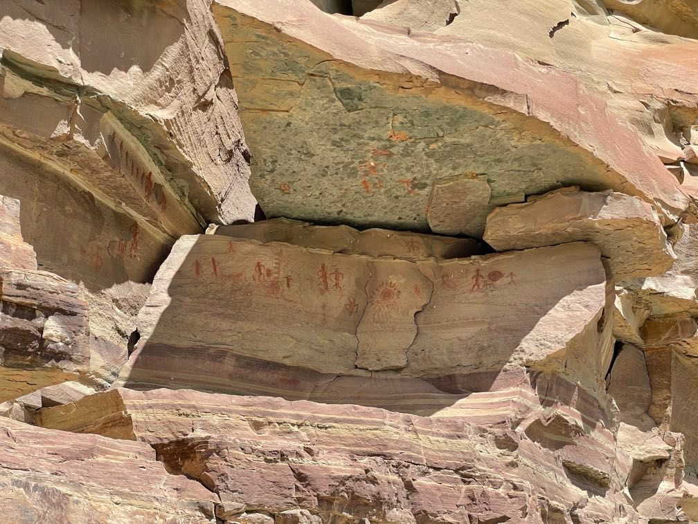 A small fraction of the figures on the Whitmore panel
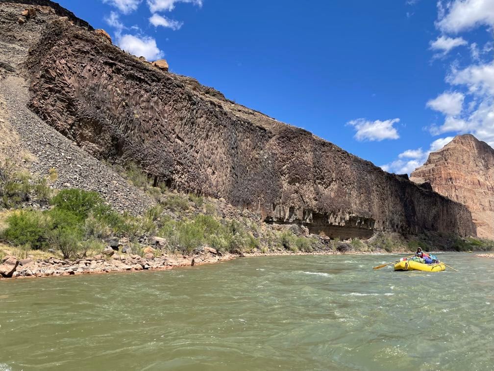 A massive wall of basalt
We stopped for lunch near a cave formed by sedimentary rock under a lava flow eroding away. Gary took us up to the cave while the rest of the guides made lunch. We got back on the water with plenty of miles to go. We faced some stiff headwinds. While not as bad as yesterday, it was pretty difficult. I did another stint of rowing. Leo and Justin paddled for a bit to make it somewhat easier.
 The cave
 A basalt arch
We pulled off to camp at Mile 202 (no clever camp name today, though it does have a cool wall of basalt). Dinner was pulled pork sandwiches.
Day 17
 Morning at Mile 202
It was quite chilly this morning. After our last day of chair yoga, Gary gave a good talk about how the canyon was formed.
 Gary’s lecture
Getting out on the river, we rafted down to some pestle-like grinding holes in a limestone shelf next to the river used by native peoples.
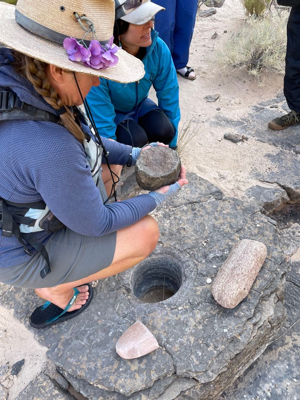 Grinding holes
We ran 205 Mile Rapid. At Indian Canyon, we stopped for a short walk to points of interest that ran the gamut from botany, to Ancestral Puebloan agave roasting pits, to jars left by early settlers, to packrat middens. We continued downriver, stopping for lunch at Granite Park, just above 209 Mile Rapid.
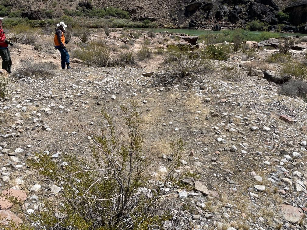 Agave roasting pit
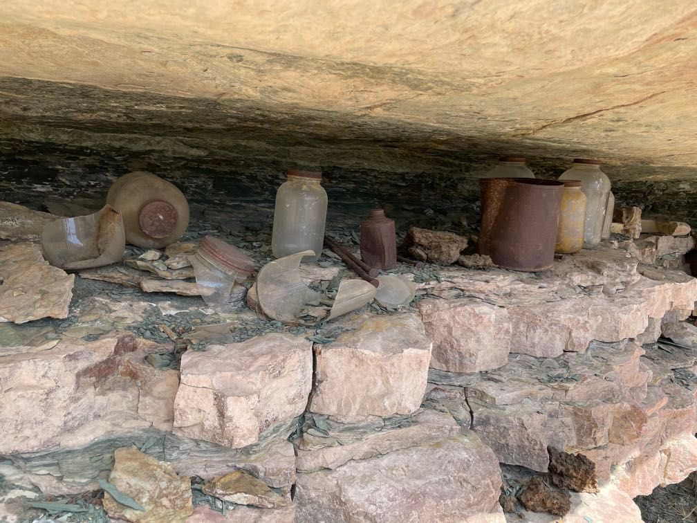 Jars
Jars
I rowed a couple more miles before Leo took over for Little Bastard Rapid. We floated by Pumpkin Spring, a river-side spring that has built up lots of travertine, stained orange by the minerals in the spring water. We continued downstream through Three Springs Rapid and 217 Mile Rapid. There are some neat opportunities down here for cliff jumping, but the relatively cool day didn’t make that very appealing. I did a bit of rowing, my last stint of the trip.
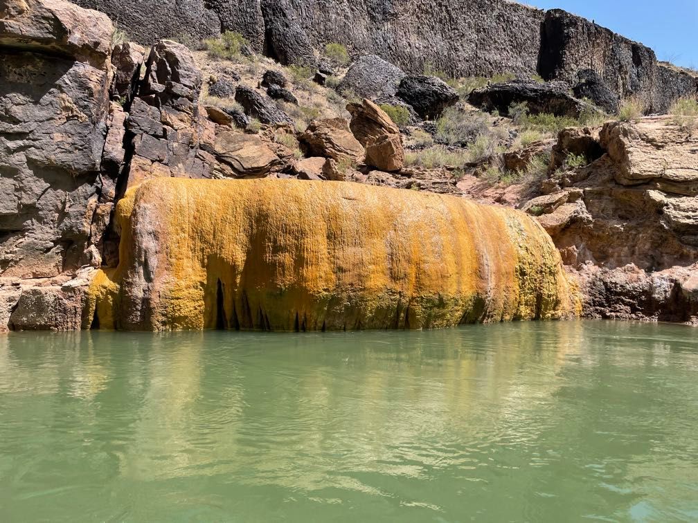 Pumpkin Spring
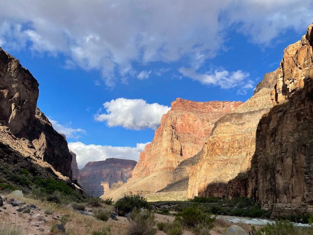
We stopped for the night at Middle 220 Mile Camp, one of three on a large delta at 220 Mile Canyon.
Throughout the whole trip, Sequoyah had been collecting the clips from all the bags of bread on the brim of her hat, saying she’d teach us how to use them for duck calls. At dinner, she handed out two clips to each person and showed us how to interlock them and hold them at a particular angle. Then she demonstrated how to use them…by holding them up to her mouth and yelling, “Here duck duck duck duck!” It was definitely a long con.
After dinner, Gary talked a bit about the logistics for tomorrow: getting an early start, the trip down to Diamond Creek, getting the boats off the river, the journey back to Flagstaff, and plans for post-trip drinks. We had the opportunity to talk about our feelings about the trip. Everyone seemed to agree that it was a pretty awesome experience.
Since we’d be starting early, I decided to sleep out under the stars again. It was kind of chilly, but I did all right.
Day 18
We had a quick breakfast and got the rafts loaded up. We rode with Dave and got on the river about an hour earlier than most other days. There was about six miles from camp to Diamond Creek, with a couple of minor rapids. The previous night Gary had suggested doing the part from the last rapid to Diamond Creek in silence. It was quite a pleasant experience just drifting quietly along.
 Reflections on the river
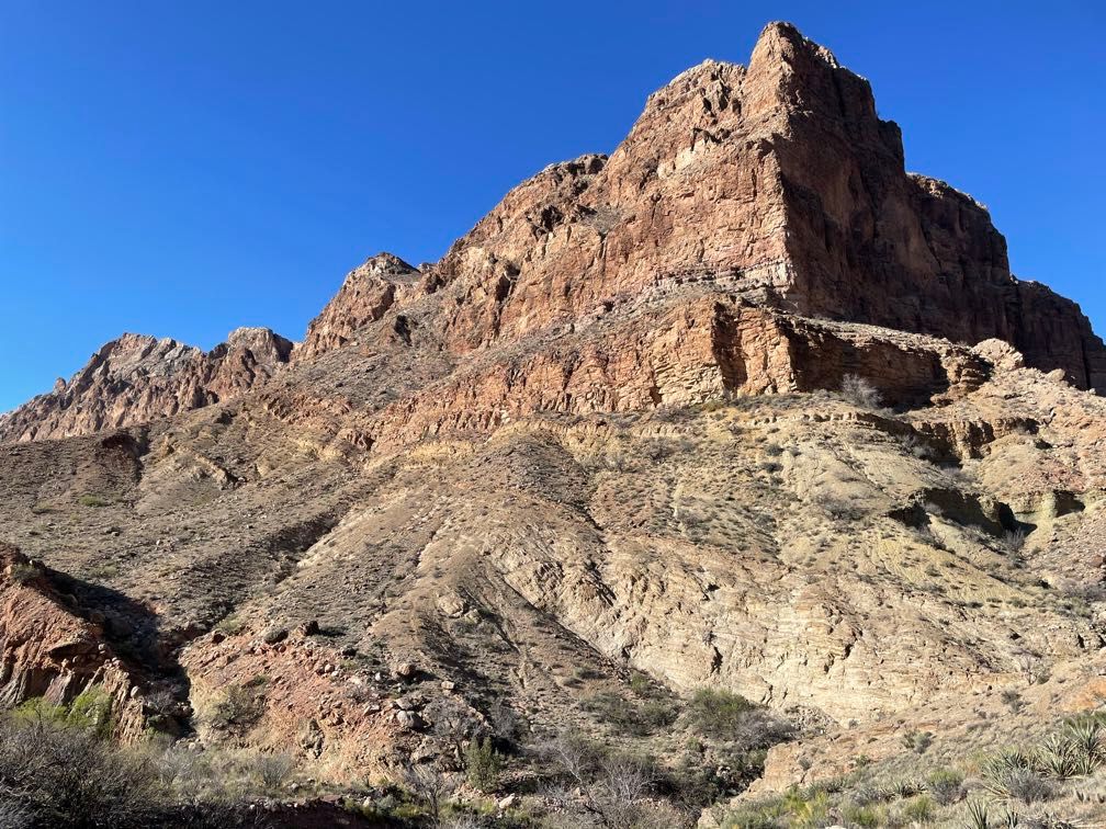
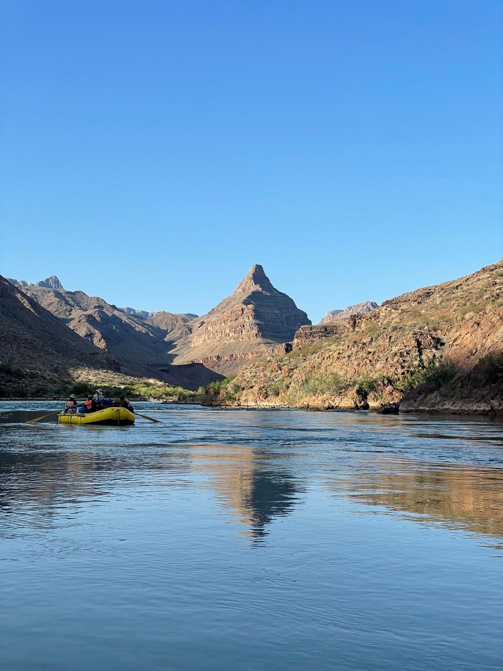 Diamond Peak
At Diamond Creek, we waited a bit on the beach just upstream before rafting over to the take-out point. Not only did we completely unload the boats, but we also derigged them, taking the frames out and carrying the empty boats onto the beach for deflating. This is a lot of work, but with everyone pitching in, we got it done.
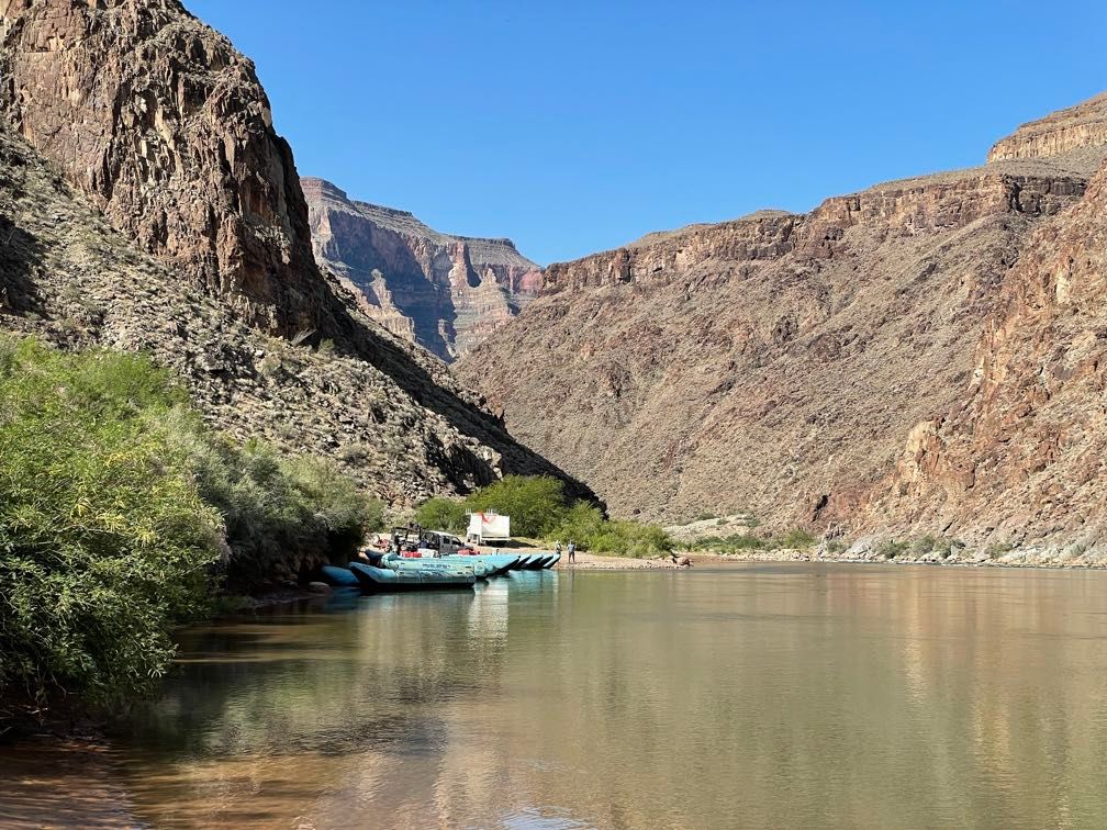 The takeout at Diamond Creek
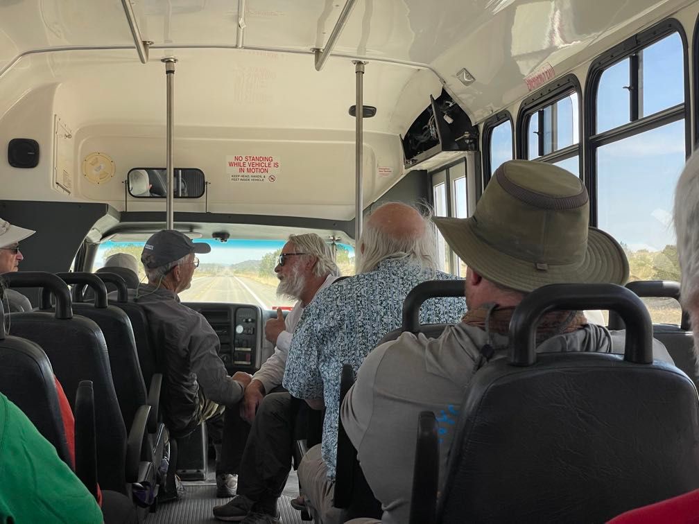
We had a nice lunch at the ramada there before loading up the bus for the trip out. The drive out was one of the bumpiest roads I’d ever been on, bouncing and rocking the bus dramatically. It took over an hour to make the seventeen-mile trip to Peach Springs. There we swapped onto another bus for the drive back to Flagstaff. First, though, there was a stop at Delgadillo’s Snow Cap in Seligman for ice cream.
 On the road
The bus dropped us off back at the hotel. We finally had our first opportunity for a shower and clean clothes in eighteen days. After getting some dinner, all the guests and most of the guides gathered in the hotel bar at around 7 pm for some drinks. We chatted about the trip, then said our goodbyes.
After the river
The next day, my parents drove me to Las Vegas and dropped me off at the airport. Thankfully, the flight back was less eventful than the flight out had been. I actually arrived home a little early.
Conclusion
This was an awesome trip. I’ve spent plenty of time in the Grand Canyon but going down the river let me see it in a whole new way. It also opened up parts of the canyon that I’d never been to before.
One of the best parts of the trip was getting to know the guides and the other guests. Everyone on the trip was great, and it was a pleasure to spend time with them.
I have to give a special shout-out to Gary, Dave, Amy, Leo, Sequoyah, Sherri, and Elise. They got us down the river safely, provided tons of great knowledge about the canyon’s geology, biology, inhabitants, and history, and were just all-around great folks. I’d happily take another trip with any of them. If you’re interested in a river trip, Grand Canyon Explorations/Expeditions puts on a great one.
You can also read about my lessons learned from this trip or how the trip led to a career change.